♩♫♪ I’m Dreaming Of A White Christmas ♩♫♪
2016-12-23 21:32:53.000 – Ryan Knapp, Weather Observer/Staff Meteorologist
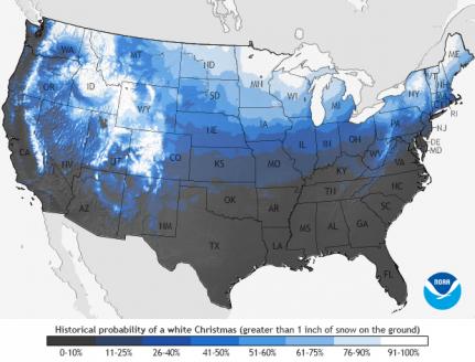 NCEI map – Probability of at least 1 inch of Snow on Christmas
Now when you compare this map to today’s snowfall coverage map from the NWS National Operational Hydrologic Remote Sensing Center (NOHRSC) map (below) or Intellicast’s Snow Cover Map (below) it is looking like a White Christmas for almost 50 percent of the lower 48 (if splitting hairs, it is 42.9% of coverage as of 12/23). This is far better than it was looking like leading up to and on Christmas Day last year when only 37.2% of the lower 48 was covered; for New England, only northern Maine lucked out last year (map below). So if you’re in New Hampshire and dreaming of a White Christmas, it is looking like this will be your year.
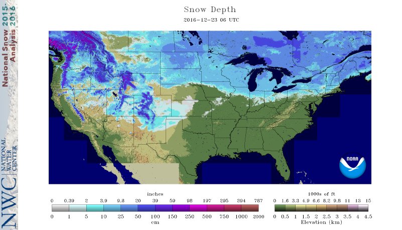 NOHRSC map – National Snowfall Coverage map as of 23 December 2016
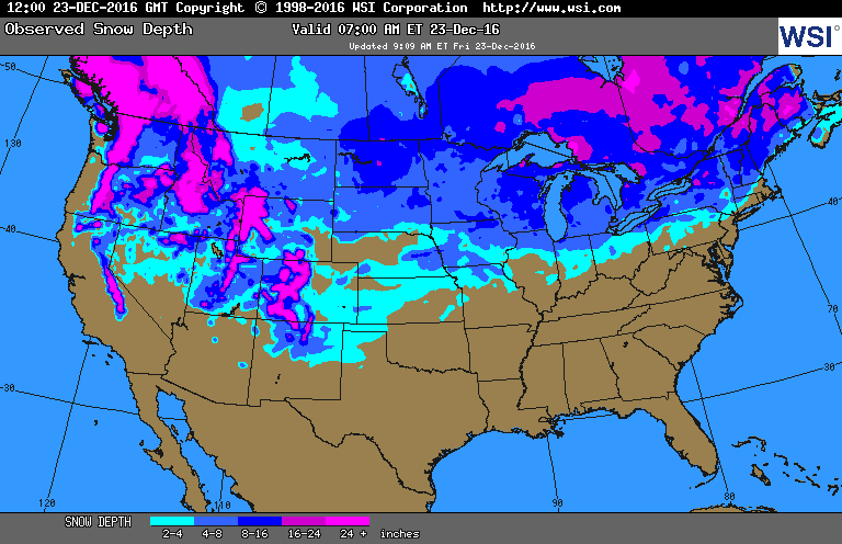 Intellicast map – National Snowfall Coverage map as of 23 December 2016
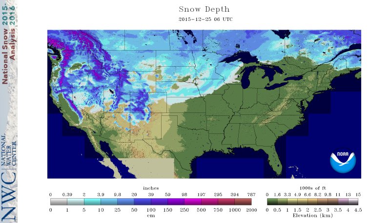 NOHRSC map – National Snowfall Coverage map Christmas Day 2015
Ryan Knapp, Weather Observer/Staff Meteorologist
Team Flags Return for Seek the Peak’s 25th Anniversary
Team Flags Return for Seek the Peak's 25th Anniversary By MWOBS Staff Mount Washington Observatory is looking forward to continuing a much-loved tradition for Seek the Peak’s 25th Anniversary: Team flags. In inviting teams
Meet Summer Interns Zakiya, Max and Maddie
Meet Summer Interns Zakiya, Max and Maddie By MWOBS Staff We are excited to welcome six teammates to the summit of Mount Washington this summer! During their internship, these students and graduates will play
Saying Goodbye to the Summit
Saying Goodbye to the Summit By Alexis George After an extraordinary last three years working as a Weather Observer and Meteorologist, I am excited to pursue a different career. As sad I as am


