
Trail Report: Seek the Peak Hikes 7 and 8
By Chris Nichols
July 16, 2025 – Summit 7 of 17
Another opportunistic forecast, another summit! Since this was a day trip, I once again headed for the Ammonusuc Ravine Trail. The climb up to the Lakes of the Clouds hut was uneventful. About halfway up the climb past the Gem Pool is a side trail that takes you to a really cool waterfall. I hadn’t taken that side trail in years, so I thought it would be a nice change. The waterfall never disappoints, and I highly recommend the extra 1/10th of a mile or so to check it out. On the way up I ran into a couple of groups of girl scouts heading down after a night at the hut. While the Ammo trail is not the easiest to descend, they all seemed to be making it work and looked like they had a nice night.
Above tree line it was a beautiful blue bird day. My older brother passed away in 2018, he was just 56, and the last time I saw him was during Seek the Peak 2018 when we climbed up the Ammo trail. The day was very similar to today and brought back fond memories of the hike. My brother lived in North Conway and spent many days hiking in the mountains. Seek the Peak was always one of the few times each year I spent time with him.
On the way up, I took a short break at the hut to refill my water bottle, then off to the summit. There was some haze in the distance, so visibility was not as good as it could be, but the views were still spectacular.
At the summit, the temps were in the mid 60’s and the wind speed was just 8 mph, very calm for the summit. Visibility was just 30 miles.
Wednesday is shift-change day for the Observatory staff, I snuck in for a quick peek at the transfer meeting, but didn’t stay long.
I took the Ammo trail back to the base and along the way I encountered several groups of kids from Camp Cody in Freedom, NH. Fast or slow, they all looked like a trip to the summit was in the cards. Overall, I encountered more than 70 people along the Ammo trail, which is 10 times the number I usually encounter. Everyone was taking advantage of a beautiful day!
I summited in about 3:10 and overall hiking (9.44 miles), including many breaks to talk with people and enjoy the views was 6:50.
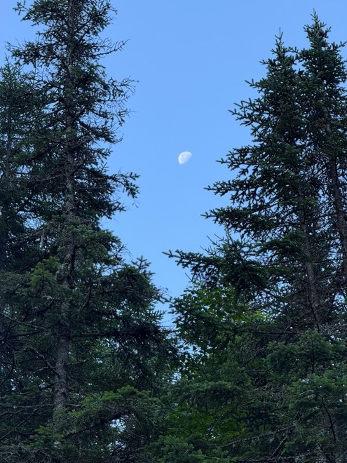
A peak at the moon.
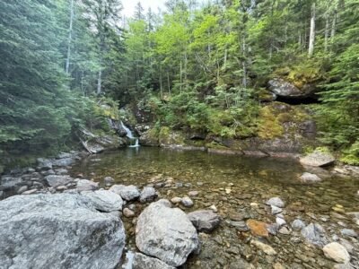
The Gem Pool.
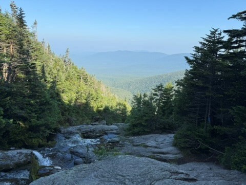
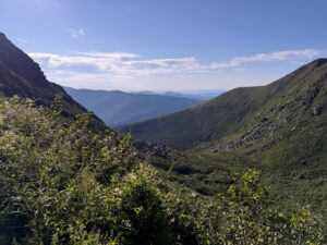
Looking back into the valley.
July 19, 2025 – Summit 8 of 17
Today is Seek the Peak day! There are more than 500 registered Seek the Peaker’s this year, a record for the event. So I expected the mountain to be crowded, though I was ahead of the pack. Today I would climb the Tuckerman’s Ravine Trail for the first time a several years and I would also descend the trail for the first time in many years. The Tuckerman’s Ravine Trail is the most popular way to climb Mount Washington, though it is by no means the easiest. For those who suffer from a fear of heights, this might be a trail to avoid.
My family and I had been up in the area for a few days, so I was able to get an early start. I met Drew Bush, Executive Director of the Observatory, setting up the welcome tent at Pinkham Notch at about 5:30. No Avalanche danger today as the snow has all melted from the ravine (though I have encountered snow in the ravine in July many times). The Tuckerman’s Ravine trail is steep but easily climbed up to the Hermit Lake Shelter (about 2.5 miles in), where I took my first break.
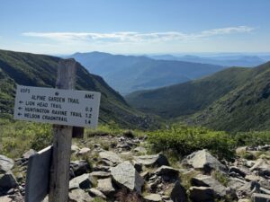
Once you leave the shelter, you begin the climb into the ravine and then you ascend the headwall using very steep rock steps until you cross above the headwall, over the top of a few waterfalls. Once you clear the headwall, the trail becomes less steep and you’re just a little over a half mile from the summit.
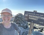
I reached the summit before 9:00 am, beating the Cog and the first cars coming up the auto road. It was just me, a couple of day hikers and some AT through hikers enjoying temps in the 50’s and virtually no wind. The conditions photo below shows just 1 mph of wind speed. Visibility was 85 miles, the best of all my hikes so far.
Most people who climb up Tuckerman’s go down Lionhead, but I look to mix things up, so I went back down Tuckerman’s. The only disadvantage to that route is you encounter lots of people climbing and down past the headwall can be very narrow with little room to pass. Hiker etiquette says those on the way up have the right of way, so I had to stop many times to give those climbing the ability to pass me. Once I cleared the headwall, the bulk of the climbers where above me. I took another break at the Hermit Lake shelter, where I met Floki (if you don’t know who Floki is, you should check out @adventureswithflockicat on Instagram), and her owner.
After the shelter, the last 2.5 miles were done in less than an hour.
Looking up from Pinkham Notch.
Looking back.
Over the top.
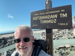
Summit Selfie.
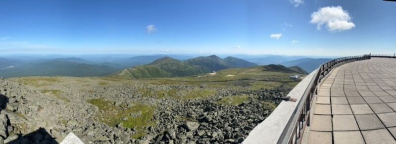
A panoramic shot from the deck.
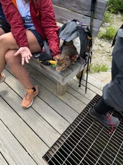
Floki!
Hiker Safety
Hiker Safety By Fawn Langerman, Dave Fatula and Julie Saccardo USFS Trailhead Steward volunteering season has begun, and hiker safety is on my mind. Truthfully, hiker safety is always on my mind, but more

Watch Our 2026 Annual Meeting and Read About the Highlights
Watch Our 2026 Annual Meeting and Read About the Highlights By Drew Bush United States Representative Maggie Goodlander headlined Mount Washington Observatory’s 2026 Annual Meeting, and she set the tone right from the start.
Seek the Peak Spotlight: The Middleton Family
Seek the Peak Spotlight: The Middleton Family By MWOBS Staff Every summer, the White Mountains offer no shortage of reasons to get outside. Trails stretch in every direction—endless miles of terrain, summits that each
