
Trail Report: Seek the Peak Hikes 11-15
By Chris Nichols
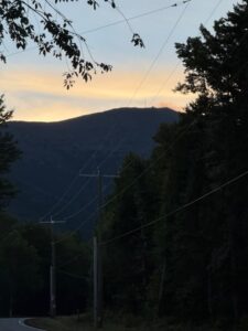
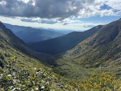
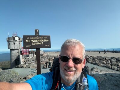
August 22, 2025 – Summit 11 of 17
It’s definitely feeling like fall up in the mountains. Temps at the base where in the upper 40’s when I headed up the Ammonoosuc Ravine trail this morning.
I met a few hikers along the way, apparently, I’m too quiet and I scared a couple of them as I came up behind them. I took my usual snack break at the Gem Pool. It’s a great spot to spend a few minutes, take in some calories, and listen to the waterfall.
Another bluebird day (I’ve been lucky so far). The trip up to the hut was uneventful and a quick break to refill my water and I was on my way to the summit. It’s been very dry up in the mountains this summer (almost no rain in the past month) and it is obvious based on how low the Lakes in the Clouds are (more than 2 feet below normal).
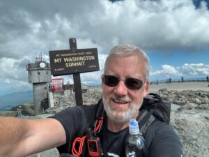
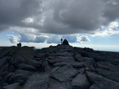
At the summit it was about 44 degrees, with a windchill of 35. The wildfire has and improved, so visibility was nearly 100 miles. Getting to the summit early is the key to some relative peace and quiet up there (beat the cog and you will usually have almost no line for a summit photo).
A quick hello to the Observatory staff, a snack and I was headed back down. I took the Jewel Trail down, which is a typical route for people coming up Ammonoosuc who don’t want to go down that way. It’s a little further, but nice views for the first couple of miles and then a nice walk in the woods.
Total time was 6:01:51 (excluding my time on the summit, which is usually about 30 minutes) for 9.37 miles.
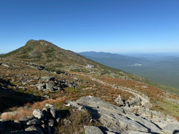
Looking back at the Hut and Mount Monroe.
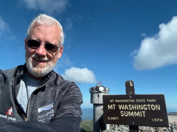
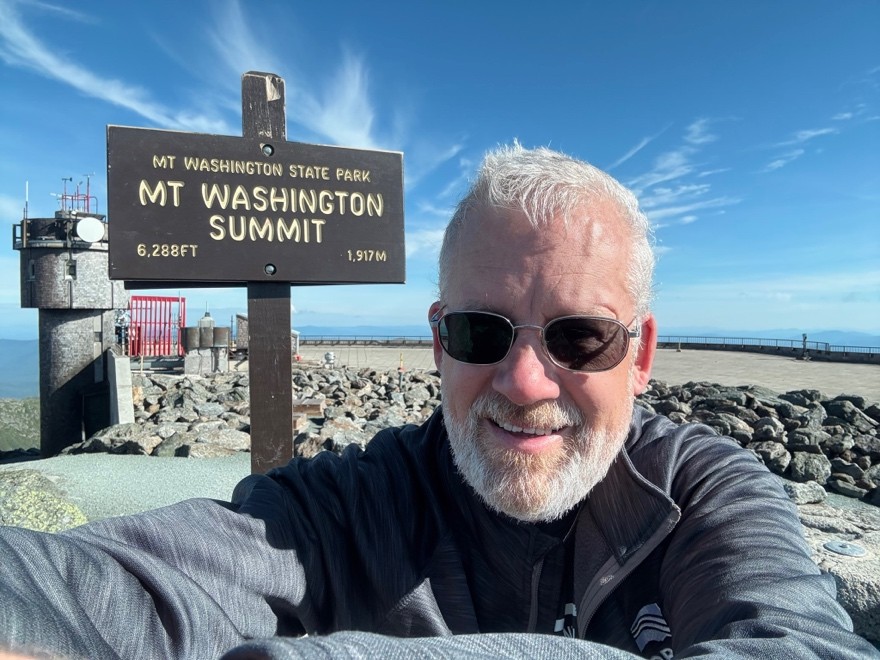
Summit Photo (Note the cool gear!)
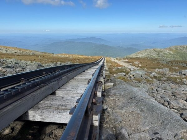
Looking down the cog tracks.
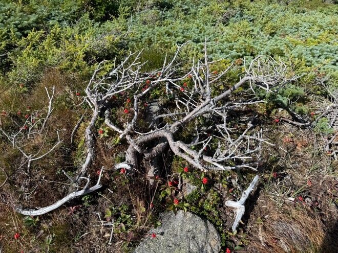
Some wild berries.
August 28, 2025 – Summit 12 of 17
The temperature reading in my car said 38 degrees as I approached the Ammonoosuc Trailhead parking lot, but it was early and the sun hadn’t reached the west side of the mountains yet. The forecast was for temps in the 40’s on the summit, with relatively light winds (typical winds for the summit) so off I went.
I took the Jewel Trail up and didn’t see another person (outside the parking lot) until I broke tree line and met someone who was on their way down. By the time I reached tree line, the west side of the mountain was still mostly in shadows, which makes it a little easier to climb without the sun in your eyes.
Shortly after heading up I heard the sound of a Cog train heading out. Very early for a Cog train and it turns out they were delivering the Good Morning America crew to the summit. Nearly at the summit I ran into someone who said they had been interviewed. I arrived at the summit about 9:15, but the broadcast was over and the GMA team was on their way down the mountain. I did get a shot of their train.
No line for the summit photo, and a quick hello to the Observatory staff (including their newest intern).
Another spectacular day, I’ve been lucky so far, temps in the high 30’s, windchill of 27 though I thought it felt warmer than other days I’d been up there. I did get a few odd looks about my shorts!
I took the Cog path down and met people coming up for the time. 3 trail runners and 1 hiker. When I got down to the Jewel connector trail, I hopped back into the woods and finished on the lower part of the Jewel trail.
8.9 miles in 5:16:52 (excluding time on the top).
Summit from the trailhead, probably just after the sunrise was visible on the summit.
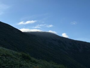
The summit in the distance, temporarily in a cloud.
Summit photo.
September 2, 2025 – Summit 13 of 17
The temps had warmed a bit from last week and there were some optimistic forecasts for the higher summits, so I headed all the way up to Pinkham Notch for climb number 13.
At the base, temps were in the low 50’s and the summit was forecast to be much the same later in the day. I headed up the Tuckerman’s Ravine trail toward Hermit Lake just before 7:00 am. I passed another hiker near Crystal Cascade and we exchanged hello’s and I answered a question.
The climb up to Hermit Lake is somewhat steep, but was otherwise uneventful with a beautiful blue sky overhead. I always have a snack at the shelter, about 2.5 miles in from the base and just before the toughest part of the climb starts. As I enjoyed my snack, the gentleman I met near Crystal Cascade caught up to me. He wasn’t sure exactly which direction to go, so I invited him to follow me.
As we climbed, I learned that my climbing companion was 64 and had never climbed Mount Washington. In fact, he had never climbed a 4000-footer. We took our time climbing up and over the headwall and when we reached the top, he admitted that there were a few places where he might have lost the trail or frozen up if he had been hiking alone. I encouraged him along. We reached the summit in about 3:45, not bad for a first timer.
We saw the sights, and took some pictures then headed inside for a snack. I snuck in to say howdy to the summit staff. My companion said he was recovered from the climb and wanted to hike back down. He had originally planned to go down Lionhead, but after some discussion, he opted to follow me down Boott Spur.
We left the summit just before noon and arrived back at Pinkham Notch right at 5:00 pm. I didn’t push the pace and we stopped many times to rest and he took lots of pictures. Round trip, my watch said we hiked for just over 9 hours. A long day, but we both made it up and down without incident and he has a great story and lots of pictures to share.
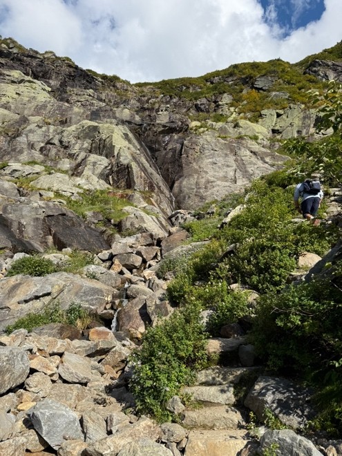
The headwall.
From above the headwall.
Very little wind since midnight.
Summit photo.
Looking back at the summit from the near the Boott Spur trail.
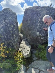
Split Rock.
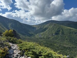
Looking back into Tuckerman’s Ravine.
September 3, 2025 – Summit 14 of 17
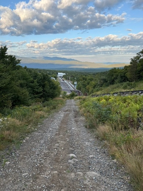
For the second time this year, I found a weather gap that worked and climbed the Rock Pile on back-to-back days. After yesterday’s 9-hour hike, I decided to really change things up and see if I could set another personal best. To set a fast time, I needed to hike the shortest distance, so for the first time I decided to climb up the Cog path. As those who have been following along know, I have used the Cog path to descend many times.
I parked in the hiker’s lot at the base of the Cog, paid my $10 use fee, and set out about 6:50 am. The lower part of the path is firm but climbs steeply. Once you cross under the tracks, the steep parts become less stable and the footing more challenging. I had a good head start on the first Cog train, which leaves the base at about 9:00 am, but the first two miles climb aggressively, and I didn’t want to overdo it.
I made better time than I anticipated up to the point where the Cog turns up towards the summit and the ascent moderates considerably. I reached the summit before 9:15. I forgot to hit the pause button on my watch when I got to the summit sign, so my actual time was a little better than the 2:28:31 that I had when I did hit pause. That beats my best time, coming up the Jewel Trail, by more than 30 minutes. It is probably worth noting that the Cog runs a foot race up the path each year and the record time is around 30 minutes…so I’m not sending my time to Guinness!
I had the summit mostly to myself and it was another beautiful day. I said a quick hello to some of the new summit interns, had my snack, and took my photos.
Heading down I wasn’t in a rush. I ran into a couple in their 60’s who were climbing up the path and we had a nice conversation and shared words of encouragement. They had climbed Washington before, and we all agreed that the Jewel Trail was easier than the Cog path. About 30 minutes later, I did get hit with a couple of rain drops and there was one loud roll of thunder. I’m guessing the couple made it up and stayed dry.
Round trip my watch tells me it was 6.18 miles in 4:42:24. Only 3 more to go!
Looking down before the cross under.
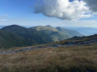
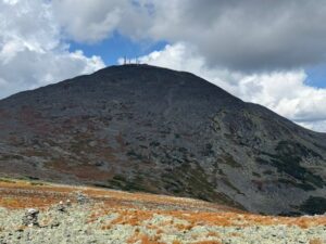
The Northern Presidentials.
An extremely rare sight in the White Mountains…nobody waiting at the summit for a photo.
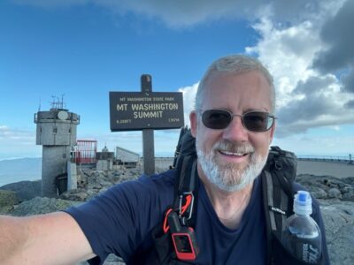
Summit photo.
September 9, 2025 – Summit 15 of 17
I’ve discovered that the wind speed is much more important than the temperature when evaluating a forecast for climbing. Today the forecast said it would get up into the upper 40s and the wind would be 10 – 25 mph. Since I start climbing shortly after sunrise, I may not see the predicted high temp, but I will likely experience whatever wind is forecast.
Today was spectacular! With temps reaching the mid-40’s (it was 40 at the base) and wind at about 10 mph, the climb was perfect for shorts and a tee-shirt, though I did meet a couple of folks coming out of the Lakes of the Cloud hut dressed for winter. I had the benefit of working up a light sweat, and the sunshine kept me warm.
Once again, I climbed up the Ammonoosuc Ravine Trail, which will always be my favorite. A brief break at the gem pool then the rugged climb up to the hut. I passed two people along the way. It didn’t look like the hut had a big crowd for the night, so I was able to sit in peace on the bench outside and enjoy another snack and the warmth of the sun (my kind of break).
I passed a couple me people on the way to the summit and amazingly I didn’t have to wait for a summit photo, even though the first Cog train had already arrived. A few more photos, then into the Observatory to say hello. A group from the office staff was getting ready to head out to learn some wilderness first aid. I overhead a description of a simulated broken leg as I was preparing to head down.
I took the common route of up Ammo and down Jewell. I’ve come to enjoy the Jewell trail, though I don’t love the section from the start off the Gulfside trail down to tree line. That section, probably ½ mile or so, requires you to be very thoughtful about where you place your feet and it’s rough on the knees. Below tree line, it is a nice walk in the woods.
9.4 miles per my watch, 6:27:32 of hiking time.
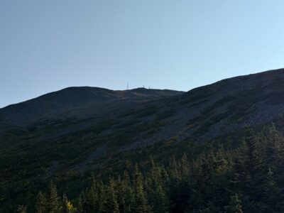
Summit in sight.
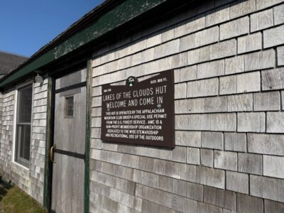
The Hut welcome sign.
Summit photo.
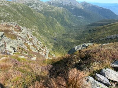
Looking down into the Great Gulf Wilderness.

Seek the Peak Spotlight: The Cloud Chasers
Seek the Peak Spotlight: The Cloud Chasers By MWOBS Staff Mike Bergeron and Desiree Bolton have been participating and volunteering for Seek the Peak for three years now. Together, they comprise Team Cloud Chasers

Celebrating 250 Years: The Declaration’s Legacy in the White Mountains
Celebrating 250 Years: The Declaration's Legacy in the White Mountains By Peter Crane We are now approaching July Fourth, Independence Day, the day when we celebrate the adoption of the Declaration of Independence in

Seek the Peak Spotlight: Ryan Shepard
Seek the Peak Spotlight: Ryan Shepard By MWOBS Staff Before Ryan Shepard moved to Conway, he was in Western New York celebrating his 40th birthday party. “I wanted to go big,” he said. “Big”
