
When will Winter Arrive?
2016-08-07 19:21:54.000 – Michael Dorfman, Weather Observer/IT Specialist
It may feel like the dog days of summer to everyone in the valley, but the observers on Mount Washington are already planning for the winter months! When does winter-like weather come to the summit? The short answer is (statistically speaking) as early as next month. Let’s take a look at some figures to get an idea.
Two of the main indicators that winter is on its way are (rime/glaze) ice growth and snowfall. For those unfamiliar, rime and/or glaze ice accrues whenever the summit is in the fog and below freezing. Fog, even when below freezing, consists of tiny water droplets suspended in the air. These water droplets are in a supercooled state, meaning they are below freezing but can’t turn into ice because of several factors (mainly the geometry and small size of the droplet). However as soon as this droplet hits any larger object that can allow freezing to initiate in the liquid, the droplet freezes on contact. While one cloud droplet frozen onto an object may be imperceptible, thousands and thousands are not and can form feathers of ice 6 inches per hour in length.
Mount Washington is obscured in the fog approximately 60 percent of the time and is below freezing for long period of time in the winter. Let’s take a look at when we start to see our first riming events:
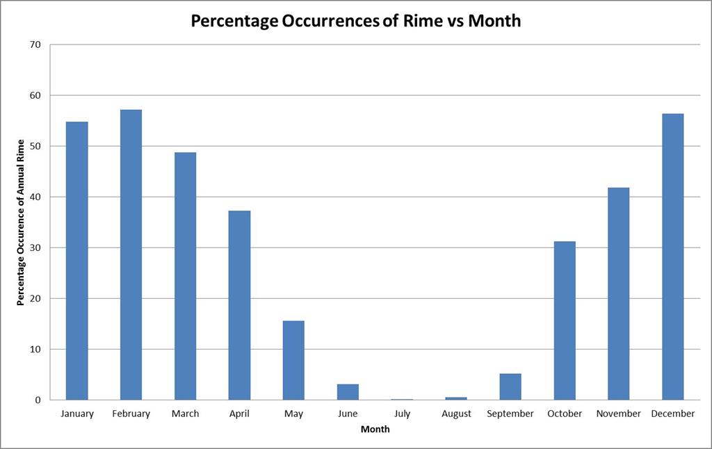 Daily percentage chance of riming through the month of September and October.
The graph above is an average (grouped into months) percentage that you will see rime on any given day of that month. As is evident in the above graph, riming is essentially nonexistent in July and August and very quickly begins to pick up in September and October. Let’s take a closer look at those shoulder months to see more specifically when in September and October we start to see riming.
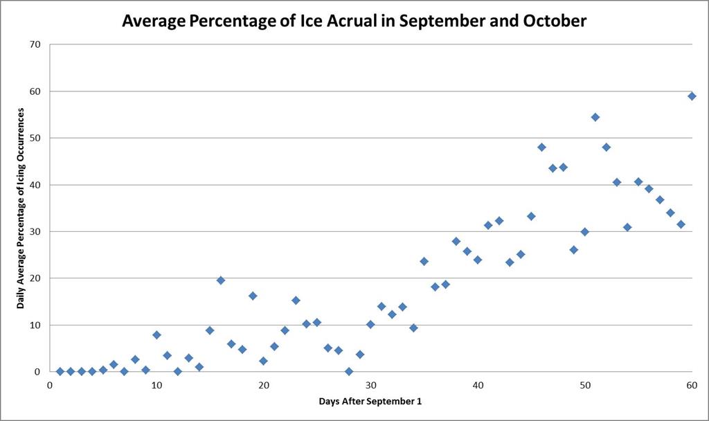 The daily risk of riming increases through September and October
We see riming start to pick up mid-month in September and increase even more to an average of just over 30% of the observations seeing riming in the month of October! That number grows through the winter, mainly thanks to our consistently-below-freezing temperatures and increasing amount of fog.
Another indicator that winter is on its way here on the summit is the first snowfall of the year. When does snow first start to fall? Let’s take a look:
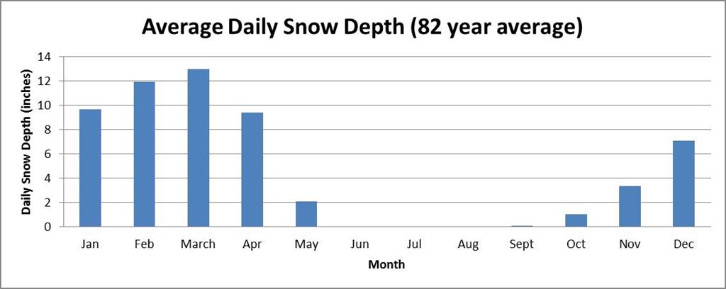
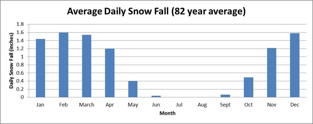 Average daily snowfall, grouped by month
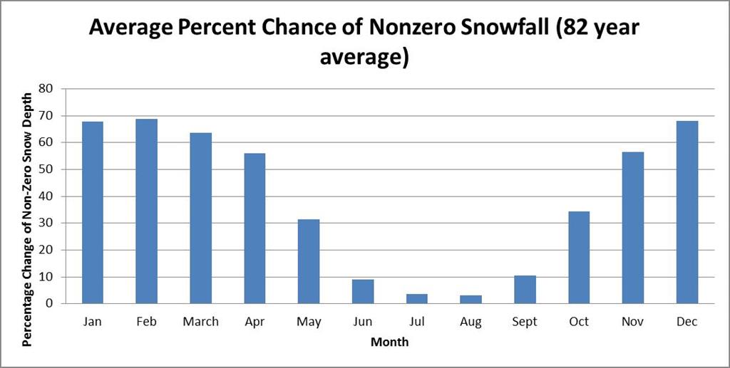 Average daily chance, grouped by month, that a trace or more of snow will fall on any given day within that month
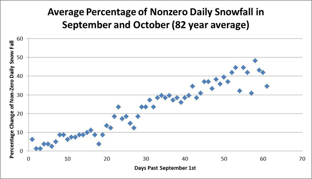 Daily percentage chance of a trace or more of snowfall through the month of September and October
And finally, what skiers and snow enthusiasts are often the most interested in, snow depth:
 Average daily depth of snow, grouped by month
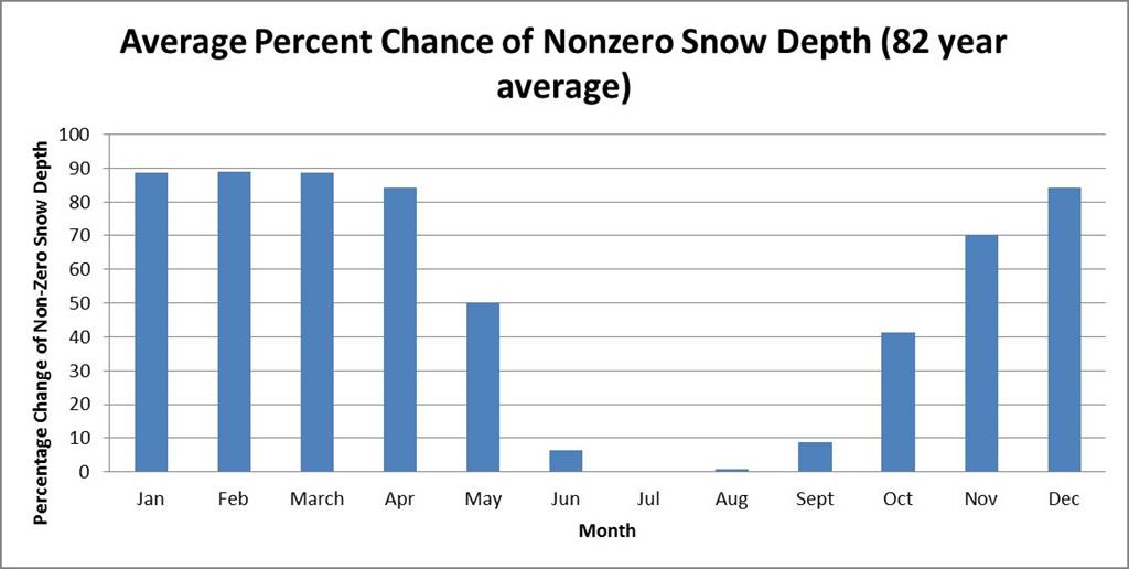 Average daily chance of snow depth greater than 0 inches, grouped by month
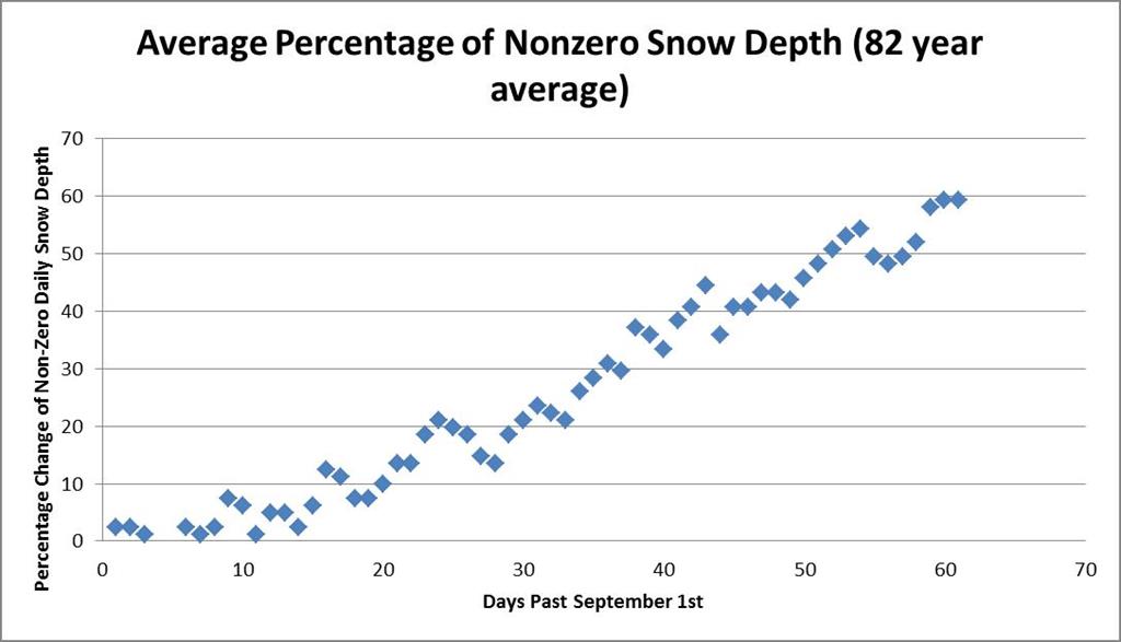 Average daily chance of a snow depth greater than zero in the months of September and October
While I’m thoroughly enjoying the rest of the summer-like weather, winter will inevitably march closer and closer! If you do plan on venturing above treeline, be sure to check out our Higher Summits Forecast to understand the conditions you may be hiking into and prepare accordingly!
Michael Dorfman, Weather Observer/IT Specialist
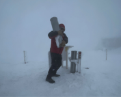
The Precip Can: Measuring Rain, Snow, and Everything Else on Mount Washington
The Precip Can: Measuring Rain, Snow, and Everything Else on Mount Washington By MWOBS Staff Averaging 281 inches of snow per year, the Observatory is no stranger to measuring precipitation. While it might be
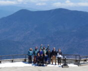
Meet MWOBS’ 2026 Seek the Peak Teams
Meet MWOBS’ 2026 Seek the Peak Teams By MWOBS Staff Another year, another epic Seek the Peak! As of June 2026, there are 430 hikers signed up for Mount Washington Observatory's annual summer fundraiser and
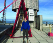
What the Rockpile Taught Me (Besides How to Dress for the Arctic)
What the Rockpile Taught Me (Besides How to Dress for the Arctic) By Kathryn Hawkes It turns out that living on the top of a mountain will teach you A LOT of things. How
