
Follow the Maze of Precip
2013-03-12 22:45:06.000 – Mike Carmon, Weather Observer/Meteorologist

NULL
What an entertaining Tuesday it’s been!
While forecasting this morning, computer models were advertising temperatures hovering right around the freezing point today on the summit. These temperatures are particularly difficult to forecast for, especially when precipitation is involved. The progression of events was anything but boring. See if you can keep up with this:
At 6:45 AM, with temperatures still in the upper 20s, the first band of precip came through, resulting in freezing rain on the summit.
At 7:40 AM, despite temperatures warming slightly, freezing rain changed over to snow.Forty minutes later, at 8:20 AM, freezing rain mixed back in, and continued through the majority of the day.
Snow wrapped up around 10:30 AM, but began to mix back with freezing rain around 12:30 PM.
An hour later, at 1:30 PM, snow changed over to ice pellets (sleet), again with freezing rain still descending on the summit.
At this point, temperatures were hovering at 31F.
Ice pellets fell for approx. an hour, until 2:30 PM, then stopped for a while, and subsequently mixed back in at 3:30 PM.
To make matters even more entertaining, snow made a return around 4:40 PM, but this was just as temperatures hopped above freezing. This resulted in a time period where snow, ice pellets, and (now) plain rain were all falling simultaneously. I know what you’re thinking, but indeed, this is possible!
The snow machine shut off at around 5:20 PM, and ice pellets followed suit at 6:00 PM, leaving just rain.
At this point, rain became heavy at times, with temperatures now above the freezing mark. Rain fell moderate to heavy for a good three hours, and ultimately became lighter around 9:30 PM.
Confused yet?
Mike Carmon, Weather Observer/Meteorologist

From Florida Heat to the Rockpile
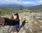
From Florida Heat to the Rockpile By Alek Libby Hi everyone! My name is Alek Libby, and I am one of the summit interns here at Mount Washington Observatory this summer! I recently graduated
Summit Summer
Summit Summer By Aspen M. Hello everyone! My name is Aspen, I’m one of the summer weather interns here at the Mount Washington Observatory. I fell in love with weather at a young age
From the Sunshine State to the Home of the World’s Weather
From the Sunshine State to the Home of the World's Weather By Kristen Mihalcik Hello Everyone! My name is Kristen Mihalcik, and I’m one of the Summer interns here at Mount Washington. Enjoying
