
A taste of fall in August?
2010-08-05 17:11:25.000 – Brian Clark, Observer and Meteorologist

NULL
The forecast for tomorrow night is looking rather interesting. Between now and then several cold fronts will sweep through the region, with the strongest coming through tomorrow evening. Behind the front, Canadian High Pressure will build in and winds will shift to a cold northwesterly direction. Because of this, temperatures will plummet, reaching a low just at or below the freezing mark late tomorrow night.
Of course, this means there is a chance that we could see some glaze ice forming. Whether that actually happens or not will be ultimately determined by whether the summit stays in the clouds. While the building high will bring colder air onto the summits, it will also bring drier air as well.
We’ll see, and naturally we’ll be posting pictures here, and on our page on Facebook if we do end up getting a taste of fall in August!
Brian Clark, Observer and Meteorologist
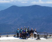
Meet MWOBS’ 2026 Seek the Peak Teams
Meet MWOBS’ 2026 Seek the Peak Teams By MWOBS Staff Another year, another epic Seek the Peak! As of June 2026, there are 430 hikers signed up for Mount Washington Observatory's annual summer fundraiser and
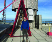
What the Rockpile Taught Me (Besides How to Dress for the Arctic)
What the Rockpile Taught Me (Besides How to Dress for the Arctic) By Kathryn Hawkes It turns out that living on the top of a mountain will teach you A LOT of things. How
Hiker Safety
Hiker Safety By Fawn Langerman, Dave Fatula and Julie Saccardo USFS Trailhead Steward volunteering season has begun, and hiker safety is on my mind. Truthfully, hiker safety is always on my mind, but more
