
A 50-Degree Swing
2016-11-17 14:02:52.000 – Mike Carmon, Senior Weather Observer & Education Specialist
Fall 2016 continues to be a chaotic one in New England, and another abrupt change is on the way—perhaps one of the most extreme of the season yet!
A strong ridge of high pressure centered over the southeastern United States will build into New England today through the weekend, bringing with it some extremely warm temperatures to the White Mountains region. Due to the very warm flow of air with this ridge, high temperatures on the summit of Mount Washington will be pushing 50°F tomorrow (Friday)! Considering our average daily temperature for November 18th is only 20°F, this is a significant daily anomaly. Our daily record for the day is 46°F, so we’re certainly anticipating breaking that record tomorrow, with room to spare.
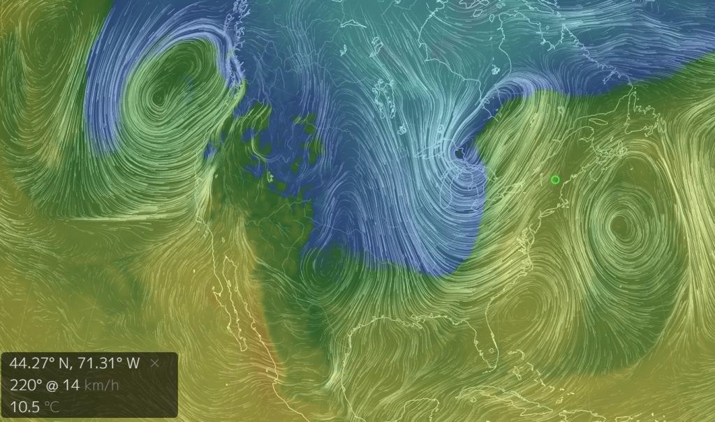
7AM Saturday 11/19 shows a strong warm flow in the lower-levels of the atmosphere. In the lower-left hand corner, note the forecasted wind direction & speed (SW at 8 mph) at Mount Washington’s lat/lon, along with the forecasted temperature (51F).
Our meager young snow pack will likely completely succumb to this noteworthy November warmth, giving the summit a more August-like appearance.
However, a brusque end to this November “heat wave” is very much in sight for later this weekend into early next week, as a dynamic cold front brings about some compelling changes to Mount Washington. A hasty metamorphosis from August to January conditions is in the forecast over a scant 48-hour period from Saturday night through Monday, with our first sub-zero (°F) readings of the season possible by Monday morning!
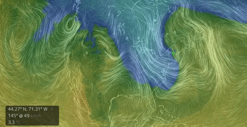 7AM Sunday: Note the sharp contrast in temperature nearly right over Mount Washington–that’s the cold front. The anticipated winds at this time are out of the SE at 30 mph, with temperatures down in the upper 30s F.
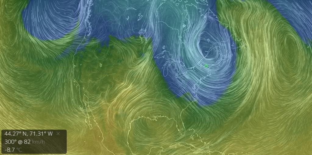 10PM Monday: Note how the cold flow into New England has taken over. Winds are now out of the NW at 50 mph, with temperatures down in the mid teens F.
Mike Carmon, Senior Weather Observer & Education Specialist

Seek the Peak 2026: New Adventures, Rooted in Tradition
Seek the Peak 2026: New Adventures, Rooted in Tradition By MWOBS Staff Seek the Peak is Mount Washington Observatory's largest annual fundraiser, and for 26 years it's brought together hikers, adventurers, and people who

What “Prepared” Really Means in the White Mountains
What “Prepared” Really Means in the White Mountains Early Spring in the Whites: The Most Honest Season By Andrew Harris, Burgeon Outdoor If you’ve spent any time in New Hampshire’s White Mountains in March,

March on Mount Washington
March on Mount Washington By Ryan Knapp Looking towards Mt. Madison at sunset on March 21, 2026. The calendar has spoken: Friday, 20 March 2026, marked the first day of astronomical spring.
