
A Cirque-us Around Mount Washington
2020-04-20 13:42:40.000 – AJ Grimes, Weather Observer
Continuing on last week’s theme of extreme ice, let’s talk about glaciers! If you’ve ever gone skiing at Tuckerman Ravine or climbing at Huntington Ravine, you may have wondered what force created these spectacular formations. Or, perhaps you’ve stood at the crest of the Gulfside Trail and wondered at the Great Gulf. Would you believe that there used to be massive ice sheets there that carved these awe-inspiring sights?
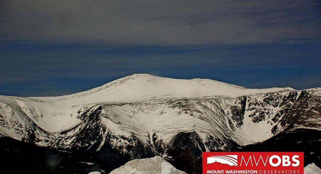
View of Mount Washington from Wildcat Mountain, with Tuckerman Ravine on the left and Huntington Ravine on the right.
Each of these formations is a glacial cirque: a geologic formation that occurs when glaciers carve out an amphitheater-like valley.* The headwall is the highest boundary; two other cliffs encircle the basin. A lip, the lowest side, offers an outflow path. Snow accumulates and packs in this basin, and a glacier develops. Through a few different processes, the area is then scraped down. Erosion happens as the glacier moves, rotates, wears through and mechanically abrades, and breaks off pieces of bedrock (called “plucking”). Also, freeze-thaw weathering can occur when water enters into cracks and faults in a surface, expands with freezing, then melts and contracts, thus weakening the bedrock. This is similar to what happens on roads, resulting in ice heaves and potholes, something I am sure all New Englanders are familiar with. When the glacier finally melts, it leaves behind this amphitheater-shaped valley.
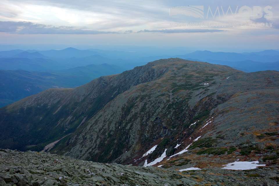
Looking into Tuckerman Ravine from above.
Tuckerman and Huntington Ravines are two of the most famous cirques surrounding Mount Washington, but a few others might catch your eye when you visit: Oakes Gulf, Gulf of Slides, Ammonoosuc Ravine, and of course, the Great Gulf.
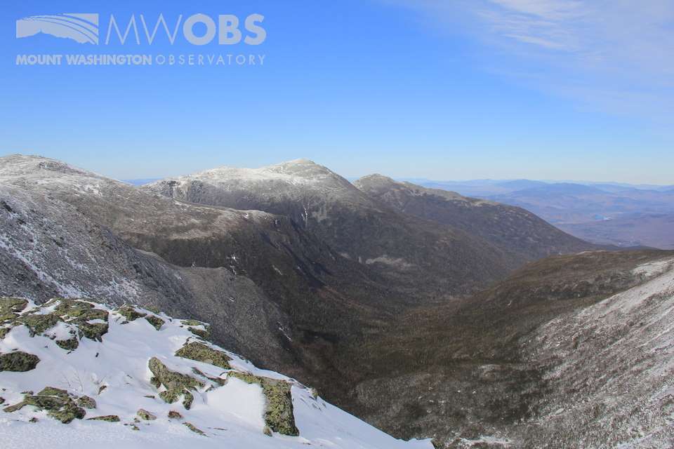
The view into the Great Gulf from the Gulfside Trail.
While this might seem surprising, the height of Mount Washington allowed for it to retain its glacial cover for longer than nearby areas – it was under glacial ice 15,000-20,000 years ago. Additionally, the makeup of the bedrock is more easily eroded and “plucked”. As a result, Mount Washington is an excellent place to see a number of magnificent cirques!
*While arguments have been made that continental glaciers contributed to the local geography of the mountain, the sharp sides of Tuckerman Ravine and Huntington Ravine are believed to be evidence of an additional process involving local glacier formation and recession.
AJ Grimes, Weather Observer

Team Flags Return for Seek the Peak’s 25th Anniversary
Team Flags Return for Seek the Peak's 25th Anniversary By MWOBS Staff Mount Washington Observatory is looking forward to continuing a much-loved tradition for Seek the Peak’s 25th Anniversary: Team flags. In inviting teams
Meet Summer Interns Zakiya, Max and Maddie
Meet Summer Interns Zakiya, Max and Maddie By MWOBS Staff We are excited to welcome six teammates to the summit of Mount Washington this summer! During their internship, these students and graduates will play

Saying Goodbye to the Summit
Saying Goodbye to the Summit By Alexis George After an extraordinary last three years working as a Weather Observer and Meteorologist, I am excited to pursue a different career. As sad I as am
