
A Heaping Helping of Heat
2018-08-26 12:31:10.000 – Thomas Padham, Weather Observer/Meteorologist
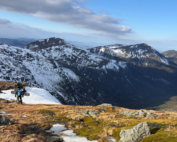
With September just around the corner, I thought I would take a look at the longer range weather models. Personally I’m very much looking forward to the fall season and our first snowflakes, whenever that may be. Unfortunately there’s not much hope for any wintry weather over the start of September. Over the next few days temperatures will climb well into the 80s and 90s°F across the surrounding valleys in advance of a cold front, with temperatures climbing to possibly just shy of daily records in the lower to mid 60s here on the summit of Mount Washington.
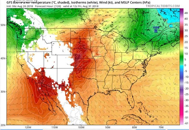
Taking a look at upper level winds, the jet stream is staying well to our north over the majority of the extended period all the way towards September 7th or so. A huge upper level ridge parks itself across the Southeast, keeping a warm and humid air mass streaming into New England. There will be some relief this coming Thursday and Friday just behind a cold front, with temperatures on the summit dropping possibly as low as the upper 30s.
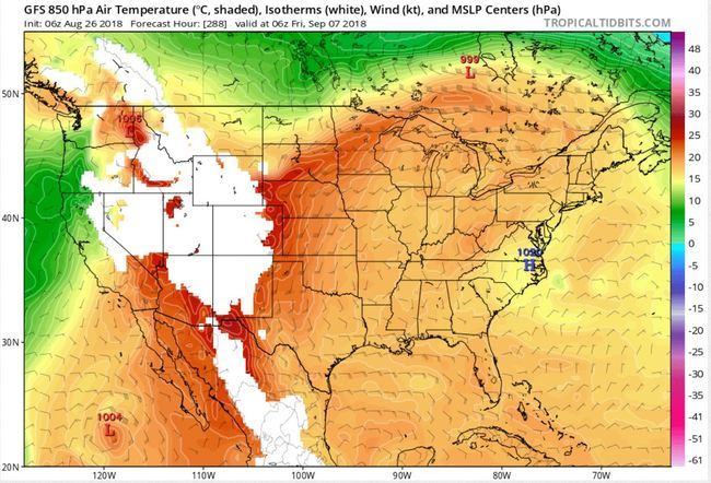
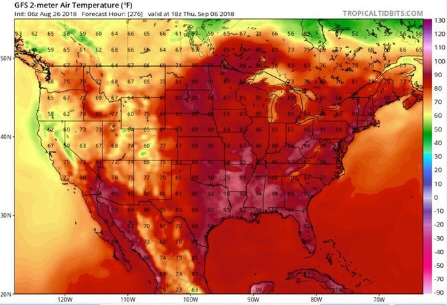
By the end of the weekend and start of the first full week of September, another helping of heat is in store for most of the eastern U.S. The large ridge mentioned earlier builds and anchors itself across the southeast and Midwest, with a plume of very warm air riding over the top from the northern plains into the Northeast. Temperatures in the 80s and 90s will likely return for much of New England, with readings likely around 60 degrees on the summit, some 10-15°F above average. This heat will likely last 3-4 days, potentially resulting in one last heat wave (temperatures of 90°F over 3 consecutive days) for parts of southern New Hampshire and the Boston metro area.
There is some indication of colder air bringing an end to this late-season warmth by September 9th or 10th, but at this point we’re getting way ahead of ourselves and really at the limits of our long range weather models (the GFS model in this case). In the meantime, I plan to make the most of our comfortable temperatures this upcoming weekend, and still have my fingers crossed for snow on the summit in the next few weeks!
Thomas Padham, Weather Observer/Meteorologist
Seek the Peak Spotlight: The Middleton Family
Seek the Peak Spotlight: The Middleton Family By MWOBS Staff Every summer, the White Mountains offer no shortage of reasons to get outside. Trails stretch in every direction—endless miles of terrain, summits that each
Lots of Digging, but Never Enough
Lots of Digging, but Never Enough By Ryan Tanski Over the past four months, I had the privilege of working with the Mount Washington Avalanche Center and Mount Washington Observatory, deepening my understanding of

Saying Goodbye to the Summit
Saying Goodbye to the Summit By Anna Trujillo It's hard to believe that my time on the summit is already coming to an end. Over the past several months I have learned so much
