
A November to Remembrrr!
2018-11-29 11:17:17.000 – Tom Padham, Weather Observer/Education Specialist
With the month of November coming to a close, I thought I’d take a look back at how this month compares to our averages and our extremes. For our current observers it has been the coldest and snowiest “fall” season in memory, and taking a look at records this backs that up. 58” of snow has fallen as of this writing, with very little, if any additional snow expected over the next day before the month ends. This total ends up being the 8th snowiest November on record. The snowiest November occurred back in the legendary winter of 1968-1969, with 87” falling in November and beginning an incredible snow season for the summit, with 566”, or 47 feet of snow falling through the following June.
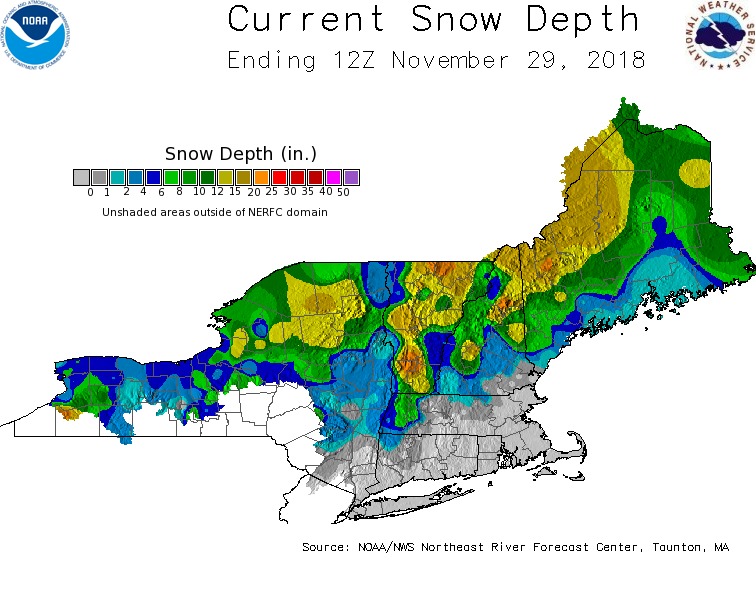 NWS current snow depth map showing deep snow across much of the Northeast, with 20-25″ across the highest elevations of the White Mountains
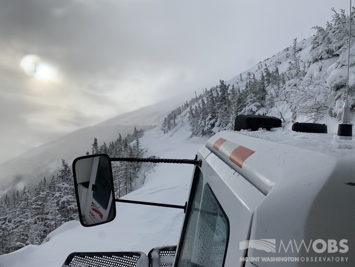
We’re off to a pretty good start to the snow season, as I mentioned earlier this month, but not quite up to the pace of our all-time record season. For the snow season (which starts on July 1st) the summit has now seen 110” of snow, a little more than 4 feet above average to date. Over the past month most of this snow has also stuck around on the ground, with the summit averaging only 15°F in November little melting has happened, and we actually haven’t risen above freezing since back on Nov 13th (barely) with a high temp of 33°F. This quickly building snowpack also meant a very early start for our Snowcat becoming the main mode of transportation, which often doesn’t happen until December but this year began in October!
A brief, but record-breaking cold snap occurred on Thanksgiving Day, November 22nd. Temperatures plummeted all the way down to -26°F, absolutely crushing the previous record for the date of -11°F. This was also the coldest Mount Washington has ever been in the month of November, with the previous record occurring on November 30th, 1958 at -20°F. What an impressively cold Thanksgiving!
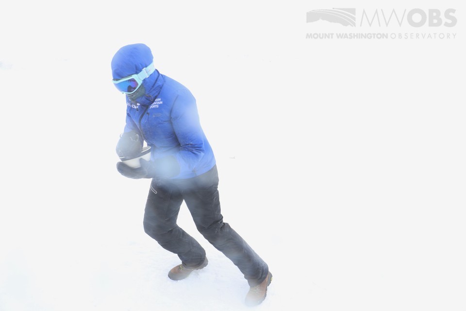 Weather Observer Taylor Regan braves -26°F temperatures and hurricane force winds with a hearty bowl of ramen soup!
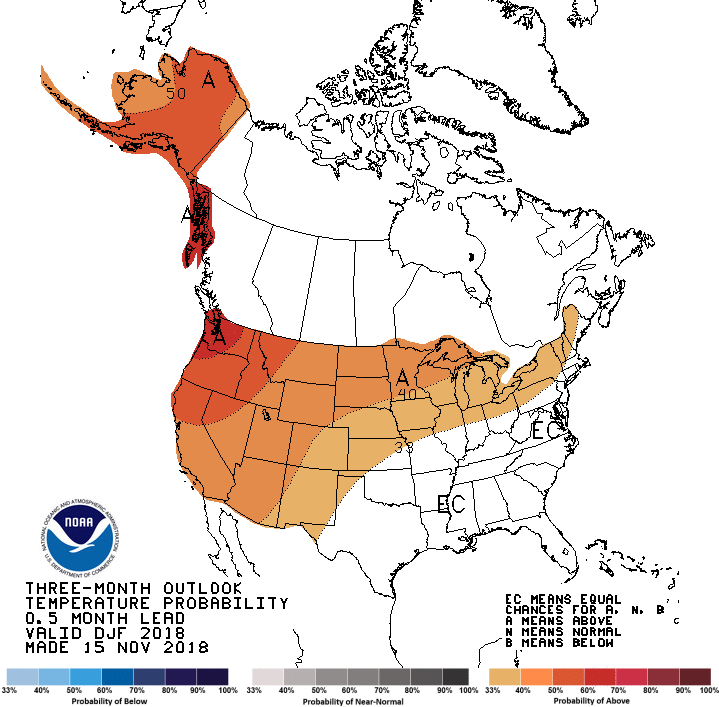
Taking a look at longer range forecasts from the Climate Prediction Center it’s unfortunately not very definitive whether we’ll see an above or below average snow season through this winter. It seems that with a developing El Nino in the West we’ll trend towards above average temperatures, with equal chances for above or below average precipitation. Above average temperatures could still mean mostly snow for the summit of Mount Washington, but for lower elevations may mean more in the way of mixed precipitation events. For now we’ll have to wait and observe, but I’m hoping this winter keeps the trend going on what has been an impressively cold and snowy fall!
Tom Padham, Weather Observer/Education Specialist

Seek the Peak Spotlight: The Cloud Chasers
Seek the Peak Spotlight: The Cloud Chasers By MWOBS Staff Mike Bergeron and Desiree Bolton have been participating and volunteering for Seek the Peak for three years now. Together, they comprise Team Cloud Chasers

Celebrating 250 Years: The Declaration’s Legacy in the White Mountains
Celebrating 250 Years: The Declaration's Legacy in the White Mountains By Peter Crane We are now approaching July Fourth, Independence Day, the day when we celebrate the adoption of the Declaration of Independence in

Seek the Peak Spotlight: Ryan Shepard
Seek the Peak Spotlight: Ryan Shepard By MWOBS Staff Before Ryan Shepard moved to Conway, he was in Western New York celebrating his 40th birthday party. “I wanted to go big,” he said. “Big”
