A Shift Full of Escalating Weather
2018-01-09 22:10:53.000 – Caleb Meute, Weather Observer / Meteorologist
Well that escalated quickly! The weather, the tied record low temperature, the misinterpretations, and… Well, the weather!
First off, -38°F was our lowest recorded air temperature January 6th which tied a daily record low of -38°F set back in 1959. Our peak wind gust that morning was 113 mph but that occurred before the coldest of the air arrived. When the -97°F wind chill occurred, our temperature was at -37.6°F and the wind speed was at 106 mph. It certainly did not feel tropical… The weather this week has been exceptionally intense up here and quite memorable for me. Since this shift began, nights have been hectic and they have REALLY kept me on my toes.
First, there was the Nor’easter that strengthened faster than Barry Bonds when he went to the Giants. 59mb in 24 hours! The last time a storm strengthened this rapidly, winds atop the Rockpile soared to 150 mph! Impressively, the center of that storm (also) January 4th, 1989 was 600 miles away and still caused the winds to gust that high. The center of this recent storm was expected to pass much closer to the White Mountains. Therefore, as you can imagine for this storm we were anticipating similar results. Unfortunately, we did not quite get up to 150 mph, but our peak gust of 122 mph was still impressive!
After this storm, the Arctic gates opened and frigid air poured into the northeastern United States. We felt it up here as temperatures plummeted through the 30s below zero. Every single observation that night required me to spend several minutes preparing myself before going outside. Plenty of misconceptions arose from this cold weather outbreak and I want to highlight some information regarding wind chill. One misconception is that we broke a temperature record. It was spread around the media realm that we got down to -109°F. The coldest air temperature ever recorded on the summit of Mount Washington is -47°F. We did NOT break this record by 69°F… The lowest wind chill that was even calculated at any point was -97°F. Wind chills do not account for temperature records by any stretch of the imagination. I touched on wind chills in my last blog but I want to attempt to clear this up again.
What is wind chill?
The quick answer is that wind chill reflects the rate at which heat is lost from your body. Imagine all around your skin is a thin layer of warm air. When the wind blows past your skin, it transfers this layer of warmer air away from your skin. The stronger the wind, the more heat will be lost from your body, and the colder this will feel to your exposed skin. By covering up all of your skin, you are trapping the heat, and keeping it protected from the wind trying to transport it away from your body. Without taking the right precautions when dealing with wind chills falling well below zero, you are increasing your chances at hypothermia and frostbite. Whenever you hear that there is a Wind Chill Advisory or even a Wind Chill Warning, be sure to bundle up, and cover up ALL of your skin!
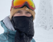
I think the most important thing to realize and understand from this particular event and the dangerously low wind chills is that we minimized wind chill from the equation by covering up all of our skin. With wind chills plummeting this far through below zero numbers, you better believe that none of us observers went outside with any skin exposed. In fact, we typically analyze one another before going outside into these conditions to ensure there is not a sliver of skin exposed. With no skin exposed, the risk associated with wind chill is greatly minimized and “wind chill” essentially becomes a glorified number. With wind chills falling this low, exposed skin would begin to experience the effects of frostbite in seconds and then permanent damage could result within as little as 1-2 minutes. This also makes it important to not be outside for too long. Another way to minimize the risks associated with wind chill is to simply avoid a lengthy exposure to the elements. We have the luxury of going outside and coming into the heated building immediately after! The longer you are outside, the cold winds have a better shot of navigating around your gear and prodding through a weakness. Because of this, we were EXTREMELY diligent throughout this Arctic outbreak to minimize our exposure, bundle up and cover up fully for each one of our hourly weather observations that involved being outside for an extended period. We were able to negate the effects of wind chill, BUT this was still the coldest air that I (personally) have ever experienced.
After the cold, it got so gusty… I mean, it got REALLY gusty. The winds fluctuated rapidly… I messaged Ryan Knapp, my counterpart night observer, Sunday morning saying it was the most intense night I had experienced up top since I started working for the Observatory. This was no exaggeration! Generally speaking, when we have crazy weather happening up here, the summit is in the clouds and our observations are a bit easier. Granted, we still have to deice the tower, and venture to the precipitation can frequently. The difference Sunday morning was that we were in the clear and I had to walk around the perimeter of the deck each hour while using the sling psychrometer and attempting to find cloud layers and determine horizontal visibility, all while being battered by winds going from 40 mph to 113 mph. It was incredible! At times, I could stand completely upright and walk around with ease while the noise from the wind dropped off entirely. Then all of the sudden, a tremendous noise grew from the corner of the deck and it seemed as though Troy Polamalu was repeatedly attacking me and pushing me down (his hair would have been all over the deck). At times, I literally just sat on the deck for a minute waiting for the wind to subside, and then I got back up and continued walking around. That was the most exhausting night that I have had up here by a longshot.
After an exhilarating and exhausting week, conditions have finally calmed down and we are heading into what looks to be a beautiful day tomorrow for shift change. The mercury is above zero degrees, winds will finally drop off tonight and the snow will taper for a pleasant end to a WILD week spent on the summit of Mount Washington.
Caleb Meute, Weather Observer / Meteorologist
Three and a Half Months of Snow, Ice and Rime
Three and a Half Months of Snow, Ice and Rime, with Deeper Drifts. By Ryan Steinke Me outside on the summit near the Yankee Building. My internship with the Mount Washington Observatory
Supporter Spotlight: Righteous Vices Coffee Roasters
Supporter Spotlight: Righteous Vices Coffee Roasters By MWOBS Staff Righteous Vices Coffee Roasters, a local coffee roaster and shop located in Center Conway, New Hampshire, has been a partner of the Observatory since 2024.
Winter Storm Tracks Across New Hampshire
Winter Storm Tracks Across New Hampshire By Alex Branton As winter comes to a close, most of us are ready for the warmer temperatures and sunshine that come with Spring and Summer. Although we


