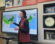
A Storm to Remember
2017-03-15 09:24:48.000 – Mike Carmon, Senior Weather Observer & Education Specialist
The winds on the morning of Tuesday, March 14th were feeble at best—at least by the standard of a mountain renowned for its regularly high wind speeds. Winds of 10-25 mph out of the southwest brought an eerie lull to the start of a day that promised to be a tempestuous one. Thick clouds obscured any promise of morning sunlight from above, and the clouds with tops below the level of the summit brought that familiar sense of isolation to the summit staff—perhaps an eerie omen that whatever came this day, we were on our own to endure it.
The all-too-familiar fog rolled in to the highest peak in the Northeast around 6:30AM, and the commencement of the snow followed promptly thereafter. Almost on cue, the winds began to pick up as they shifted around to the southeast—the wind direction that prompted our former-world record gust of 231 mph back in April of 1934. Although we were not expecting to match this impressive feat, the seldom-seen wind direction certainly had us contemplating the possibilities.
As heavier bouts of snow began to move in during the early afternoon, we estimated snowfall rates in excess of 5-6″ per hour at times. Much to our disappointment, however, catching all of this light powdery fluff was becoming near-impossible by this time as winds concurrently ramped up as they shifted around to the east, quickly becoming sustained over hurricane force by about 2:30PM, with gusts approaching the always-coveted century mark.
Every passing moment we believed the situation could not get any more thrilling, the falling snow would intensify, and the easterly winds would strengthen even further, sending a seemingly-perpetual wall of snow careening over the summit at speeds akin to a Category 4 Hurricane. Our attention became firmly fixed on our Hays Wind Chart, and with each new peak wind gust, we eagerly became spoiled hoping for another, more impressive maximum. Snow and cold air was forced into the cracks in our tower door, turning the interior of our instrumentation tower into a white winter wonderland. Ventures outdoors were short and violent, as the rare easterly wind direction combined with awe-inspiringly dense blowing snow became a challenge to endure, even for the most seasoned of the summit staff.
I was lucky enough to be gazing at the Hays Chart when the needle shot over a reading of 9″ of water—the highest reading I’ve ever personally witnessed while on the summit. This calculated to a value of 138 MPH, which would be our peak gust of the event, and our new maximum of the Winter of 2016-2017!
The snow continued to fall into the evening, and the winds remained intense, although began to slowly ease up on our hallowed mountain as midnight approached. Seemingly just as quickly as the storm arrived, the deafening roar of the high winds subsided, and the heavy snow eased to a lighter, more delicate descent.
Mike Carmon, Senior Weather Observer & Education Specialist
Three and a Half Months of Snow, Ice and Rime
Three and a Half Months of Snow, Ice and Rime, with Deeper Drifts. By Ryan Steinke Me outside on the summit near the Yankee Building. My internship with the Mount Washington Observatory
Supporter Spotlight: Righteous Vices Coffee Roasters
Supporter Spotlight: Righteous Vices Coffee Roasters By MWOBS Staff Righteous Vices Coffee Roasters, a local coffee roaster and shop located in Center Conway, New Hampshire, has been a partner of the Observatory since 2024.
Winter Storm Tracks Across New Hampshire
Winter Storm Tracks Across New Hampshire By Alex Branton As winter comes to a close, most of us are ready for the warmer temperatures and sunshine that come with Spring and Summer. Although we


