
A Turbulent Weather Day
2016-07-19 14:15:45.000 – Mike Carmon, Senior Weather Observer & Education Specialist
Yesterday, we were all thrilled with the prospect of severe weather in northern New Hampshire. All signs pointed to an eventful afternoon for most of New Hampshire and Maine, with the summit of Mt. Washington smack in the middle of the action.
 Yesterday’s severe weather risk from the Storm Prediction Center
Forecasted values of CAPE (Convective Available Potential Energy) were exceptionally high (by New England standards), signifying a good deal of instability in the air. That’s ingredient number one.
Due to the income of a warm, moist air mass from the southwest, plentiful moisture was available, which is necessary for convection to occur. This is ingredient number two.
And finally, a strong cold front was approaching from the northwest. A frontal boundary such as this provides the third and final ingredient needed for convection: lift. A source of jump-starts the convection process, prompting air parcels at the surface to begin an ascent into the atmosphere.
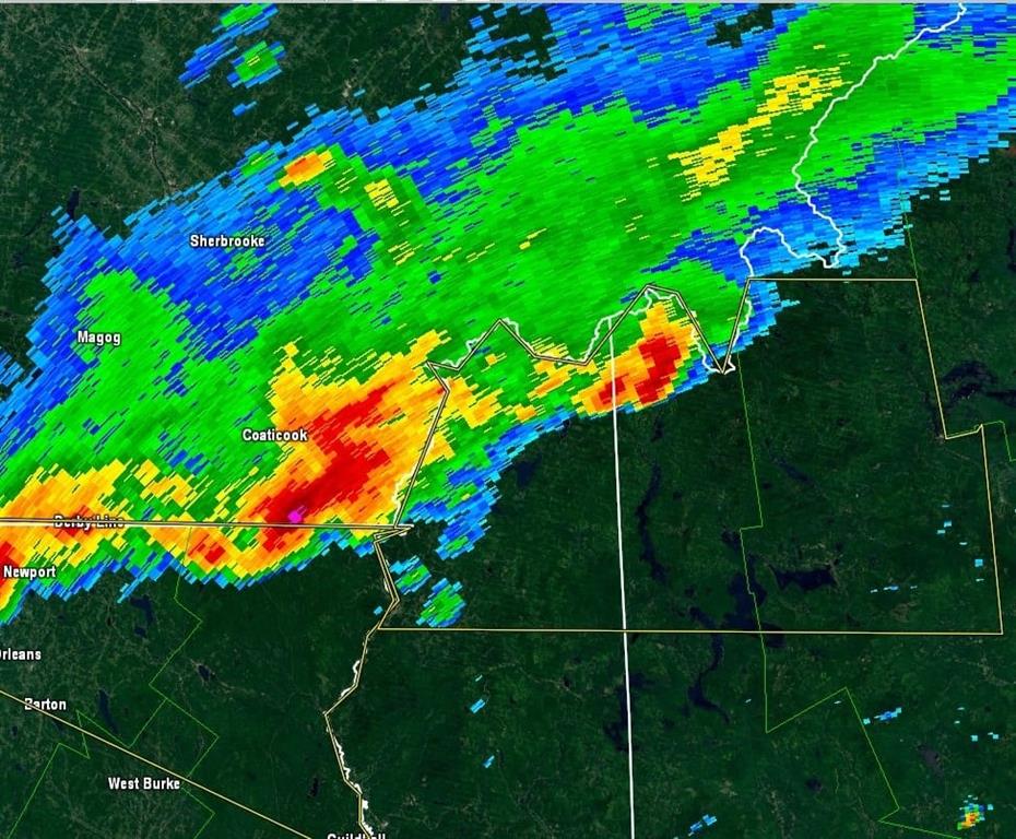
With these three components in place, thunderstorms began to fire across northern New Hampshire around midday on Monday. It didn’t take long before Severe Thunderstorm Warnings were posted for these thunderstorms blossomed into supercells.
The first thunderstorms to fire yesterday afternoon.
 Structure of a supercell thunderstorm (Note the separation of the updraft & downdraft)
Lines of thunderstorms continued to form throughout the afternoon and evening, bringing several rounds of turbulent weather all across the region. In fact, several tornado warnings were issued for counties in northern New Hampshire and Maine, although no tornadoes have been confirmed as of yet.
Being stationed on the summit of a mountain, receiving a direct hit from a supercell thunderstorm is a rare occurrence for summit weather observers. Mountains disrupt wind flow and can present a literal physical barrier to developing thunderstorms. Unfortunately, passing thunderstorms succumbed to these effects yesterday, as any and all storm that formed either went around us to the north, to the south, or hit the summit and promptly weakened.
However, we were treated to a spectacular show yesterday afternoon around 4PM as a particularly intense supercell hit the Presidential Range and skirted around to the north. Simultaneously, the fog cleared from the summit, allowing us to witness this menacing storm as it passed to the north. Check out our Facebook Live video as we followed this storm while it passed us to the north yesterday.
Mike Carmon, Senior Weather Observer & Education Specialist

Seek the Peak Spotlight: The Cloud Chasers
Seek the Peak Spotlight: The Cloud Chasers By MWOBS Staff Mike Bergeron and Desiree Bolton have been participating and volunteering for Seek the Peak for three years now. Together, they comprise Team Cloud Chasers

Celebrating 250 Years: The Declaration’s Legacy in the White Mountains
Celebrating 250 Years: The Declaration's Legacy in the White Mountains By Peter Crane We are now approaching July Fourth, Independence Day, the day when we celebrate the adoption of the Declaration of Independence in

Seek the Peak Spotlight: Ryan Shepard
Seek the Peak Spotlight: Ryan Shepard By MWOBS Staff Before Ryan Shepard moved to Conway, he was in Western New York celebrating his 40th birthday party. “I wanted to go big,” he said. “Big”
