A Very Snowy Start to February
2015-02-09 17:57:57.000 – Tom Padham, Weather Observer/Meteorologist
Holy snow! A very active weather pattern will finally give New England a break Tuesday, but only after dropping nearly a foot of snow across much of central and southern New Hampshire. With a very snowy February already underway, if this overall weather pattern continues and we see a big storm or two we could be looking at well above average snowfall for the month.
Relentless may be the best way to describe the snow this week on the highest peak in New England. Although in general the snow has been light, we’ve seen an inch or more of snowfall for what will be 6 days by Tuesday morning. As of this writing, the summit has picked up 16 inches of snow since we arrived on the summit last Wednesday, with a bit more expected into early Tuesday morning.
Looking ahead, dry and chilly weather will move in under arctic high pressure Tuesday and Wednesday, with a clipper system spreading light snow into New England late Wednesday night before redeveloping offshore Thursday. At this time it appears the storm will only brush the area with a light snowfall as it strengthens offshore Thursday into Friday morning, but if the storm were to strengthen more quickly and track slightly further west we could be looking at a more substantial snowfall. For now, there’s plenty of snow here already, with still more likely on the way!
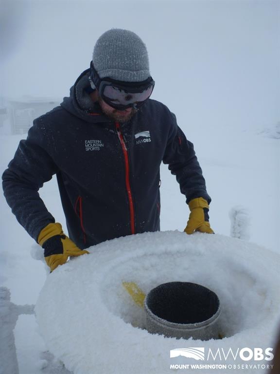
 Weather Observer Caleb Meute collecting the precipitation can on February 9, 2015
Tom Padham, Weather Observer/Meteorologist
Team Flags Return for Seek the Peak’s 25th Anniversary
Team Flags Return for Seek the Peak's 25th Anniversary By MWOBS Staff Mount Washington Observatory is looking forward to continuing a much-loved tradition for Seek the Peak’s 25th Anniversary: Team flags. In inviting teams
Meet Summer Interns Zakiya, Max and Maddie
Meet Summer Interns Zakiya, Max and Maddie By MWOBS Staff We are excited to welcome six teammates to the summit of Mount Washington this summer! During their internship, these students and graduates will play
Saying Goodbye to the Summit
Saying Goodbye to the Summit By Alexis George After an extraordinary last three years working as a Weather Observer and Meteorologist, I am excited to pursue a different career. As sad I as am


