
A Winter to Remember: Comparing this Season to the Winter of ’68-’69
2017-02-19 13:44:21.000 – Taylor Regan, Weather Observer
This winter has certainly seen its share of snow, that’s for sure. As of this writing, the summit has seen 253.4 inches of snowfall from June 2016 to present. Our annual average (annual looking at a snow year from July to June) is 281.2 inches, meaning that we have about 30 inches of snow left in our “snowfall budget” before the winter becomes above average. Given that in March alone, our average snowfall is 45.1 inches, we will almost certainly have an above average season.
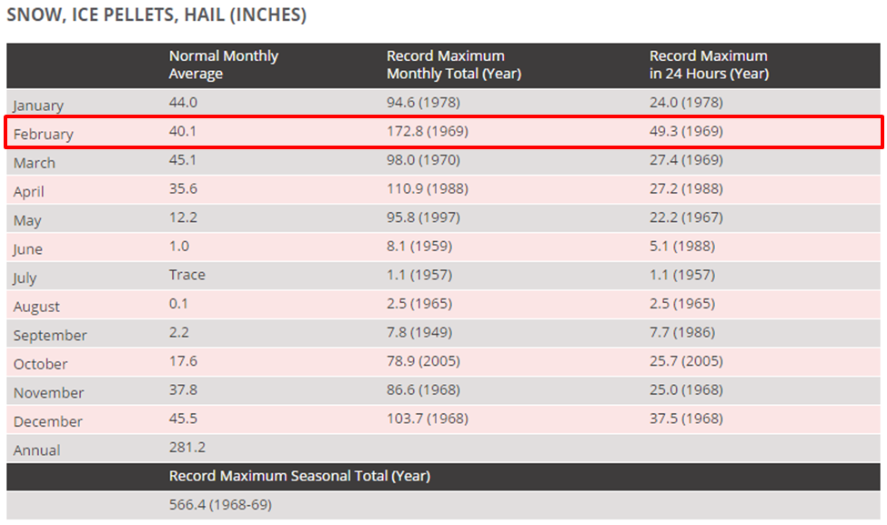
Looking back over the course of the year, the summit saw its 2nd snowiest December on record, second only to December 1968. And while January was just about perfectly average, February has already seen 69.7 inches of new snowfall hit the summit, well above the monthly average of 40.1 inches. With February proceeding as it has, many people have remarked on the severity of the winter and associated snowfall, which begs the question, how does this winter stack up to the infamous winter of ‘68-‘69? Short answer: In the waning days of the month, the summit has a lot of work to do to catch up.
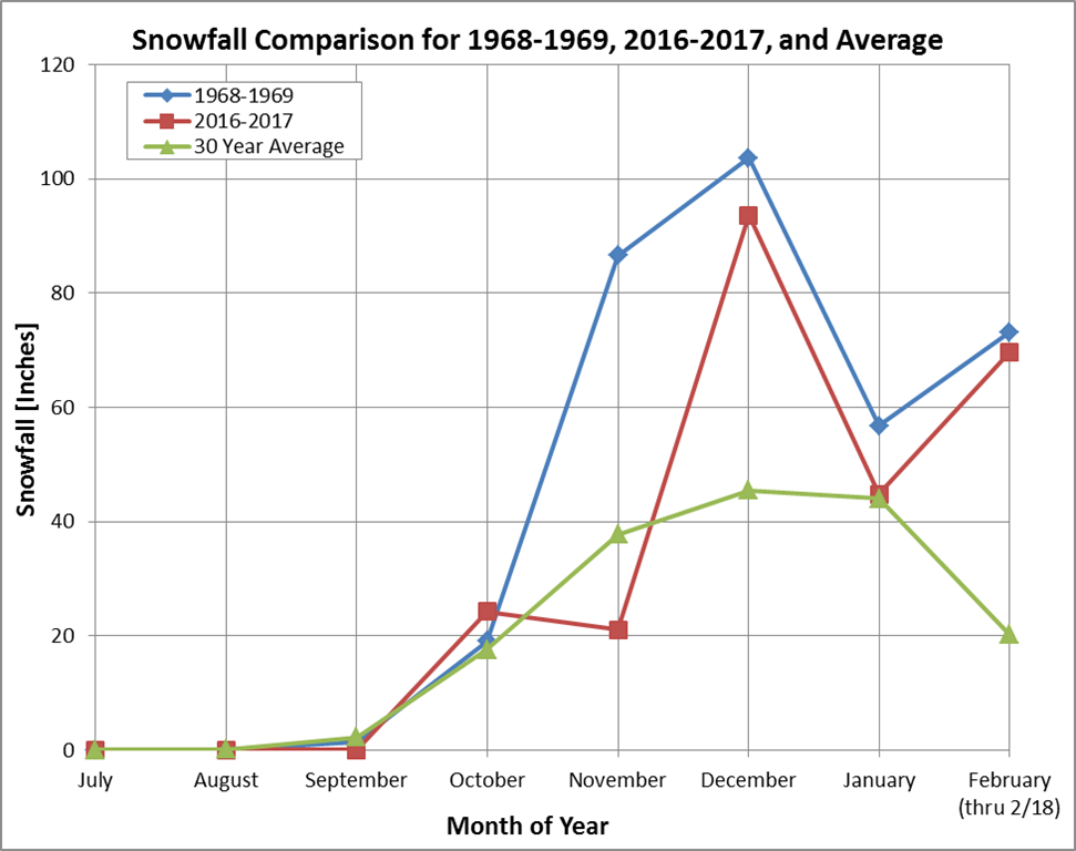
I confess however, this plot is a little misleading. It gives the impression that, while November was an anomaly, we are altogether trending fairly closely to the infamous winter of ’68-’69. And, while this winter has been brutal, it pales in comparison to its historical rival. Just how extreme of a difference am I talking about? Well, consider for example, the extended forecast for the remainder of the month, unless a new storm system rapidly develops, it’s currently looking as if we may get up to 8 or so inches of additional snow on the summit. Not too bad, you may think, we’re already way above average, but how did the rest of February 1969 pan out?
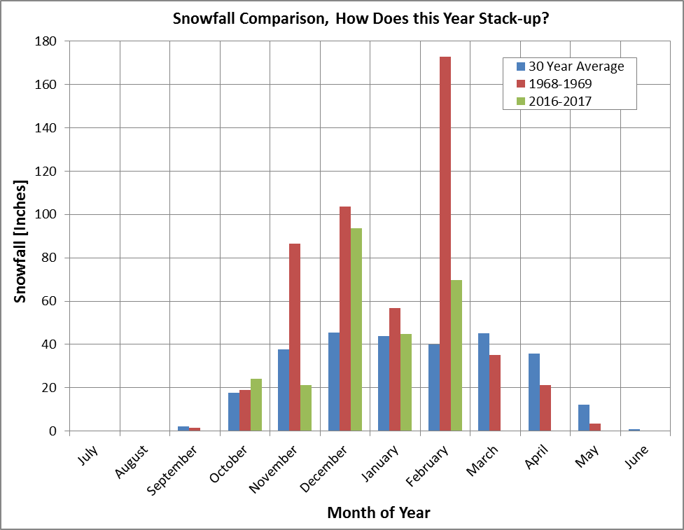
After 4 days with no new snowfall, the morning of February 24 brought flurries that soon turned into heavy snow. The snow was unrelenting, and the summit picked up 6.7 inches of powder. The next day, a whopping 49.3 inches of snow was recorded in just 24 hours, followed by 27.8 inches the next day, and 14 the day after. All in all, the month of February saw a staggering 172.8 inches of snowfall, making the snowiest month in our summit record (over 4x the average for the month of February), as well as the record for maximum amount of snow in 24 hours. The plot below shows how each of the winters of ’68-’69 and ’16-’17 each compare to a 30 – year average of snowfall for the summit.
Taylor Regan, Weather Observer

Seek the Peak Spotlight: The Cloud Chasers
Seek the Peak Spotlight: The Cloud Chasers By MWOBS Staff Mike Bergeron and Desiree Bolton have been participating and volunteering for Seek the Peak for three years now. Together, they comprise Team Cloud Chasers

Celebrating 250 Years: The Declaration’s Legacy in the White Mountains
Celebrating 250 Years: The Declaration's Legacy in the White Mountains By Peter Crane We are now approaching July Fourth, Independence Day, the day when we celebrate the adoption of the Declaration of Independence in

Seek the Peak Spotlight: Ryan Shepard
Seek the Peak Spotlight: Ryan Shepard By MWOBS Staff Before Ryan Shepard moved to Conway, he was in Western New York celebrating his 40th birthday party. “I wanted to go big,” he said. “Big”
