And Now, For the Rest of the Story…
2012-08-02 18:34:15.000 – Ryan Knapp, Weather Observer/Meteorologist
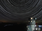
Star Trails and the Story Behind Them.
When I started working here, I saw a picture downstairs taken at night of our weather tower with Polaris above it and slight star streaks around it. I liked it and wanted to try it out on my own; and not just duplicate it but improve upon it. So, over the years, I started doing my homework and learning how to replicate the image on my own. When I set out on looking into how to do this, a lot of what I used didn’t exist or if it did exist, costs were just too high. So I had to wait for prices to drop and technology to catch up. My first and biggest hurdle I needed to overcome was my camera. While I loved using my Canon SD1100IS, it just wasn’t capable of the settings I needed. So, after two years of saving up bit by bit, I bought a Canon G12 which would be capable of the manual operations I needed. While it may not have been an DSLR that others typically use, I figured it should work.
Next up, the correct amount of memory. So, I took a sample photo, got its memory size, and worked out the math (see kids, math is useful when you get older) and found out the proper size of card I would need for a full night. Next up, battery life. I ran my camera one night and timed how many shots I could get on one battery. Surprisingly it only lasted three hours. I did have additional batteries but I didn’t want to keep moving the camera to swap out batteries. So, I bought a pack that could be plugged into an outlet for continuous power. Once I had the images, I needed to learn how to stack them. When I first started, this had to be done manually. While doable, it wasn’t something I wanted to do. Luckily, over time, software caught up and would be able to do the stacking for me. So, I downloaded a pack for Adobe Photoshop to do the hard part for me. Lastly, I needed to get the star placement right to create the trails I was looking for. When I started working here, if I wanted to read the night sky I had to use my plastic wheel of stars I picked up from my local planetarium. Luckily though, when I finally got down to doing this project, technology caught up, allowing me use Google Sky Map on my smartphone/tablet to look at the night sky for me.
So, by July of this year, I had all the ingredients I needed, so it was time to set off trying to accomplish my goal of a star trail from the summit. But prior to that, I tried it out during my off week to see how things went. I tried it at near home under a controlled environment, I tried it by at the Pondicherry Wildlife Refuge, and at Chocorua Lake during an Aurora Borealis event. After a week of experimentation, I was ready for a summit trial, all I needed was for the weather to provide me a clear, calm night; something of a rarity on the summit of Mount Washington. But the stars all aligned (get it!) the night before Seek the Peak this year (July 20/21) for me to accomplish my trial. So knowing this, on my break the night before with Google Sky Map in hand on my tablet, I set out to scout my location. Then the big night arrived and I set out to get my picture, setting up my camera, the extension cord and its settings to start capturing images an hour after sunset until an hour before sunrise.
So I let my apparatus do its thing the whole night, the whole while fearing I would be losing my camera to one of the several night hikers we had. Usually we see one a week but this night I saw no less than a dozen or more. But luckily, everything was still there and ready to be layered on my off week. And after 7 hours of composing, adjusting, cleaning, stacking, and editing, I created the images and videos of the event. So, here are the results of this work to capture the summits star trails:
Picture 1 – A negative stacking of all 750+ images.
Picture 2 – A positive stacking of all 750+ images.
Picture 3 – A stacking of 675+ images
Picture 4 – A stacking of approx. 600 images
Picture 5 – Final stack of approx. 600 images with a handful removed to clean up the image
And a link to the video in case you missed it. The video link has additional information on the settings I used to accomplish all of this in case you are interested. So that’s a peek behind the video and images that were mentioned and had been shared over the past week. And now that I know what I am doing, I will try to do this again…in winter!
Ryan Knapp, Weather Observer/Meteorologist
Team Flags Return for Seek the Peak’s 25th Anniversary
Team Flags Return for Seek the Peak's 25th Anniversary By MWOBS Staff Mount Washington Observatory is looking forward to continuing a much-loved tradition for Seek the Peak’s 25th Anniversary: Team flags. In inviting teams
Meet Summer Interns Zakiya, Max and Maddie
Meet Summer Interns Zakiya, Max and Maddie By MWOBS Staff We are excited to welcome six teammates to the summit of Mount Washington this summer! During their internship, these students and graduates will play
Saying Goodbye to the Summit
Saying Goodbye to the Summit By Alexis George After an extraordinary last three years working as a Weather Observer and Meteorologist, I am excited to pursue a different career. As sad I as am


