
Best Day Ever, Part 1: An Irrational Pi Day
2017-11-03 09:12:58.000 – Mike Carmon, Senior Meteorologist & Education Specialist
It can be remarkably difficult to pinpoint one’s most memorable experience in a place teeming with endless opportunities for once-in-lifetime events. Occasionally I’ll say to myself “I should seriously catalog these memories somehow,” but in the same manner as these events pertain to, these thoughts are fleeting and become amalgamated in a haze of similar situations. Nevertheless, there are certainly a few weather events that stick out from the rest of the pack as far as their notoriety, and the subsequent level s of excitement that are achieved within the confines of our weather station.
My most notable day during my time on Mount Washington’s summit came just this past winter; a winter in which over 400 inches of fallen snow were recorded, making it the sixth-snowiest winter in MWO history. That amount of snow in and of itself presented a myriad of distinctive storm systems that could be contenders for my personal top spot, but there is, without a doubt in my mind, one event that has a clear edge over all the rest. That storm came on March 14, 2017, which we affectionately refer to as the “Pi Day Blizzard.”
Pi Day is named as such thanks to the mathematical constant pi, which is the ratio of a circle’s circumference to its diameter. This ratio is a constant for all circles, and is equivalent to a value of approximately 3.14, which has given all serious scientists a not-so-elaborate excuse to celebrate the date 3/14 with a few freshly-baked pies. But I digress.
The Pi Day Blizzard was the result of a strong coastal Nor’easter, which formed off the Carolina coastline, and was launched northward by an exceptionally strong and progressive upper-level jet stream. A bone-chilling air mass that had anchored itself over New England the previous few days set the stage for the snowstorm: the minimum air temperature just three days prior on the 11th was a frosty -35°F, and air temperatures struggled to climb out of the negative readings for the next few days leading up to the event, topping out at a mere 11°F the morning of the 14th.

Caption: Some of the first flakes that fell from the Pi Day Blizzard, captured on our snow board.
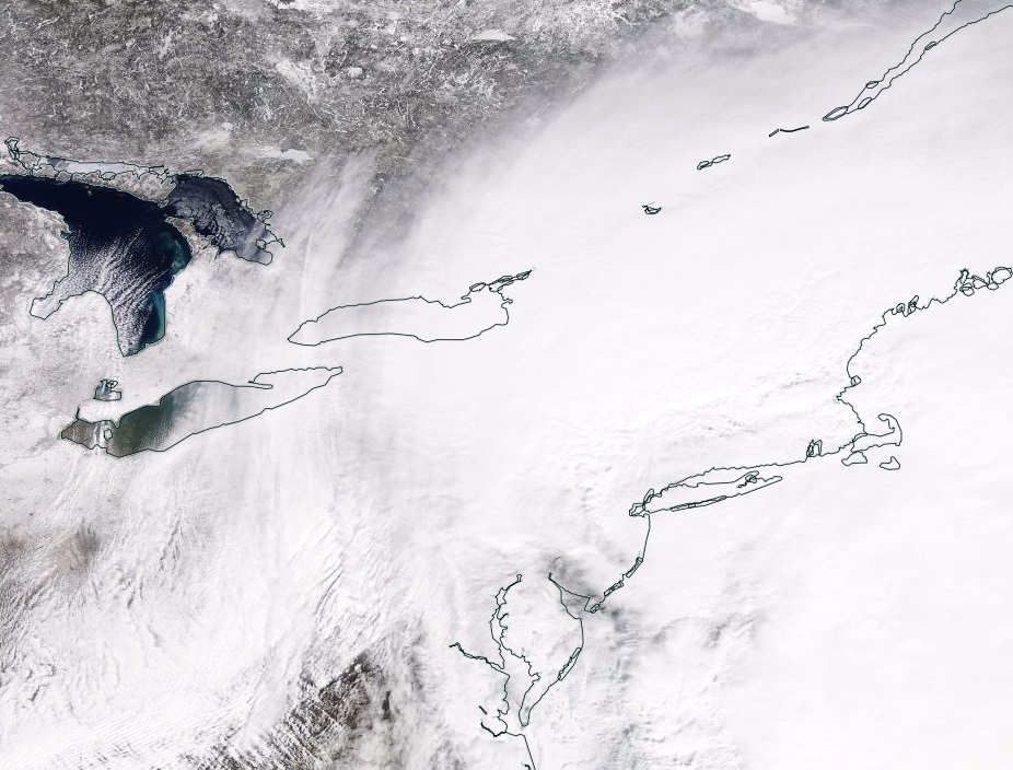 Caption: A satellite view of the Pi Day Blizzard on March 14th, 2017.
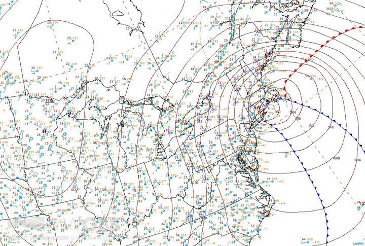 Caption: A surface analysis of the storm as winds were at their maximum, around 4PM on 3/14/17.
The conference takes place on November 11th; for more information, and to register for the workshop, check out http://www.esaw.org
Mike Carmon, Senior Meteorologist & Education Specialist

Seek the Peak 2026: New Adventures, Rooted in Tradition
Seek the Peak 2026: New Adventures, Rooted in Tradition By MWOBS Staff Seek the Peak is Mount Washington Observatory's largest annual fundraiser, and for 26 years it's brought together hikers, adventurers, and people who

What “Prepared” Really Means in the White Mountains
What “Prepared” Really Means in the White Mountains Early Spring in the Whites: The Most Honest Season By Andrew Harris, Burgeon Outdoor If you’ve spent any time in New Hampshire’s White Mountains in March,

March on Mount Washington
March on Mount Washington By Ryan Knapp Looking towards Mt. Madison at sunset on March 21, 2026. The calendar has spoken: Friday, 20 March 2026, marked the first day of astronomical spring.
