
Building Blocks of a Nor’Easter
2015-01-29 13:57:23.000 – Nate Iannuccillo, Summit Intern
Over the past week, New England has seen the effects of two relatively strong storms, or “Nor’easters” as we affectionately call them. After seeing these two systems move through New England almost back to back, the region now faces a third storm beginning tonight and continuing throughout Friday, surely bringing more snowfall to New Hampshire.
For those that have been diligently following the paths of these storms, you may have already noticed that these storms follow similar paths in their stages of development. These storms begin with low pressure over the central United States and begin to strengthen and move northeast when they reach the East Coast. Is this a coincidence? Not exactly; our string of three storms including the grand slam of a snowstorm on Tuesday can all be attributed to what meteorologists call blocking patterns.
What exactly is a blocking pattern? Blocking patterns are large scale patterns that we witness in the upper troposphere that can often last for weeks at a time. These upper air patterns often dictate the frequency of weather that see on a daily or weekly basis.
The blocking pattern that we are seeing right now, is one that meteorologists are quite familiar with. We call it the Omega Block, because its shape resembles the Greek letter omega.
 Source: The COMET Program, MetEd
In this image, we can see the ridge of high pressure sandwiched by two low pressure troughs, the essential Omega Block. The jet stream is directly associated with these pressure patterns and in this case, follows the shape of the Omega underneath the low, over the high, and back beneath the low.
Next, we’ll take a look at what went on this past Monday leading into Tuesday.
Here is 7AM EST on Monday:
 Source: University of Washington, Department of Atmospheric Sciences
 And then 7AM EST on Tuesday:
 Source: University of Washington, Department of Atmospheric Sciences
Looking at these two images, it is important to note the wave-like features of the isobars, lines of equal pressure, on this map. When we look at the longwave features, our patterns generally follow the pattern of the Omega Block. We can see one low pressure trough near the Aleutians, the high pressure ridge over the Northern Rockies, and then the other trough on the East Coast.
Next, we’ll take a look at the shortwave features. These features are the ones that determine the frequency of our weather, and that of our storms. The connection you want to make here is that the shortwave features are directly influenced by the longwave features, our blocking patterns. Looking at our two maps, we can see how short wave features move along the general shape of the Omega Block and the jet stream. In our case, we can see how the low pressure center that develops on Tuesday is in time with our most recent Nor’easter.
The take home point here is that the large scale pattern in the upper troposphere has a big influence on the kinds of weather we experience and with what frequency.
Looking forward to tonight and Friday, we see our Omega Block diminishing into the weekend, but not before a little snow on Friday!
7PM EST Friday:
 Source: University of Washington, Department of Atmospheric Sciences
 7PM EST Saturday:
 Source: University of Washington, Department of Atmospheric Sciences
Nate Iannuccillo, Summit Intern
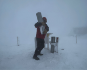
The Precip Can: Measuring Rain, Snow, and Everything Else on Mount Washington
The Precip Can: Measuring Rain, Snow, and Everything Else on Mount Washington By MWOBS Staff Averaging 281 inches of snow per year, the Observatory is no stranger to measuring precipitation. While it might be
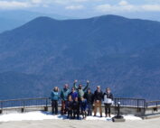
Meet MWOBS’ 2026 Seek the Peak Teams
Meet MWOBS’ 2026 Seek the Peak Teams By MWOBS Staff Another year, another epic Seek the Peak! As of June 2026, there are 430 hikers signed up for Mount Washington Observatory's annual summer fundraiser and
What the Rockpile Taught Me (Besides How to Dress for the Arctic)
What the Rockpile Taught Me (Besides How to Dress for the Arctic) By Kathryn Hawkes It turns out that living on the top of a mountain will teach you A LOT of things. How
