
Cold Temperatures, but Deep Snow
2015-02-16 17:43:43.000 – Mike Dorfman, Weather Observer/IT Specialist
The summit dipped down to 35 degrees below zero last night, tying my personal record for cold temperatures in my time here. As far as I can tell, we were recording the second coldest temperature on Earth for several times last night, second only to the South Pole station in Antarctica. Our wind chill, which approached 90 below at its coldest, was the lowest recorded on Earth last night. So, why are we getting such cold temperatures? The answer is related to the reason we’re getting so many storms.
We’ve been seeing a cycle of alternating low pressures and weak high pressures in the last month in the Northeast. Typical low pressure systems generally have a cold front associated with them on their backside. This allows wind to shift to the north, and with this Canadian air, temperatures plummet. To get an idea of how consistently low the temperatures have been in New Hampshire, I can take a look at some of the ASOS and COOP stations in the region. The last above-freezing temperatures recorded at a co-op station in North Conway occurred on January 20th.
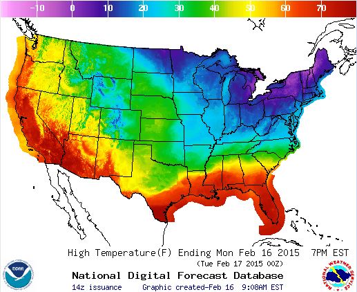 Map of the temperature across the US. Courtesy of NOAA
 Large facets, otherwise known as hoar frost, form in the tower due to temperature and moisture conditions.
So, what do these temperature swings do to our snow pack? If you enjoy backcountry skiing, strong temperature gradients in the snow pack can morph the rounded crystals that fell into what are called facets. These angular ice crystals don’t adhere to each other too well and can often be a sign of an unstable snow pack. Typically the ground is a constant 32 degrees, so the colder the air temperature, the sharper the temperature gradient in the snow pack. This is allowing the possibility of large facets in New England snow pack, possibly increasing avalanche danger. Whether you’re getting out into avalanche terrain, or are an armchair enthusiast of avalanches, the Mount Washington Avalanche Center has some very interesting and helpful information.
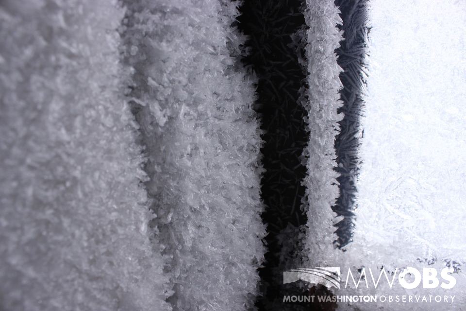 Large facets, otherwise known as hoar frost, form in the tower due to temperature and moisture conditions.
The biggest and most notable thing cold weather does is minimize melting and help keep a solid base of snow on the slopes! Canon has reported 135 inches so far this season, with a base depth between 24 and 48 inches! Most resorts in New Hampshire are reporting 3-5 FEET snow for their base. If there was ever a time to get out there and ski, now is the time!
Mike Dorfman, Weather Observer/IT Specialist

Seek the Peak Spotlight: The Cloud Chasers
Seek the Peak Spotlight: The Cloud Chasers By MWOBS Staff Mike Bergeron and Desiree Bolton have been participating and volunteering for Seek the Peak for three years now. Together, they comprise Team Cloud Chasers

Celebrating 250 Years: The Declaration’s Legacy in the White Mountains
Celebrating 250 Years: The Declaration's Legacy in the White Mountains By Peter Crane We are now approaching July Fourth, Independence Day, the day when we celebrate the adoption of the Declaration of Independence in

Seek the Peak Spotlight: Ryan Shepard
Seek the Peak Spotlight: Ryan Shepard By MWOBS Staff Before Ryan Shepard moved to Conway, he was in Western New York celebrating his 40th birthday party. “I wanted to go big,” he said. “Big”
