
Comparing October 2018 and 2019
2019-10-21 13:37:27.000 – Thomas Padham, Weather Observer/Education Specialist
With the month of October already nearing a close I thought I’d take a look back at how this relatively mild start to our fall season compares to right around this time last year. Although we’ve finally recorded our first significant snowfall of the month this past week, we’re still only at a measly 6.6” of snowfall for the month. In reality, the month of October averages 18” of snow and we could end up right around average with another 10 days to go. Still, this feels like it’s way behind compared to last year, and it is, but last year really was exceptional and started an impressively snowy and windy winter season. October often sees dramatic change from the beginning of the month to the end, and there’s still time for this month to end out on a snowy end (more on this later).
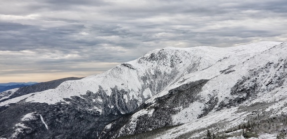
Last year actually started out even more mild than this year, with an impressive 9-day stretch of well above average temperatures with daytime highs in the 50s from the 3rd through 11th. This was due to a large upper-level ridge of high pressure. By the middle of the month, it was almost as if we hit a switch and turned on winter. A series of cold fronts carved out a large-scale trough across the Northeast, resulting in much colder temperatures bottoming out in the single digits above, with 10” of snow falling in just a week’s time by the 20th. Comparing that to this year we’re actually about even, but instead of seeing a thaw out or return to near average conditions a massive snowstorm plunged the summit into winter for good, with 3 feet of snow falling over a four day period from Oct 23rd to 27th 2018. October 2018 ended with 52” of snow for the month, a surplus of nearly 3 feet!
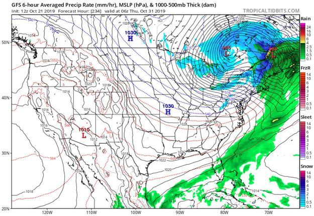
Unfortunately for snow lovers there isn’t anything nearly of that magnitude on the immediate horizon, although there’s at least a small chance 10 days out. Our next chance for snowfall of at least an inch will occur this weekend, when the models have routinely had a weak wave of low pressure crossing New England with just enough cold air in place for snow across the higher elevations. Right around Halloween a much more robust storm system has been in the models for several runs now. Unfortunately, the storm intensifies well to our west across the Great Lakes, resulting in heavy rainfall at the onset of the storm. On the backside of the storm, there may be a period of heavy snow if things line up properly with the track, and precipitation doesn’t end too early. But again, this is 10 days out so we’ll have to wait several days before taking this too seriously. Check back in around this time next week, perhaps we’ll be gearing up for another round of 100 mph winds, heavy snow, and the all-around weather Mount Washington is famous for!
Thomas Padham, Weather Observer/Education Specialist

Seek the Peak 2026: New Adventures, Rooted in Tradition
Seek the Peak 2026: New Adventures, Rooted in Tradition By MWOBS Staff Seek the Peak is Mount Washington Observatory's largest annual fundraiser, and for 26 years it's brought together hikers, adventurers, and people who

What “Prepared” Really Means in the White Mountains
What “Prepared” Really Means in the White Mountains Early Spring in the Whites: The Most Honest Season By Andrew Harris, Burgeon Outdoor If you’ve spent any time in New Hampshire’s White Mountains in March,

March on Mount Washington
March on Mount Washington By Ryan Knapp Looking towards Mt. Madison at sunset on March 21, 2026. The calendar has spoken: Friday, 20 March 2026, marked the first day of astronomical spring.
