
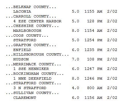
Fresh Powder for February!
2015-02-02 17:54:39.000 – Kaitlyn O’Brien, Weather Observer/Education Specialist
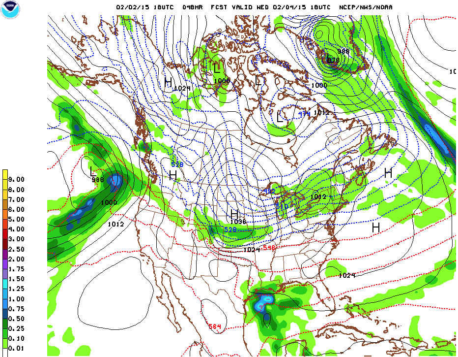 Forecast for Wednesday 1PM: A weak Clipper looks to impact New England, courtesy of www.theweathergun.com
Kaitlyn O’Brien, Weather Observer/Education Specialist

Team Flags Return for Seek the Peak’s 25th Anniversary
Team Flags Return for Seek the Peak's 25th Anniversary By MWOBS Staff Mount Washington Observatory is looking forward to continuing a much-loved tradition for Seek the Peak’s 25th Anniversary: Team flags. In inviting teams

Meet Summer Interns Zakiya, Max and Maddie
Meet Summer Interns Zakiya, Max and Maddie By MWOBS Staff We are excited to welcome six teammates to the summit of Mount Washington this summer! During their internship, these students and graduates will play

Saying Goodbye to the Summit
Saying Goodbye to the Summit By Alexis George After an extraordinary last three years working as a Weather Observer and Meteorologist, I am excited to pursue a different career. As sad I as am
