
From the Mountains to the Oceans, in Search of Fog
2018-01-12 15:12:16.000 – Taylor Regan, Weather Observer
Up on the summit, weather observers are no strangers to fog. In fact, we see the stuff every two out of three days on average, limiting our otherwise remarkable 130 mile visibility to sometimes a matter of feet. But did you know there isn’t just one type of fog? In fact, there are five common types of fog: radiation, rain-induced, advection, upslope, and steam fog.
Last week, while the summit (and all of New England) was a veritable icebox, I happened to be offshift, and took the opportunity to explore a bit, searching the seacoast for a phenomenon known as sea smoke, something more commonly found in the Arctic.
Sea smoke is a term used to describe a variant of steam or evaporation fog. Opposed to advection fog, which I’ll describe later, evaporation fog occurs when water vapor molecules are added to the air directly overhead to the point where the air cannot hold any more water. Added water is forced to condense and become fog. This type of fog is common after a rainstorm on a hot day or over lakes or large bodies of water when the water is much warmer than the air temperature. For sea smoke to occur, the air temperature needs to be much colder than the water, and with ocean temperatures currently in the upper 30s, that meant that the subzero temperatures recently seen across the Northeast were the perfect conditions to catch a glimpse of some sea smoke.
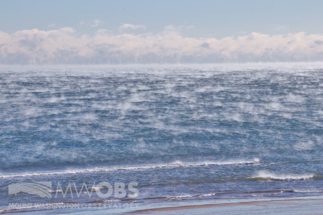 Figure 1. Sea Smoke looking over the Atlantic Ocean
Ironically, back on the summit, temperatures climbed over 40 degrees, surpassing the daily highs during my off-week, spent over 100 miles south! And, in true Mount Washington fashion, we are currently solidly socked in the clouds, making for a soupy fog that seemingly eats the snow, demolishing our pristine snowpack in epic fashion.
Advection fog is generated when warm, moist air is transported over a colder surface (through a process called advection). The warmer air contains more moisture than cooler air, so, as it passes over the cold surface and cools, some of the water vapor is able to condense into water droplets (causing fog). Advection fog is also sometimes called “snow-eating” fog, because it can cause a robust snowpack to diminish almost in front of your eyes. The heat released when the water vapor condenses into liquid water droplets (fog) moving over the cold surface is enough to melt seven times as much snow!
Below is a comparison of our snowpack on January 3rd, with nearly two feet of snow and rime, to a photo taken today, the 12th of January. It looks like spring! From record low temps to record high temps, the mountain always has a surprise in store!
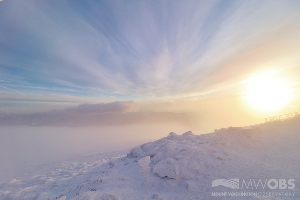 Figure 2. Looking east on the morning of January 3
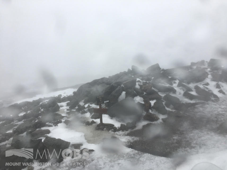 Figure 3. Nelson Crag sign melted out looking east on January 12, 2018
Taylor Regan, Weather Observer

Seek the Peak Spotlight: The Cloud Chasers
Seek the Peak Spotlight: The Cloud Chasers By MWOBS Staff Mike Bergeron and Desiree Bolton have been participating and volunteering for Seek the Peak for three years now. Together, they comprise Team Cloud Chasers

Celebrating 250 Years: The Declaration’s Legacy in the White Mountains
Celebrating 250 Years: The Declaration's Legacy in the White Mountains By Peter Crane We are now approaching July Fourth, Independence Day, the day when we celebrate the adoption of the Declaration of Independence in

Seek the Peak Spotlight: Ryan Shepard
Seek the Peak Spotlight: Ryan Shepard By MWOBS Staff Before Ryan Shepard moved to Conway, he was in Western New York celebrating his 40th birthday party. “I wanted to go big,” he said. “Big”
