
Heat Wave
2010-04-02 04:58:34.000 – Mike Carmon, Staff Meteorologist

No volcanoes, but a fiery sky indeed
By now, I sincerely hope you, avid and loyal observer comment reader, have come to the realization that Mt. Adams is, indeed, not spewing lava down its slopes into the Great Gulf and onto the surrounding Northern Presidentials.
No portion of yesterday’s comment was in any way true. We really need to keep a more watchful eye on those capricious interns…they seem to get outlandishly creative around April 1st.
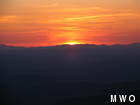
Drew’s choice of folly is not without a tad of irony, however, as the exceptionally mild temperatures currently gracing the higher summits have us thinking there is some unseen and unfamiliar heat source in the area.
Yesterday’s (April 1) climatological average temperature is 18 degrees Fahrenheit. Yesterday’s actual high? A whopping 46 degrees!
That’s just the start of the swelter, however. Today (April 2), the record high is a mere 44 degrees. All of the computer models we utilize for forecasting suggest high temperatures reaching into the mid 50s today! In fact, as of the time I’m posting this comment, the record has already been broken, as the temperature recorded at my last observation was a balmy 46 degrees.
And just when you thought things couldn’t get any sultrier, it looks as if Saturday’s highs could be pushing 60 degrees. Not only is that rare, but it borders on unprecedented. The record high for the entire month of April is 60 degrees, set on the 19th in 1976 and 20th in 1941. The models have been overestimating the highs a bit, so I’m not exactly confident that we’ll set a monthly record. However, with clear skies and a southwest wind in the forecast, it is plausible. At the very least, the daily record will be blown out of the water, as it stands at a feeble 42 degrees for April 3rd. In fact, I would not be terribly shocked if our temperatures on Saturday fail to fall below the old record high at any point–now that takes some serious heat!
The reason for these June-like temperatures is a very strong ridge of high pressure parked over the eastern-third of the continental U.S. This has allowed for mild air from the southern states to flow northward into our neck of the woods. Valley temperatures in NH will be quite warm as well-breaking into the 70s as far north as Plymouth today, and as far north as Berlin tomorrow!
What will keep us on our toes are the enormous “ice drifts” currently built up on our deck, especially around the A-Frame. With temperatures not expected to dip anywhere near freezing until early Monday morning, all of the water from these melting piles will have to go somewhere–and we fear one of those “somewheres” will include our tower. The buckets are in place, there is a sump pump on standby, and we have all been taking turns digging and chipping away at ice in an attempt to eject it as far from the cracks and crevices of our weathered building as possible.
These next couple of days are sure to solidify our moniker as the “good weather shift.”
NOTE: If you’re as excited as we are to see the MWO “Cantore’s Stories” on The Weather Channel, then you’ll be bummed to hear that you’ll have to wait just a little bit longer. TWC has delayed its airing indefinitely– we think they’re just not quite finished editing. But we know (that you know) anticipation makes indulgence all the sweeter.
Mike Carmon, Staff Meteorologist

Hiker Spotlight: Sandy and Joan Kurtz
Hiker Spotlight: Sandy and Joan Kurtz Sandy and Joan Kurtz have been active supporters of Mount Washington Observatory for almost five decades. After visiting North Conway in 1980, they fell in love with the
Living the Night Life
Living the Night Life By Madelynn Smith My alarm goes off in the bunkroom, with blackout curtains obscuring the sun’s rays as it begins to lower in the sky. My day starts in the

Three and a Half Months of Snow, Ice and Rime
Three and a Half Months of Snow, Ice and Rime, with Deeper Drifts. By Ryan Steinke Me outside on the summit near the Yankee Building. My internship with the Mount Washington Observatory
