
Hot in Here
2017-10-10 21:03:09.000 – Caleb Meute, Weather Observer / Meteorologist
Thanks to a strong and stubborn upper level ridge that anchored itself over the northeastern United States this shift, well above seasonable air has continued to stream into the White Mountains Region. Generally, at this time of the year my winter gear comes up to the summit with me as we begin to battle the snow and ice but so far that has not been the case. At the beginning of our last shift, I wrote a blog discussing the anticipated heat wave which would likely break consecutive daily record highs. Sure enough, the second half of our last shift (Sep 20 – Sep 27) had three record highs set and then one equaled.
September 24th – Previous record: 62°F set in 1961
New record: 65°F, 2017
September 25th – Previous record: 62°F set in 2007
New record: 64°F, 2017
September 26th – Previous record: 59°F set in 1961
New record: 67°F, 2017 – This one surpassed the record by 8°F!
September 27th – Tied record: 62°F set in 2014 and now tied in 2017
After this stretch of record setting days, the other shift took our place on the summit and the temperatures normalized a bit, with the average temperatures in the 30s through much of their shift prior to 40s the last two days. These last two days with average temperatures in the 40s was Mother Nature preparing for our shift to return. Sure enough, once we got back up the mercury began to rise to unseasonably high levels. For early October, average daily temperatures should be in the low 30s. This week, that was not the case…
A return of a large ridge over the northeast coupled with increased energy punching northward along with Hurricane Nate allowed temperatures to soar towards daily records. This time around, records were not reached, although it was close. Since we arrived, the temperature departures from where they should be are as follows:
October 4th: 15°F above average
October 5th: 8°F above average
October 6th: Only 3°F above average
October 7th: 12°F above average
October 8th: 18°F above average!
October 9th: 19°F above average!
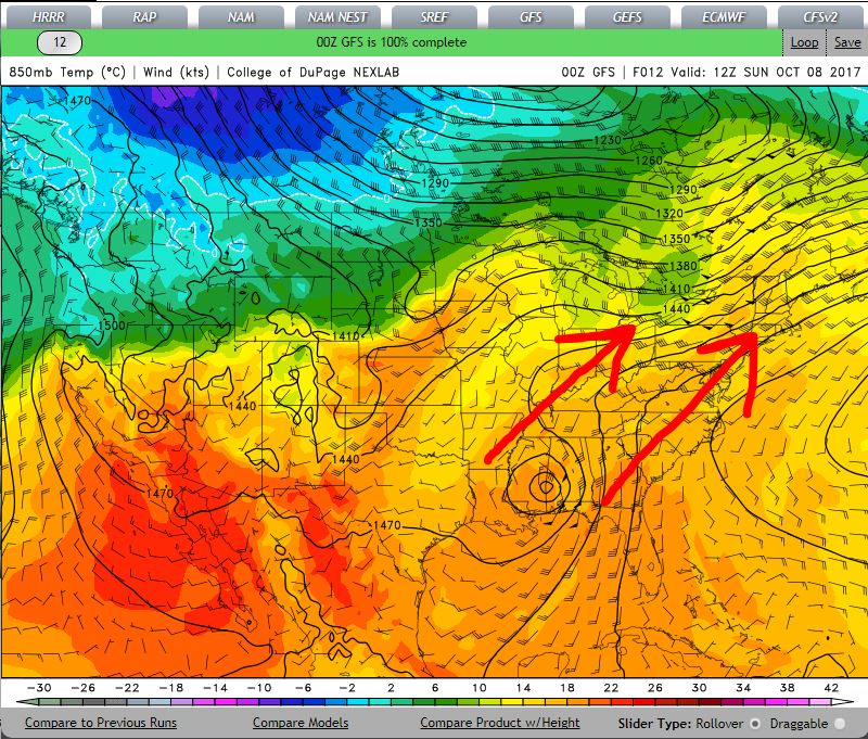
00z Model run from October 8th showing the warm air mass streaming northeast ahead of Hurricane Nate. Shown here are 850 mb temperatures which give a rough estimate as to what we can expect here at summit level. 850 mb roughly depicts an elevation of 5,000 feet.
Now the ridge is breaking down as my shift prepares to go down for our off week, and below freezing temperatures are back in the forecast for our counterparts. As Nelly would say, “It’s hot in here”. We really are the warm shift lately.
Caleb Meute, Weather Observer / Meteorologist

Seek the Peak Spotlight: The Cloud Chasers
Seek the Peak Spotlight: The Cloud Chasers By MWOBS Staff Mike Bergeron and Desiree Bolton have been participating and volunteering for Seek the Peak for three years now. Together, they comprise Team Cloud Chasers

Celebrating 250 Years: The Declaration’s Legacy in the White Mountains
Celebrating 250 Years: The Declaration's Legacy in the White Mountains By Peter Crane We are now approaching July Fourth, Independence Day, the day when we celebrate the adoption of the Declaration of Independence in

Seek the Peak Spotlight: Ryan Shepard
Seek the Peak Spotlight: Ryan Shepard By MWOBS Staff Before Ryan Shepard moved to Conway, he was in Western New York celebrating his 40th birthday party. “I wanted to go big,” he said. “Big”
