
How’s the view up there?
2016-08-06 16:52:35.000 – Christopher Hohman, Summer Intern
One of the most common reasons people hike, or head up to the top of this mountain in the first place, really is to see if they can catch a good view. Sounds simple enough, but sadly we are at the whim of the weather to actually get these spectacular views. There is however some forecasting tools anyone can use to actually increase their chances of getting good visibility, and perhaps plan their trip around these forecasted days. Of course the first thing to look at is simply whether or not it’s going to rain, but there are other factors that can be incorporated into your “Viewing forecast.”
To start it’s always good to check the forecast to see if it’s going to rain. The summit is in the clouds 60% of the time out of the year. This is due to a number of different reasons, but typically when rain is forecast for the summit, the chance of being in the clouds is very high. Pushing of moisture at the base of the summit can makes its way up to the top and actually form clouds just due to the geography of the mountain and wind flow towards the base. We’re also tall enough in the atmosphere for clouds to not only form above the mountain, but also move right through the summit. For example our current forecast for the region calls for rain and while it may just be cloudy below, those clouds are actually gliding over us right now.
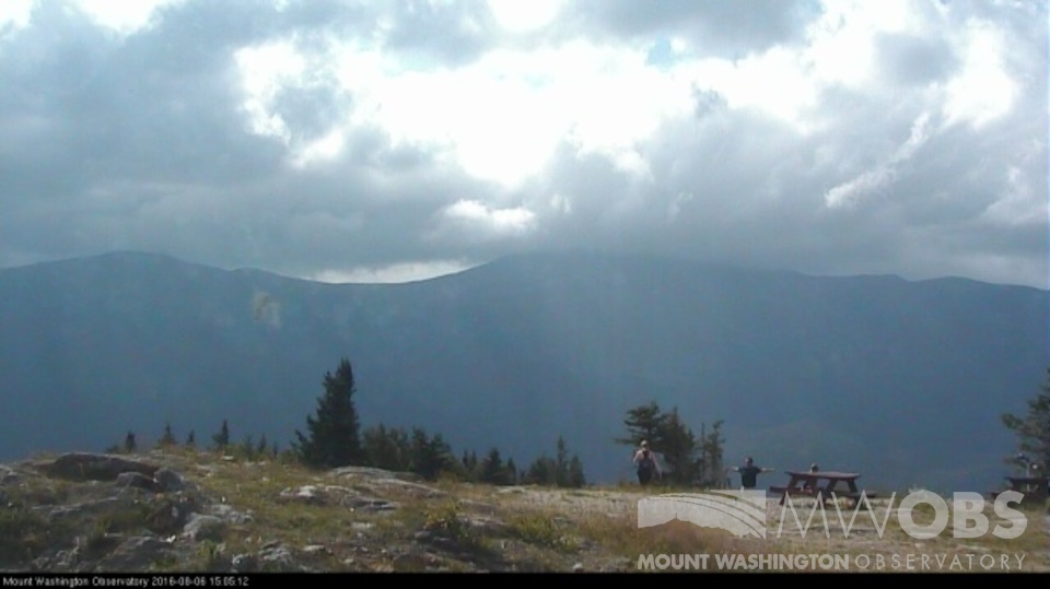
Another really important part of a wonderful view is actually how far you can see. Our maximum visibility is 130 miles (pretty impressive in my eyes) but that is very rare to reach during the summer months. Typically the farthest you can see in the summer is around 110 miles, which in my brief time here I’ve only seen a handful of times. This is because certain systems normally have to move over the region just right to push dry and haze reduced air masses from the north to extend your field of vision. This typically happens right after a rain storm comes through and higher pressure begins to build over the summit region. The clockwise motion of the system depicted here illustrates this better:
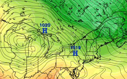 Image from: Tropical Tidbits
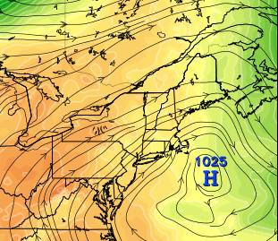 Image from: Tropical Tidbits
Christopher Hohman, Summer Intern

Seek the Peak Spotlight: The Cloud Chasers
Seek the Peak Spotlight: The Cloud Chasers By MWOBS Staff Mike Bergeron and Desiree Bolton have been participating and volunteering for Seek the Peak for three years now. Together, they comprise Team Cloud Chasers

Celebrating 250 Years: The Declaration’s Legacy in the White Mountains
Celebrating 250 Years: The Declaration's Legacy in the White Mountains By Peter Crane We are now approaching July Fourth, Independence Day, the day when we celebrate the adoption of the Declaration of Independence in

Seek the Peak Spotlight: Ryan Shepard
Seek the Peak Spotlight: Ryan Shepard By MWOBS Staff Before Ryan Shepard moved to Conway, he was in Western New York celebrating his 40th birthday party. “I wanted to go big,” he said. “Big”
