Hurricane Joaquin and a Taste of Winter
2015-10-02 18:10:30.000 – Tom Padham, Weather Observer/Meteorologist
After a few days of a very challenging forecast with regards to Hurricane Joaquin, the models have finally came into better agreement, and it looks like New England and the east coast will be able to breathe a sigh of relief. Nearly all of the models typically used by meteorologists to forecast the weather now have the powerful hurricane turning north from the Bahamas and then passing just west of Bermuda and out to sea. There will still likely be high surf and coastal flooding along the east coast as the storm passes by, but the overall effects that the storm will have on the United States will be far less than how potentially dangerous the storm could have been across major metropolitan areas like Boston, New York, and Washington D.C.
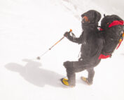
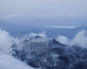
This time of year can have every type of weather we see on the summit, from hurricanes and thunderstorms to full on winter conditions. As of this writing temperatures have fallen to their lowest point so far this year at 23 degrees, with the summit becoming in the clouds and seeing our first rime ice of the season. This is actually a bit late in the season for both of these marks, with mid-late September a more typical time to see the first wintry conditions on the summit. Looking ahead temperatures will climb back towards above freezing readings through the much of the early part of next week, with high pressure nearby allowing for great conditions to view the surrounding fall foliage, just be sure to bundle up!
Tom Padham, Weather Observer/Meteorologist
Seek the Peak 2026: New Adventures, Rooted in Tradition
Seek the Peak 2026: New Adventures, Rooted in Tradition By MWOBS Staff Seek the Peak is Mount Washington Observatory's largest annual fundraiser, and for 26 years it's brought together hikers, adventurers, and people who
What “Prepared” Really Means in the White Mountains
What “Prepared” Really Means in the White Mountains Early Spring in the Whites: The Most Honest Season By Andrew Harris, Burgeon Outdoor If you’ve spent any time in New Hampshire’s White Mountains in March,
March on Mount Washington
March on Mount Washington By Ryan Knapp Looking towards Mt. Madison at sunset on March 21, 2026. The calendar has spoken: Friday, 20 March 2026, marked the first day of astronomical spring.


