In the wake of Earl
2010-09-04 17:35:37.000 – Brian Clark, Observer and Meteorologist
NULL
What is now Tropical Storm Earl has passed by and will soon become extratropical as it merges with a cold front off to our north. The storm ended up dumping just over two and a half inches of rain last night, but that is pretty much the only real effect of the storm to speak of. Winds have been increasing through the day today, but that is an indirect effect of Earl and we are only seeing what we would consider moderate wind speeds. So all that hype, and now it’s gone.
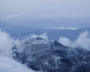
The good news is that in Earl’s wake, a big change from the heat, humidity, and haziness of the last 5 days or so is gone. We have seen some brief periods of clearing this afternoon that have revealed 100 mile visibility, and the air is cool and crisp. Certainly a taste of fall that is welcome by some (like myself), and a dreaded sign of winter for others.
Speaking of winter, there is a good chance that temperatures drop below the freezing mark later tonight while we are in the fog, creating at least a coating of rime ice. There is also the slight chance of a few snow or sleet showers. You can bet we’ll be posting some pictures tomorrow, both on here and on our page on Facebook, if we do indeed end up getting some ice and/or snow!
Brian Clark, Observer and Meteorologist
Seek the Peak 2026: New Adventures, Rooted in Tradition
Seek the Peak 2026: New Adventures, Rooted in Tradition By MWOBS Staff Seek the Peak is Mount Washington Observatory's largest annual fundraiser, and for 26 years it's brought together hikers, adventurers, and people who
What “Prepared” Really Means in the White Mountains
What “Prepared” Really Means in the White Mountains Early Spring in the Whites: The Most Honest Season By Andrew Harris, Burgeon Outdoor If you’ve spent any time in New Hampshire’s White Mountains in March,
March on Mount Washington
March on Mount Washington By Ryan Knapp Looking towards Mt. Madison at sunset on March 21, 2026. The calendar has spoken: Friday, 20 March 2026, marked the first day of astronomical spring.


