
January: A Month of Extremes
2017-01-21 09:58:31.000 – Taylor Regan, Weather Observer
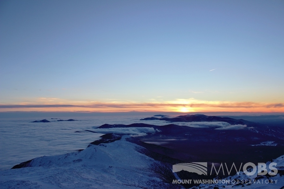
Yesterday, the summit saw a high of 35 degrees. The sky above was bright blue and nearly cloudless, with a blanket of undercast surrounding the mountain in every direction, and only the tallest of surrounding peaks poking through. Winds were in the 10-25 mph range with a peak gust in the early morning of 37 mph. All in all it was a great day. Did we break any records? No, but it was definitely above average. What are some things that make January a unique month up here for the summit? And how does this year compare to others on record?
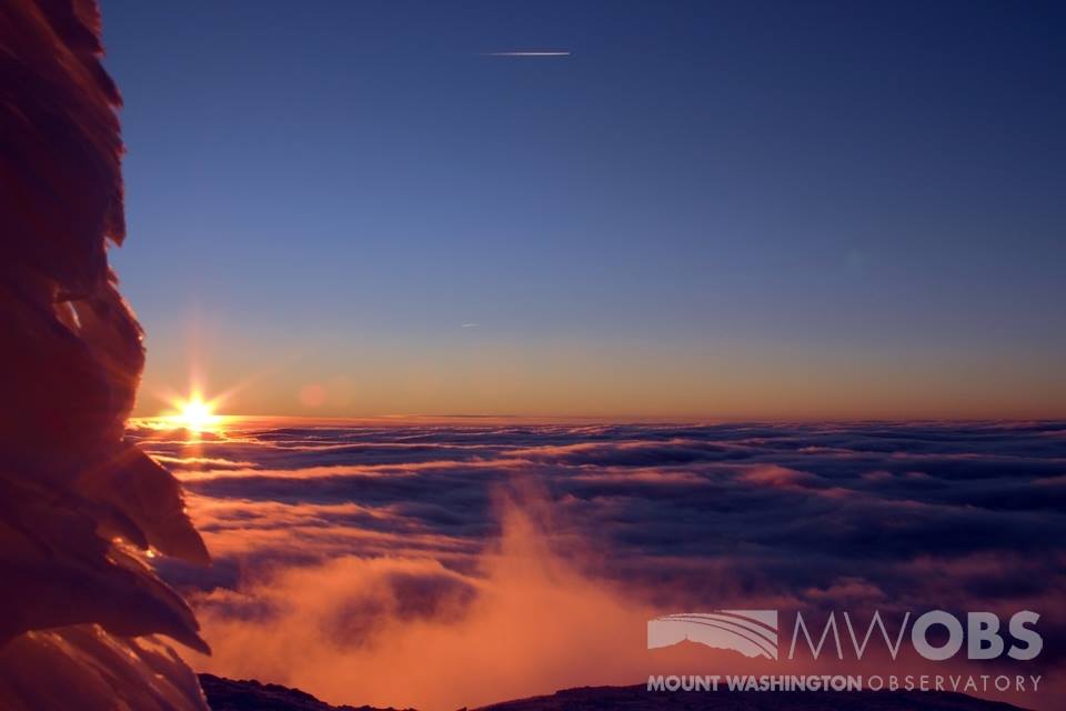
Figure 1. Sunset over a blanket of undercast.
January holds some proud titles for Mt. Washington. It is the windiest month, with an average wind speed of 46 mph. And while being the driest month (with 6.44 inches of water equivalent precipitation) it is also the snowiest month, with 44 inches of snow and ice falling on average. January is the coldest month on the summit as well, with a monthly average of 4.7 degrees above zero. Given all these statistics it’s easy to see that yesterday was extraordinary, but how has the month shaped up as a whole so far?
While yesterday’s high of 35 was 26 degrees above normal for the day, the summit also saw a spell of below average temperatures early in the month, with several days average of 10 degrees colder than normal. Taking the difference between the highest and lowest temperatures of the month, the summit saw a 59 degree spread! When averaged, our daily temperature for the month to date is 8.9 degrees, which is a 4.2 degree departure from normal.
While yesterday was mild in almost every sense of the word, the wind was no exception. Our 24-hour peak gust of 37 mph was less than our monthly average wind speed! Don’t let that fool you however, because of the last 20 days; we’ve seen seven with a gust over 100. All of this combines for a monthly average of 45.2 mph, not far off the typical monthly average of 46 mph.
Even though we’ve only received 3.29 inches of precipitation in the first 2/3rds of the month, putting us 3.15 inches below average for the month, an incoming storm this week is expected to bring 1-2 inches of liquid to the higher summits, evening the scales a bit. On average this month, we’ve trended drier and warmer than normal, but, in the true spirit of the mountain, we’ve seen plenty of variety.
Taylor Regan, Weather Observer

Seek the Peak 2026: New Adventures, Rooted in Tradition
Seek the Peak 2026: New Adventures, Rooted in Tradition By MWOBS Staff Seek the Peak is Mount Washington Observatory's largest annual fundraiser, and for 26 years it's brought together hikers, adventurers, and people who

What “Prepared” Really Means in the White Mountains
What “Prepared” Really Means in the White Mountains Early Spring in the Whites: The Most Honest Season By Andrew Harris, Burgeon Outdoor If you’ve spent any time in New Hampshire’s White Mountains in March,

March on Mount Washington
March on Mount Washington By Ryan Knapp Looking towards Mt. Madison at sunset on March 21, 2026. The calendar has spoken: Friday, 20 March 2026, marked the first day of astronomical spring.
