
Lakes of Fire
2011-11-05 17:22:12.000 – Rick Giard, Weather Observer / Education Specialist
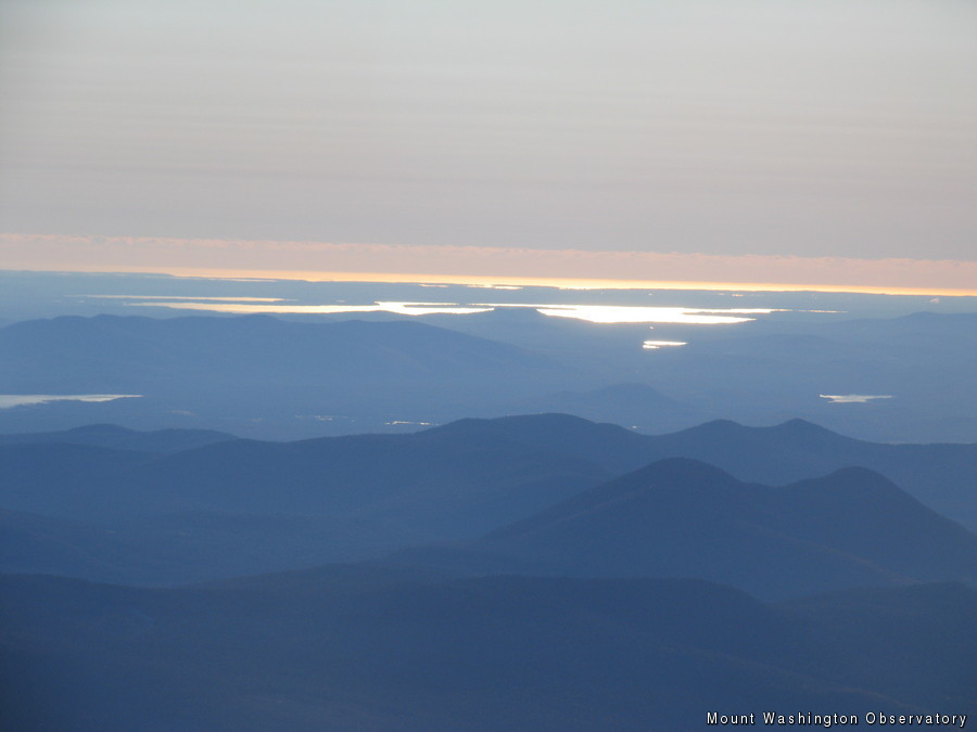
Sebago and Atlantic After Sunrise
As the first dim light of dawn began to illuminate the eastern horizon this morning, I realized that it was going to be a challenge to continue the ‘clouds’ comment theme. Completely clear conditions, while not unprecedented, are indeed unusual from this omniscient outpost – especially on a day with 130 miles visibility. Other than scattered, isolated puffs a few thousands of feet below, the celestial dome was perfectly clear. How does one write about clouds on a day with virtually none to speak of? Fortunately, the skies change rapidly here, and patience is often rewarded.
On average the summit is obscured within clouds 60% of the time, leaving only about a one-third chance to see anything beyond a hundred feet or so. Upon coming out of the fog, however, one is often treated to spectacular multi-level formations. These come in infinite forms, never to be repeated the same way twice: high wispy cirrus mares’ tails, mid-level altocumulus cotton candy, stratocumulus soldiers marching across the sky in long lines, low undercast and cap cloud formations rising up and over the northern Presidential Range like enormous waterfalls cascading down into the ravines. At different levels they move at different speeds and directions, seemingly oblivious to their fellow travelers.
One hour later the observation deck was brightly illuminated, revealing every intricately sculpted feather of rime ice. Well beyond the far side of the deck an elongated blazing yellow-orange streak penetrated my tinted goggles so intensely that I involuntarily squinted. Venturing to the east railing I discovered that the intense streak was the Atlantic Ocean just beyond Portland, Maine, some 60 miles distant. Not far inland Lake Sebago appeared as if it were a great cauldron of white-hot lava. While taking in this spectacular scene, I noticed a long stretch of marine stratocumulus well out to sea, probably 70 or 80 miles out. CLOUDS!
Rick Giard, Weather Observer / Education Specialist

Seek the Peak Spotlight: Ryan Shepard
Seek the Peak Spotlight: Ryan Shepard By MWOBS Staff Before Ryan Shepard moved to Conway, he was in Western New York celebrating his 40th birthday party. “I wanted to go big,” he said. “Big”

From Florida Heat to the Rockpile
From Florida Heat to the Rockpile By Alek Libby Hi everyone! My name is Alek Libby, and I am one of the summit interns here at Mount Washington Observatory this summer! I recently graduated
Summit Summer
Summit Summer By Aspen M. Hello everyone! My name is Aspen, I’m one of the summer weather interns here at the Mount Washington Observatory. I fell in love with weather at a young age
