Lenticular Clouds and Mt. Washington
2019-09-16 11:03:58.000 – Ian Bailey, Weather Observer/Education Specialist
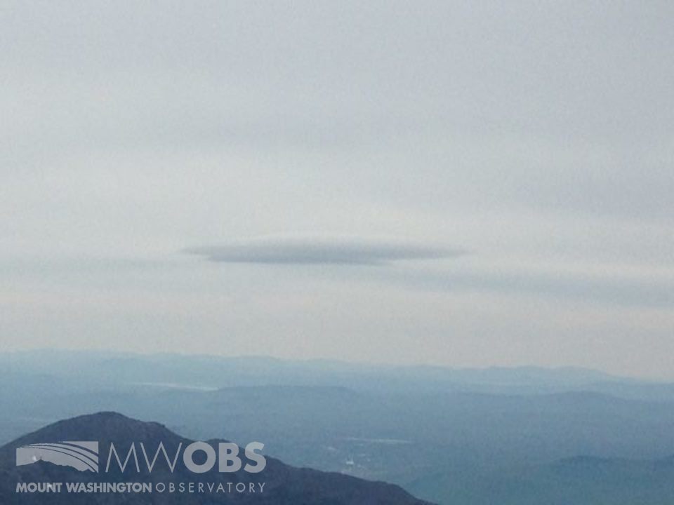
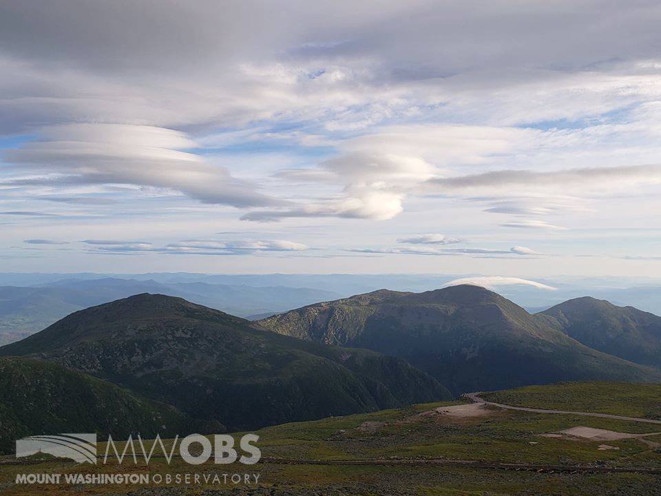
Yesterday, we had some incredible views of some Lenticular clouds over the summit! Once we cleared from the fog, I had gone outside for the hourly observation and was pleasantly surprised to find some towering “lentis” in front of me! I quickly dug out my phone and snapped the picture, luckily before my phone was blown out of my hands and down on to the deck (needless to say I’ll be swinging by the iGuys in North Conway this coming down week). But it was worth it, as these were some of the best lentis I’ve seen in quite some time!

Once we posted the image online, lots of people were reaching out to us and asking us to explain what lenticular clouds are. So I figured I’d post a brief blog today to explain what exactly lenticular clouds are, and how they form!
When a strong air current flows over a large obstacle, such as a mountain, it creates a oscillating wave pattern on the lee side of mountain (known as lee waves). This happens fairly regularly around here, as the topography of the Presidential Range (among other factors) creates a powerful current that flows up and over the summit of Mt. Washington. So we have these lee waves oscillating up and down through the atmosphere on the backside of the mountain, which is the first piece of the puzzle.
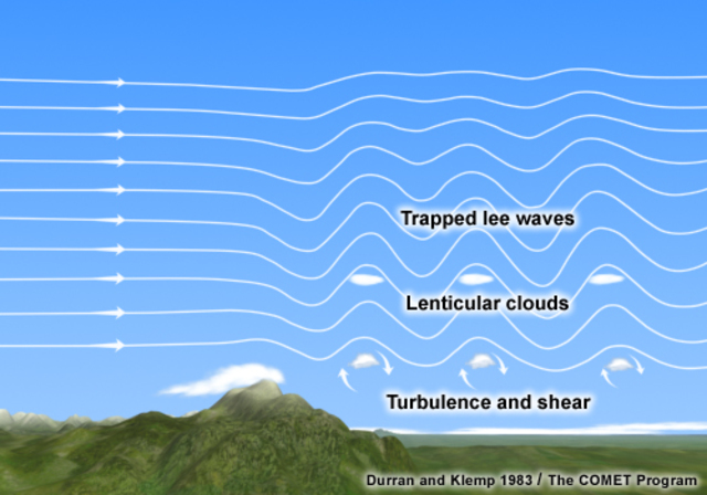
Now add some moisture into the equation. Warmer moisture from the lower levels is rapidly brought up the side of the mountain, forcing it to cool quickly. As the moisture blasts over the summit and into the lee side of the mountain, it will enter the lee wave pattern and follow along the oscillating path. At the crest of each wave, if the ambient air temperature reaches the local dew point temperature, condensation occurs and a cloud will form!
So what gives the cloud its unique shape? Well, as the moisture/cloud continues to follow the wave pattern, it will descend back into warmer ambient air temperatures and evaporate once again. What’s going on is the cloud/moisture is visually disappearing as it turns back into water vapor. So, what we seen in effect is a stationary, lense shaped cloud as air is continually condensing and then evaporating along this wave!
And when this wave pattern is particularly strong, you can have some other interesting effects as well. If the oscillation is powerful enough to continuously reach the dew point level repeatedly, you can have lines of “marching” lenticular clouds across the sky, as in this picture!
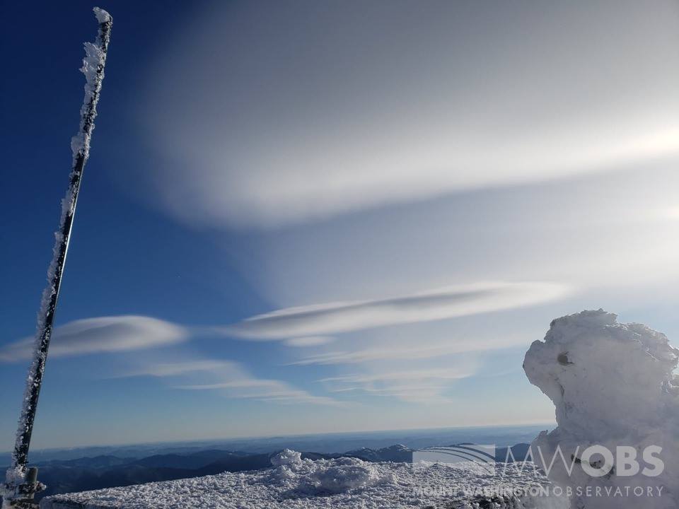
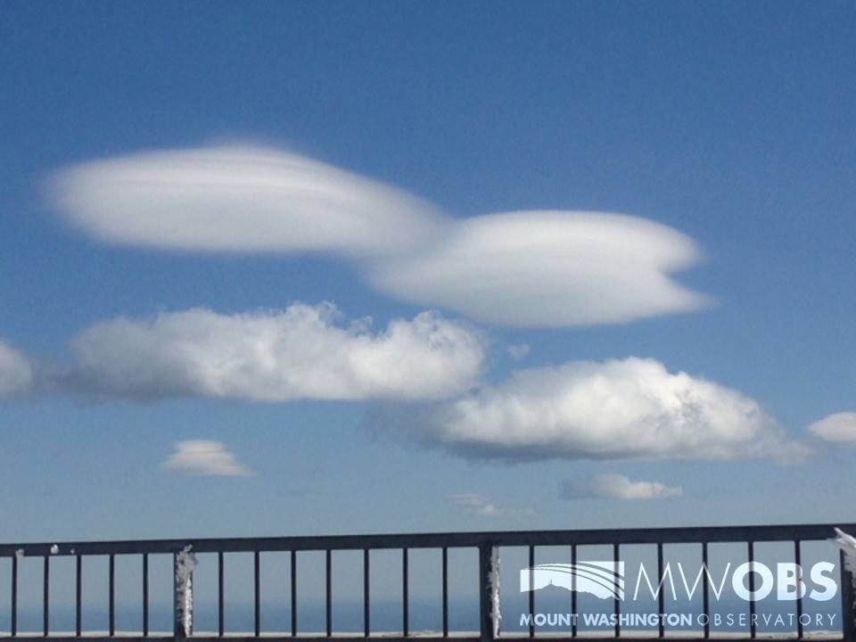
Additionally, as was the case yesterday, the current of air flowing over the summit can cross at multiple different levels of the atmosphere, particularly through the dew point level, and create a stacking effect where the lenticulars look like a stack of pancakes! This is a bit more common than the marching lenticulars, and happens fairly often up here at Mt. Washington!
Check out some more of these past photos I’ve taken of lenticular clouds from here on the summit:
Ian Bailey, Weather Observer/Education Specialist
Team Flags Return for Seek the Peak’s 25th Anniversary
Team Flags Return for Seek the Peak's 25th Anniversary By MWOBS Staff Mount Washington Observatory is looking forward to continuing a much-loved tradition for Seek the Peak’s 25th Anniversary: Team flags. In inviting teams
Meet Summer Interns Zakiya, Max and Maddie
Meet Summer Interns Zakiya, Max and Maddie By MWOBS Staff We are excited to welcome six teammates to the summit of Mount Washington this summer! During their internship, these students and graduates will play
Saying Goodbye to the Summit
Saying Goodbye to the Summit By Alexis George After an extraordinary last three years working as a Weather Observer and Meteorologist, I am excited to pursue a different career. As sad I as am

