Love Is in the Air…and So Are Clouds!
2022-02-14 13:37:41.000 – Sam Robinson, Weather Observer/Engineer
Today is Valentine’s Day, so I thought it would be fitting to focus on what I love most about being a weather observer… clouds! Up here on the summit, we get to view clouds almost non-stop, and it is very rare when we can report “SKC,” or “sky clear.”
Due to our unique location and elevation, and the fact that clouds are up in the sky, sometimes we are able to view clouds over 200 miles away! So in order to report “SKC,” there cannot be any clouds over basically the entirety of the northeast, the northwestern Atlantic Ocean, or even southern Quebec. While our horizontal visibility is limited to about 130 miles due to the curvature and topography of the earth, our visibility out and up can be much greater. The only things that limit it then are airborne particulates and, of course, other clouds.
Described below are some of my favorite common clouds that we view up here, as it would take much longer to explain all cloud types, their characteristics, and how they form. However, if interested in learning more about all of them specifically, I recommend these links from the National Weather Service: https://www.weather.gov/lmk/cloud_classification
My personal favorite are cirrus, part of the cirri-form cloud classification, or high cloud family. These form at the highest parts of the atmosphere (usually 20k to +40k feet above ground level) and are made up completely of ice crystals, rather than water vapor, even in the summer. Cirrus clouds are usually the first sign of incoming moisture ahead of approaching systems, and are also usually the first and last clouds to be viewed at dawn and dusk. Because they are so high up in the atmosphere, the rising/setting sun illuminates them before/after it crests the horizon and this is usually what leads to magnificent sunrises and sunsets.
During the day, cirrus clouds usually appear thin, fibrous, and mostly white in color except near the horizon line where they look slightly yellowed due to a greater distance and thickness of air between the clouds and viewer. They also tend to move slower across the sky than other cloud types due to their greater distance from the viewer.
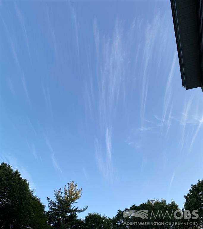
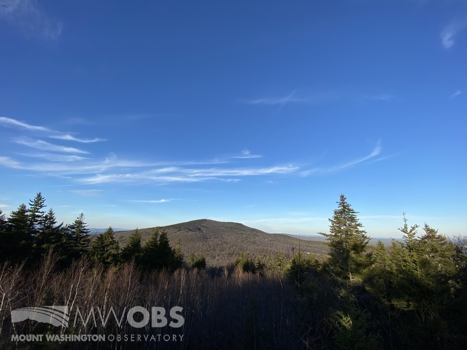
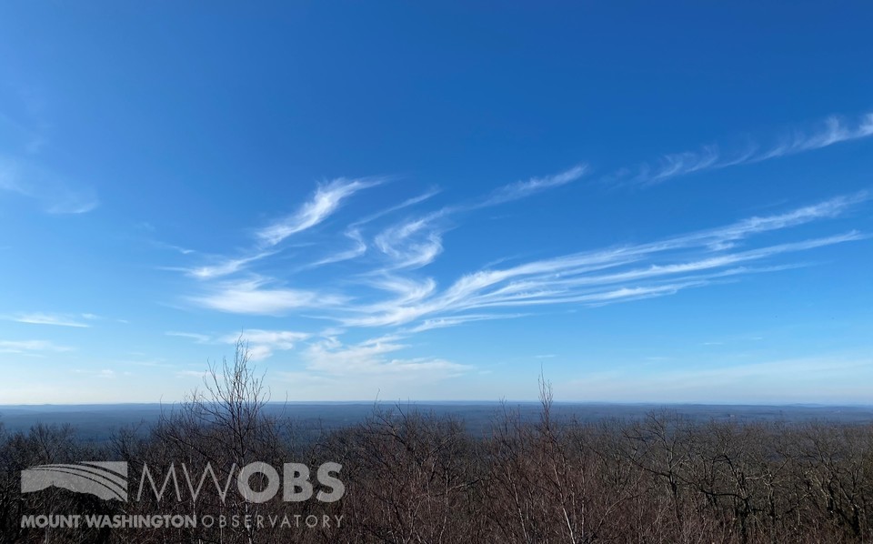
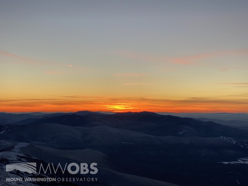
Here are a few pictures I have taken, featuring cirrus/cirri-form clouds. You may be able to spot some cirrostratus or cirrocumulus clouds in these pictures as well. These are part of the same high cloud family but cirrostratus is a denser and usually thicker blanket of cloud high up in the atmosphere, while cirrocumulus can form slightly lower and tends to be puffier looking or speckled in appearance, with fibrous edges.
Cirrus clouds as seen over my backyard in north central Massachusetts.
Cirrus clouds over Pack Monadnock Mountain in southwestern New Hampshire.
Cirrus clouds over western MA, as viewed from the summit of Mount Wachusett in north central MA.
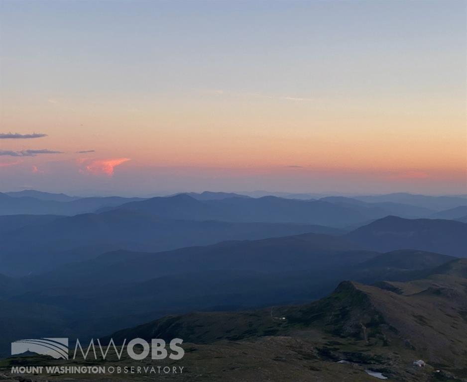
Sunset illuminating cirrus clouds to our west, as viewed from the summit of Mount Washington.
My next favorite cloud is the cumulonimbus, part of the cumulus cloud classification, or low cloud family. These clouds tend to be thunderstorms and are formed when very strong upward motion grows the clouds very high into the atmosphere. The uppermost reaches of cumulonimbus clouds can actually spread out to form cirrus clouds, and when the cloud reaches this high, lightning and hail tend to form as well (because remember, cirrus clouds are ice crystals, and lightning and hail come from ice crystals).
Cumulonimbus tend to form only during the summer in our region because atmospheric conditions need to be just right with very warm air at the surface and cold air aloft. The warm air wants to rise and the greater the gradient, the faster and higher these clouds and storms will form. Sometimes these clouds can have a base only a few thousand feet off the ground but the height reaches over 60k feet up into the atmosphere!
The signature anvil top is usually a telltale sign of a cumulonimbus cloud due to stronger winds aloft shearing off the top of the cloud quicker than at lower levels. Here are a few pictures of cumulonimbus clouds that I have taken.
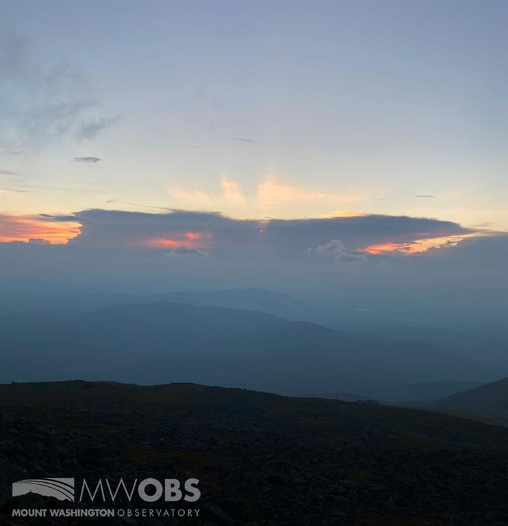
A cumulonimbus cloud at sunset to our west over Vermont. Cirrus may be viewed at the very top.

A far distant cumulonimbus to our southwest over southern MA, as viewed from the summit.
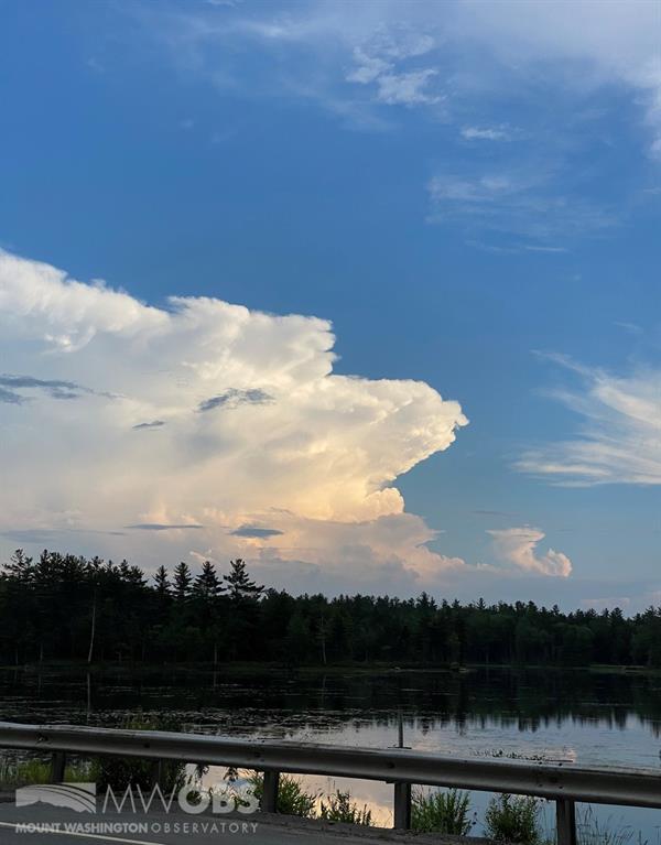
A picture-perfect cumulonimbus with signature anvil top over central MA.
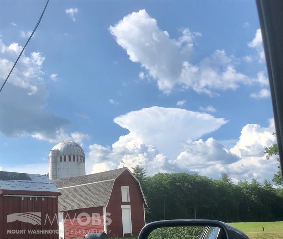
Another textbook cumulonimbus with anvil top over southwestern NH, as viewed from north central MA.
Rounding off my top three are regular old cumulus clouds. They appear puffy, usually friendly looking (compared to the ominous cumulonimbus), and are usually mostly white in color, only graying as they become thicker. They tend to look like cotton balls and can be all different shapes and sizes, which can also vary quickly depending on the conditions aloft. If you have ever laid down in the grass (or snow) and stared up at ever-changing cloud shapes trying to make them out to be real objects, chances are these were cumulus clouds.
Cumulus clouds are sometimes called diurnal cumulus because they form as the sun comes up, and starts to heat up the lower levels, and then dissipate as daytime heating is lost. These clouds can form during all seasons and tend to form anywhere from a few hundred feet off the ground up to around 6k feet. They are also sometimes referred to as fair weather cumulus because even on mostly sunny, fair weather days, if there is just enough low-level moisture and lift, they will form. I enjoy these clouds because they tend to have character and a lot of times look like the typical image of a cloud if one was to hear or read the word (stereotypical clouds in cartoons, clip art, and even emojis are cumulus).
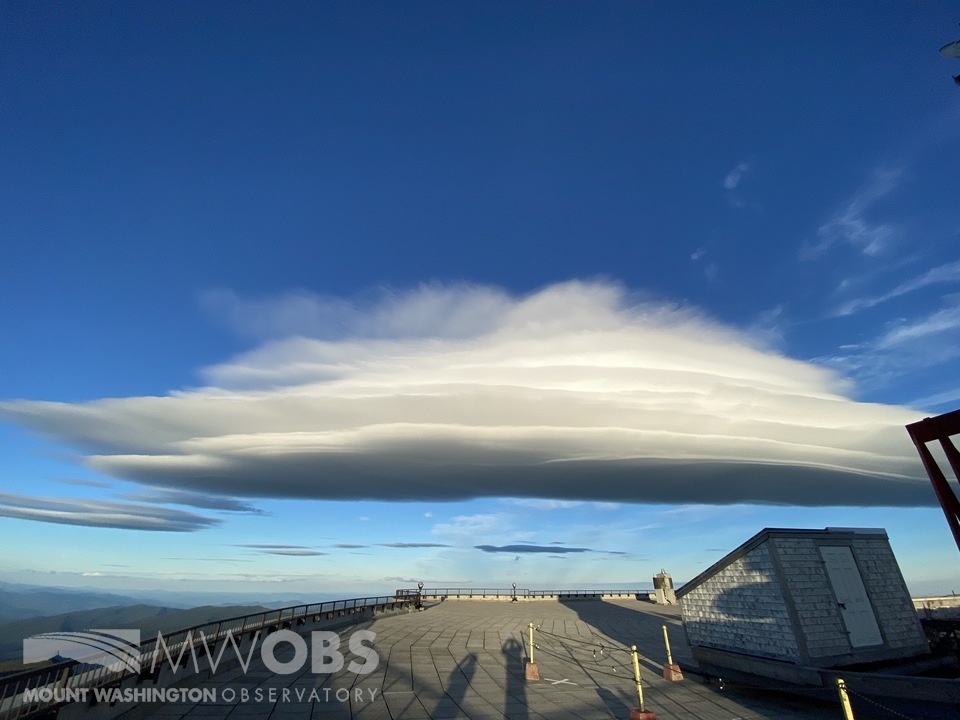
Cumulus clouds can also form stratocumulus standing lenticular clouds, which are a very popular cloud type due to their unique, flying saucer-like shape. Lenticulars can actually form at all levels of the sky but tend to share the same general shape. These unique cloud formations are shaped when air moves over hills or mountain ranges, so we often view them up here at the summit. I have attached a few pictures that I have taken of fair weather cumulus clouds, as well as some lenticulars (although some of these lenticulars may be altocumulus standing lenticulars [mid-level] or cirrocumulus standing lenticulars [high level]).
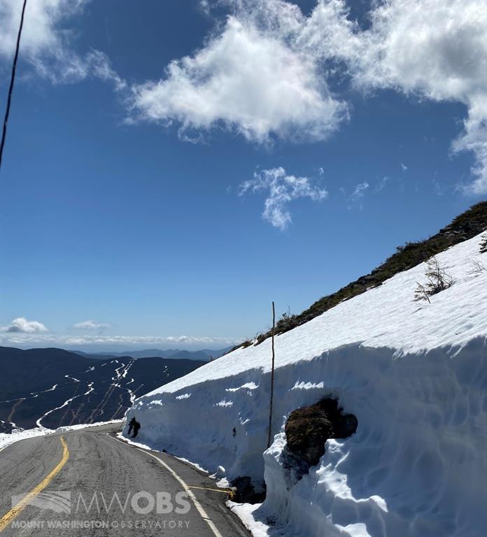
Diurnal cumulus to the east, as viewed from the Mt. Washington Auto Road.
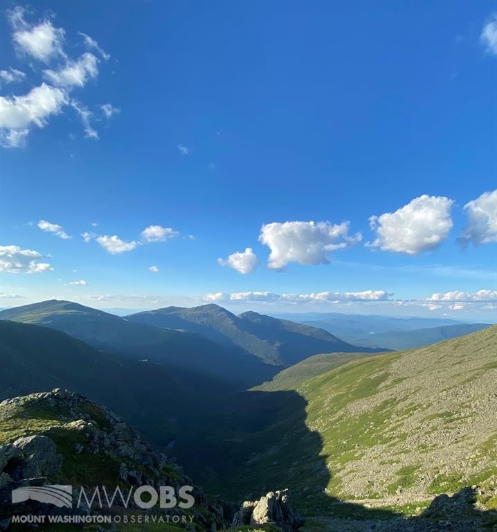
Fair-weather cumulus over the Great Gulf, to the north/northeast, as viewed from Clay Col.
A stacked stratocumulus standing lenticular (SCSL) over our observation deck.
Stacked lenticulars (altocumulus standing lenticulars [mid-level] spanning up to cirrocumulus standing lenticulars [high-level]) to our south over Lake Winnipesaukee.
Knowing about clouds is an important part of being a weather observer and crucial to observations in order to keep the aviation community safe, since pilots are flying among them in the sky. Clouds can also tell an important story of incoming or departing weather, which is especially helpful if in remote locations where forecast information is limited or unavailable. Observing and identifying clouds has been a favorite hobby of mine for a few years now. An interesting truth is this is one aspect of my job that I can practice even during my off weeks, no matter my location.
At any given time, and at any given location, there are usually some clouds up in the sky to look at. Like many weather-related phenomena, the sky condition over our heads is almost always changing and rarely ever looks identical from one point in time to the next (except clear or overcast skies, I suppose!).
That is all I have for this time, I hope you enjoyed reading this and I look forward to writing my next blog again soon!
Sam Robinson, Weather Observer/Engineer
