
Model Musings
2015-03-16 17:14:35.000 – Nate Iannuccillo, Summit Intern
With the astronomical winter season coming to a close at the end of the week, it appears that we’ll be receiving some proper winter weather before entering the spring season.
Tomorrow will bring snow showers of scattered intensity throughout the day, and we’ll take a look at some of the discrepancies in the intensity of our precipitation as displayed by two different forecasting models.
The GFS model, the top synoptic scale model of our National Weather Service, shows showers somewhat scattered, and of varying intensity.
But conversely, if we look at the Unified model of the UK’s Meteorological Office, we can see precipitation magnitudes generally a bit higher and more sustained than those calculated by the GFS.
In the image below, we can see the comparison of the two models for 8am tomorrow morning. The UKMET output is pictured on the left and the GFS on the right.
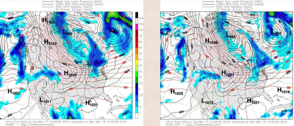
Image courtesy of UQAM-Montreal Weather Centre
As we can see, there is some discrepancy in precipitation amounts, but as a whole, there is certainly some visible agreement between the two models. We’ll see how this changes as we look further into the future.
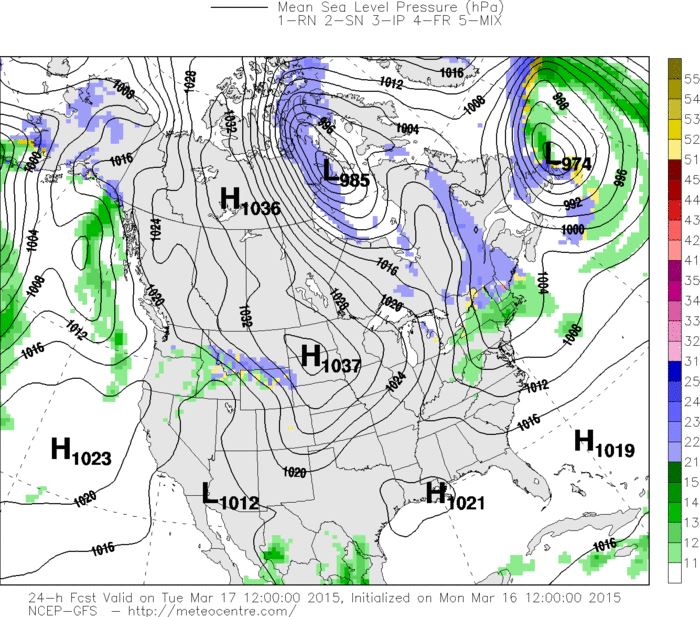
But first let’s check out the precipitation profile as forecast by the GFS model. The good news is that precipitation should remain as snow for most of New Hampshire.
Check it out.
 style=”width:100%;”
Image courtesy of UQAM-Montreal Weather Centre
Green shows rain and blue predicts snow. The one red dot on the map is freezing rain and the yellow regions display mixed precipitation.
Let’s look a little further ahead now. Here is 8pm tomorrow night, a full twelve hours further in the future.
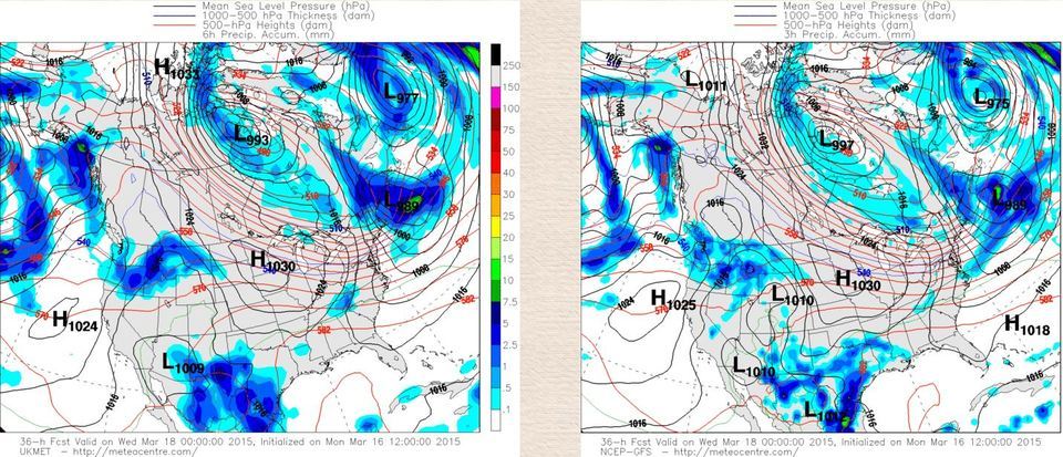
Image courtesy of UQAM-Montreal Weather Centre
Focusing on New Hampshire, we can see a little more discrepancy this time. The GFS shows very little precipitation in NH whereas the UK model shows some precipitation for all of New Hampshire. This is where the challenge of forecasting lies.
The Bottom line is we can be pretty sure of some snow for northern NH tomorrow despite uncertainties in snowfall intensity and duration.
Nate Iannuccillo, Summit Intern

Celebrating 250 Years: The Declaration’s Legacy in the White Mountains
Celebrating 250 Years: The Declaration's Legacy in the White Mountains By Peter Crane We are now approaching July Fourth, Independence Day, the day when we celebrate the adoption of the Declaration of Independence in

Seek the Peak Spotlight: Ryan Shepard
Seek the Peak Spotlight: Ryan Shepard By MWOBS Staff Before Ryan Shepard moved to Conway, he was in Western New York celebrating his 40th birthday party. “I wanted to go big,” he said. “Big”

From Florida Heat to the Rockpile
From Florida Heat to the Rockpile By Alek Libby Hi everyone! My name is Alek Libby, and I am one of the summit interns here at Mount Washington Observatory this summer! I recently graduated
