NASA GOES-R Satellite Launch and What This Means for Weather Forecasting
2016-11-22 11:25:14.000 – Ben Brownell, Summit Intern
You may have heard that National Aeronautics and Space Administration (NASA) successfully sent a new National Oceanic and Atmospheric Administration (NOAA) satellite into space this past Saturday. NASA provided excellent coverage of this launch with several Facebook live sessions. I highly suggest next time there is a launch that you check out their social media platforms for an inside peak into one of our nation’s best resources.
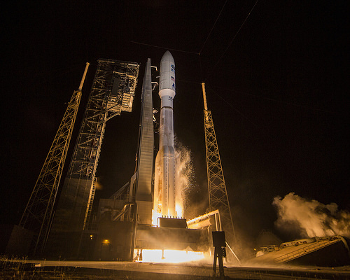
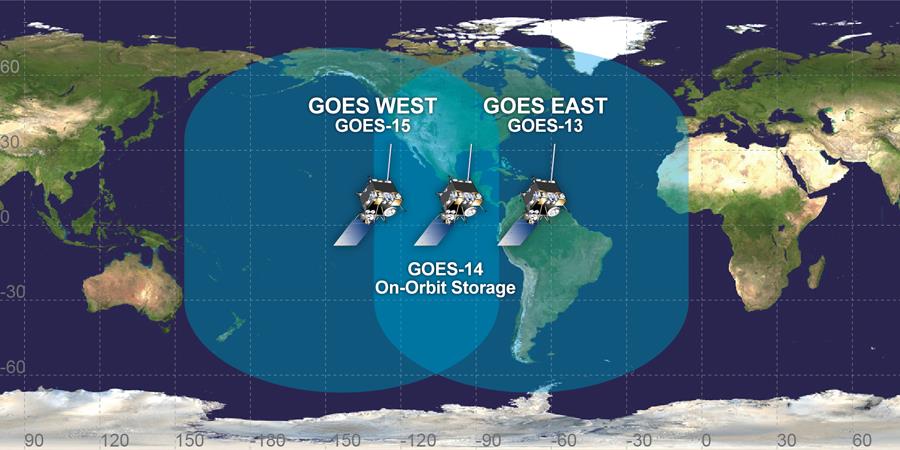
The satellite launched was called the GOES-R, which stands for Geostationary Operational Environmental Satellite-R Series. This collaborative program between NASA and NOAA has been in place since the 70’s and the first GOES satellite was launched in 1975. Currently there are 3 GOES satellites in orbit with numbers 13-15. The GOES-R will be the 16th and is currently on path to get into orbit around the Earth. The first generation of satellites viewed Earth only ten percent of the time and provided 2 dimensional data. As time progressed more advanced satellites were able to obtain vertical temperature profiles, moisture content in the atmosphere, imaging and sounding capabilities to better track tornadoes, lightning and continuous imaging.
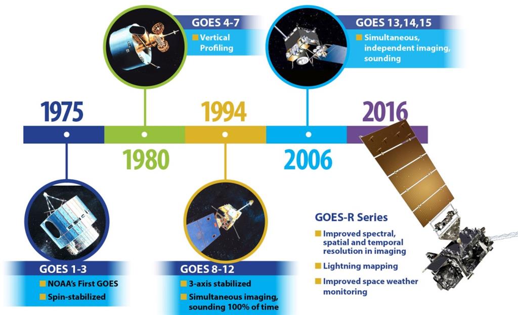
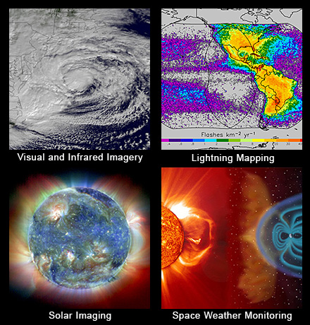
Over the last 40 year these satellites have been a significant help in achieving more accurate forecasts and better understanding of climate change through a wealth of data. So what does this newest generation of GOES satellite bring to the table? This satellite will be able to send higher resolution data faster back to Earth. NASA says that the satellite will be able to return images of storm systems and weather patterns as fast as every 30 seconds. This will be a huge benefit for Forecasters to be able to see storms develop in near real time. This will be vital for earlier notifications of severe storms and allow more time for evacuation and organization of emergency resources. The imaging technology will allow for better tracking of severe storms like tornados and hurricanes. One of the most exciting instruments on board is the Geostationary Lightning Mapper. This instrument houses a near infrared optical transient detector that can detect optical changes that denote lightning is occurring. It will be able to measure in-cloud, cloud-to-ground and cloud-cloud lightning continuously with a spatial resolution of 10km. With this instrument alone expect lightning forecast to get more accurate across the country in the coming years.
In addition to keeping tabs on Earth’s weather this satellite will be keeping a close watch on the weather in Space as well. With the amount of electronics used in everyday life it is crucial to keep tabs on what is happening out in Space like the ever present solar wind and measuring the geomagnetic field. To accomplish this job a Magnetometer is onboard the GOES-R and will be monitoring specifically the magnetic field in the outer region of the Earth’s magnetosphere. To detect events like solar flares the satellite also has an Extreme Ultraviolet and X-Ray Irradiance Sensors (EXIS) housed on the craft. Solar flares can be troublesome with the power grid, satellites, communications, and navigation. The increase in resolution of these sensors will allow for closer monitoring of solar storms which will lead to a better understanding of the physics which leads to enhanced space forecasting abilities. This also means the Aurora Borealis forecast that NOAA creates will be more accurate. Hopefully this means more accurate indications of when the Aurora will occur and more sightings from the summit as long as the weather cooperates!
Beyond the satellites capability to measure weather phenomenon there are other features that we will see benefit from. One such is the continuation of Search and Rescue Satellite Aided Tracking (SARSAT). This has already been a part of the GOES satellite mission but the new SARSAT transponder has been upgraded. This new transponder will allow uplink with less power which means the satellite can detect weaker signals and make for longer battery life in future devices. We hope this helps those in need here in our own White Mountains.
Finally the satellite will also collect data from over 20,000 sources of environmental data all over the Earth and send that data back to us on Earth. All in all the GOES-R will be a huge help for forecasters across the country. Even better is that there are 3 more GOES satellites that will be launched in the coming years. The next is scheduled to launch in 2018, the GOES-S and we can’t wait to tell you about all the capabilities of that satellite and all the benefits we have seen from this one!
References
[1] http://www.goes-r.gov/mission/history.html [2] http://www.goes-r.gov/spacesegment/mag.html [3] http://www.goes-r.gov/spacesegment/exis.html [4] http://www.goes-r.gov/
Ben Brownell, Summit Intern
Team Flags Return for Seek the Peak’s 25th Anniversary
Team Flags Return for Seek the Peak's 25th Anniversary By MWOBS Staff Mount Washington Observatory is looking forward to continuing a much-loved tradition for Seek the Peak’s 25th Anniversary: Team flags. In inviting teams
Meet Summer Interns Zakiya, Max and Maddie
Meet Summer Interns Zakiya, Max and Maddie By MWOBS Staff We are excited to welcome six teammates to the summit of Mount Washington this summer! During their internship, these students and graduates will play
Saying Goodbye to the Summit
Saying Goodbye to the Summit By Alexis George After an extraordinary last three years working as a Weather Observer and Meteorologist, I am excited to pursue a different career. As sad I as am

