Nor’easters
2009-11-15 05:16:44.000 – Mike Carmon, Staff Meteorologist
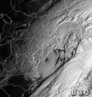
Nor’easter of 1996
Although the storm that visited the area yesterday was technically not a Nor’easter for New England, a bit further south, it certainly was.
What constitutes a nor’easter? In anticipation of the upcoming winter season, and for your general knowledge, here is a brief explanation of the distinctive characteristics of these sometimes-monster storms:
Nor’easters are unique to the northeastern United States and the Atlantic coast of southern Canada. Although low pressure systems with similar structures form in other places around the globe, the unique combination and interaction of the ocean, the coastal plain, the inland mountain ranges, and the effects the storm has on all of them leads to an equally distinctive result.
Nor’easters are extratropical, meaning they are not classified as a hurricane or tropical storm. Although a well-developed nor’easter can appear strikingly similar to a hurricane from the perspective of a satellite image (the most potent ones even possess what appears to be an eye), there are distinct differences. Extratropical cyclones are ‘cold-core’ low pressure systems, gathering their strength more from temperature gradients, or baroclinicity, while tropical storm systems are ‘warm-core,’ relying on warm ocean waters for fuel. In the case of tropical systems, the strongest winds are at the surface, whereas with extratropical systems, the fastest speeds are observed aloft.
Speaking of winds, they are another signature of a nor’easter, and perhaps the most infamous, as that is how they have ultimately been named. The very-often damaging winds are generally from the northeast along the affected coastlines. Winds can blow in excess of 50 mph at the surface, whipping up the waves, which frequently results in costly coastal damage, as well as inland structural damage. The strong northeast flow also serves another vital purpose–moisture. Without moisture to tap into, all of the dynamics in place will not amount to any significant precipitation. Because northeast winds allow moisture from off the Atlantic to come flooding in to the northeastern US, nor’easters very often produce widespread areas of significant snow or rain fall.
As far as precipitation is concerned, nor’easters can dump feet of snow on one place, and inches of rain on another, all dependent upon the proximity to the coastline. A track closer to the coast generally results in rain (and sometimes a wintry mix) for coastal locations with snow inland. If the low takes a track much further from the coast, very little will result, with perhaps modest snowfall amounts near the coast. However, if a track is followed in between these two (in the ‘sweet spot,’ if you will), significant snowfall could result for the entire northeast. And as always, the specifics change from situation to situation, such as the characteristics of the air mass that was in place, moisture availability, upper-level dynamics, and many more. So while two nor’easter-type systems may be very similar and take nearly identical tracks, the results will by no means be the same.
When the right moisture and dynamics do come together, the product can be quite extraordinary! And although not technically hurricanes, they can still produce just as much damage and disruption of daily life.
Mike Carmon, Staff Meteorologist
Living the Night Life
Living the Night Life By Madelynn Smith My alarm goes off in the bunkroom, with blackout curtains obscuring the sun’s rays as it begins to lower in the sky. My day starts in the
Three and a Half Months of Snow, Ice and Rime
Three and a Half Months of Snow, Ice and Rime, with Deeper Drifts. By Ryan Steinke Me outside on the summit near the Yankee Building. My internship with the Mount Washington Observatory
Supporter Spotlight: Righteous Vices Coffee Roasters
Supporter Spotlight: Righteous Vices Coffee Roasters By MWOBS Staff Righteous Vices Coffee Roasters, a local coffee roaster and shop located in Center Conway, New Hampshire, has been a partner of the Observatory since 2024.


