NULL
2009-11-27 14:11:57.000 – Mary Ellen Dunn, Summit Intern
Tip-Top in the Snow
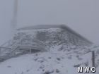
Conditions on the summit have certainly changed in the past 24 hours as a strong low pressure system has entered the region. The past few days we have been following this storm move up the Atlantic coast with the hopes of it bringing cold temperatures, accumulating snow, and high winds to the summit. November temperatures on Mount Washington have been above average with precipitation mainly rain so, wintry conditions are welcome and have been for a while. As the storm approached this morning, snow began to fall at around 8:30 am. It quickly began accumulating in the morning hours covering the summit landscape. As this storm continues to move through the region today, it is expected to dump quite a bit more snow on the summit.
Along with this storm, winds are expected to pick up over night tonight reaching hurricane force in the early morning hours. Forecasting models are predicting wind gusts to reach and exceed 100mph tomorrow. (Since the beginning of my internship in August, I have yet to see a wind gust reach the century mark. I am hoping tomorrow will be the day!) Although these high winds will be exciting, dangerous white-out conditions and wind chill temperatures reaching 20 below are expected. Lingering precipitation and fresh snow fall on the ground plus strong winds, tonight and tomorrow, will create low visibility, blowing snow, and high snow drifts which will certainly become a major issue.
Temperatures look to remain cold long after this storm is gone leaving the summit covered in the white of winter. Shift change on Wednesday could be an interesting one; will we see the first snow tractor rides of the season?!
Mary Ellen Dunn, Summit Intern
Three and a Half Months of Snow, Ice and Rime
Three and a Half Months of Snow, Ice and Rime, with Deeper Drifts. By Ryan Steinke Me outside on the summit near the Yankee Building. My internship with the Mount Washington Observatory
Supporter Spotlight: Righteous Vices Coffee Roasters
Supporter Spotlight: Righteous Vices Coffee Roasters By MWOBS Staff Righteous Vices Coffee Roasters, a local coffee roaster and shop located in Center Conway, New Hampshire, has been a partner of the Observatory since 2024.
Winter Storm Tracks Across New Hampshire
Winter Storm Tracks Across New Hampshire By Alex Branton As winter comes to a close, most of us are ready for the warmer temperatures and sunshine that come with Spring and Summer. Although we


