
NULL
2006-02-26 05:23:00.000 – Jim Salge, Observer

Wintry Window…
Yesterdays clipper came and went just about as anticipated on the summits, with light SE winds allowing the snow to actually fall and accumulate on the summits, then strong NW winds scouring it away again last night. Temps have fallen on cue as well; currently about -15 and falling, and we could set a record low tonight with a mark of -26F.
It seems like only clipper storms give (relatively) light winds from this direction up here, and therefore everything about it seems very odd. Winds in the face when theyre usually at your back and vice versa can be rather disorienting in the fog. SE winds also send the blowing snow back over the top of the building, allowing it to eddy in front of the office windows for a while. The swirling snow is rather mesmerizing, and I lost a more than a few minutes yesterday afternoon just watching the snow play outside.
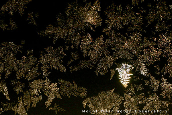
Another good point to note is that SE winds dont instantly cake rime ice on the windows, and intricate frost patterns can form in the pane. The shot that I posted today was through the office window around 10PM last night. With the snow light on below the window, I first noticed the feathery frost shimmering from across the room. A few minutes with my new Macro lens, and this 5 second exposure resulted. Just one shimmer in the frame
Frost on windows always reminds me of good cold winter daysand Im glad winters back!!!
Jim Salge, Observer

March on Mount Washington
March on Mount Washington By Ryan Knapp Looking towards Mt. Madison at sunset on March 21, 2026. The calendar has spoken: Friday, 20 March 2026, marked the first day of astronomical spring.
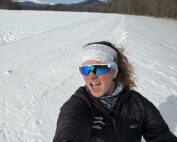
Home Sweet Summit
Home Sweet Summit By Kathryn Hawkes Me enjoying the view of Mount Washington while skiing in the valley on my off week. Hi everyone! My name is Kathryn Hawkes and I’m the
Meet MWOBS/MWAC Intern Ryan Tanski
Meet MWOBS/MWAC Intern Ryan Tanski By Ryan Tanski Hello! I’m Ryan Tanski and I’m the joint USFS Mount Washington Avalanche Center and Mount Washington Observatory Intern this winter. I’m thrilled to get to work
