
One Storm at a Time
2015-02-14 23:04:45.000 – Kaitlyn O’Brien, Weather Observer/Education Specialist

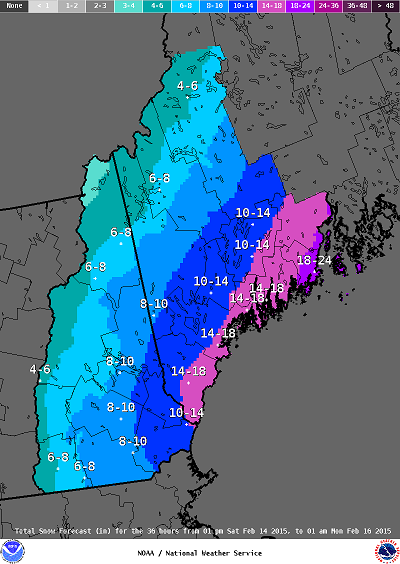 Storm snowfall totals courtesy of the National Weather Service, Gray, ME
 GFS projected 6hr precipitation 7AM Wednesday, February 18 courtesy of the Oklahoma Weather Lab
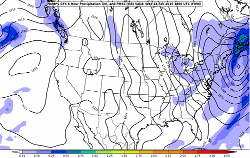 GFS projected 6hr precipitation 1PM Wednesday, February 18 courtesy of the Oklahoma Weather Lab
Kaitlyn O’Brien, Weather Observer/Education Specialist

Seek the Peak Spotlight: The Cloud Chasers
Seek the Peak Spotlight: The Cloud Chasers By MWOBS Staff Mike Bergeron and Desiree Bolton have been participating and volunteering for Seek the Peak for three years now. Together, they comprise Team Cloud Chasers

Celebrating 250 Years: The Declaration’s Legacy in the White Mountains
Celebrating 250 Years: The Declaration's Legacy in the White Mountains By Peter Crane We are now approaching July Fourth, Independence Day, the day when we celebrate the adoption of the Declaration of Independence in

Seek the Peak Spotlight: Ryan Shepard
Seek the Peak Spotlight: Ryan Shepard By MWOBS Staff Before Ryan Shepard moved to Conway, he was in Western New York celebrating his 40th birthday party. “I wanted to go big,” he said. “Big”
