
Orographic Lifting
2016-06-12 17:02:53.000 – Chris Hohman, Intern
My last post I had a large focus on learning new meteorological processes, and overall just getting my feet wet in this wonderful field. One thing I wasn’t expecting though was the real solidification of my knowledge by actually observing all these processes on top the summit. These moments have been very new to me, but I now seek them as frequent as possible. There was a wonderful moment when your knowledge base on a subject takes the leap from something you’ve read, to something you’ve actually seen with your own eyes. Those two bases of experience are already so valuable, so to gain both has given me quite the time up here so far.
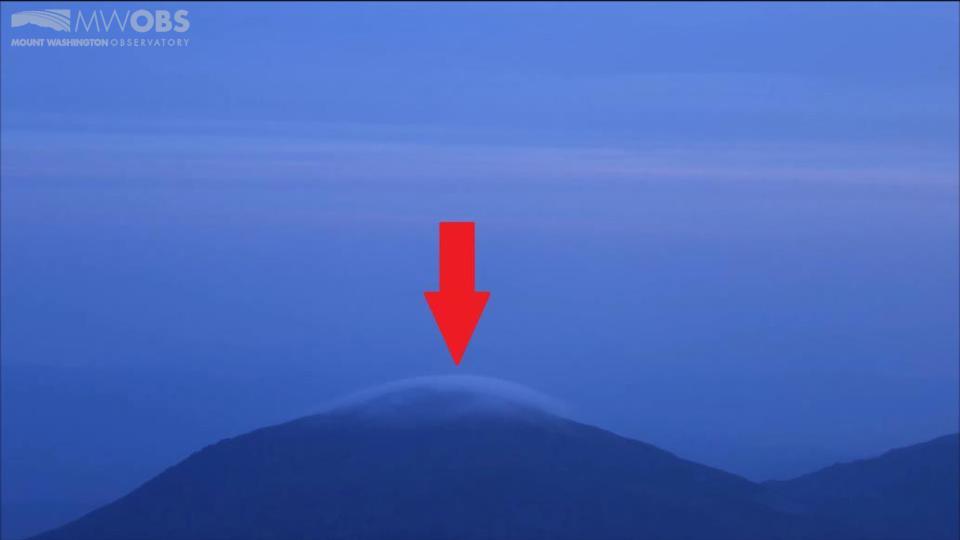
One process I’ve seen very frequently since being on top of the mountain is a process called “Orographic Lifting.” That term seems a bit cryptic at first, but what it means is: winds are being lifted into the air due to collisions with a mountain. The wind has to go somewhere, so it’s forced into the lower atmosphere where it can form clouds. When a parcel of air is lifted into the atmosphere, it follows a certain rate at which it cools. When that rate reaches the dew point of the air around it, it will condense and form a cloud. The point at which this happens is called the Lifted Condensation Level, or the LCL for short. What makes orographic lifting interesting is that the wind wouldn’t normally lift into the air like that if it weren’t for the mountain. The air needs a lifting mechanism, so these mountains are actually the beginning of some clouds in the area. One of the most common orographically lifted clouds is called a lenticular cloud. They are circular clouds that have a “UFO” shape to them. This whole process is difficult to grasp at first, so I’ve included a few photos that show this process.
At the start of the lifting there is a “Cap Cloud” forming over the top of Jefferson. This process starts out slow, only barely covering the summit:
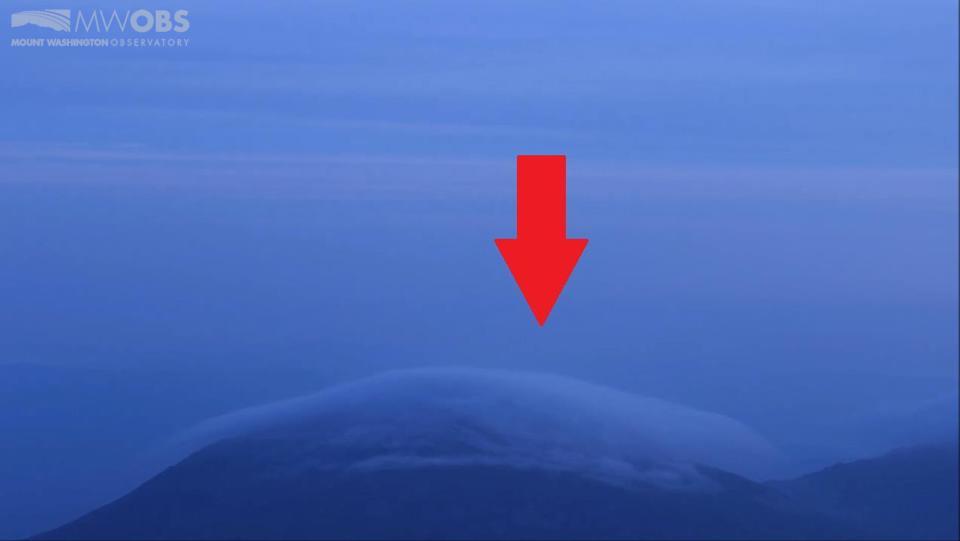
The second picture starts to show more definite formation, the summit is now in the cloud, and more formation to the right of the mountain than in the previous:
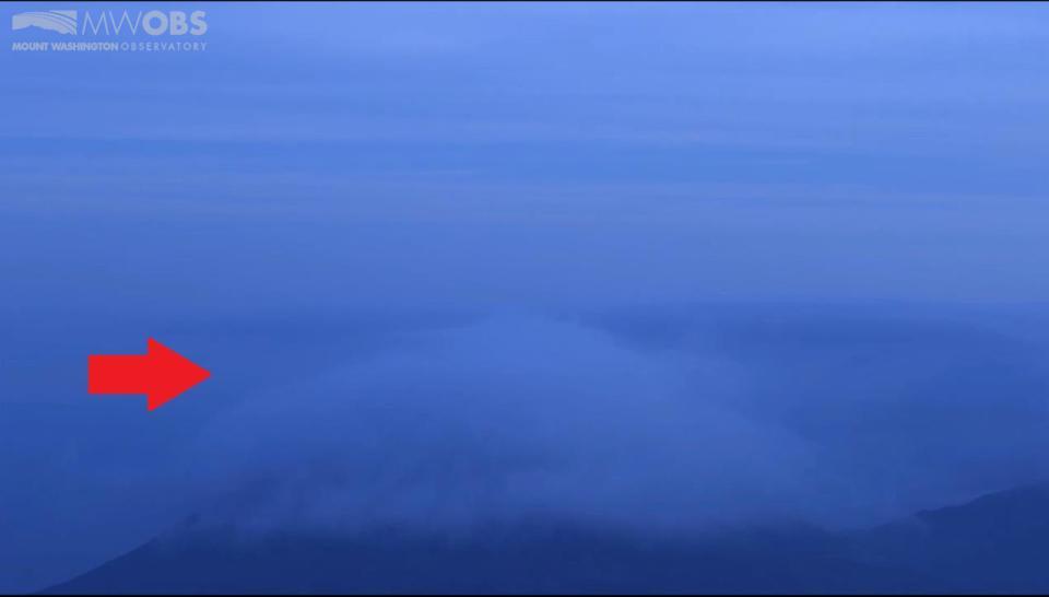
In this final picture there is a large amount of cloud formation all over the top, reaching the highest altitude out of the previous two. This photo is also especially interesting because it illustrates the flow of the clouds, acting as a liquid spilling over the clouds:
Weather can be quite beautiful, check back with me later for more posts like this! See you next week.
Chris Hohman, Intern

Team Flags Return for Seek the Peak’s 25th Anniversary
Team Flags Return for Seek the Peak's 25th Anniversary By MWOBS Staff Mount Washington Observatory is looking forward to continuing a much-loved tradition for Seek the Peak’s 25th Anniversary: Team flags. In inviting teams
Meet Summer Interns Zakiya, Max and Maddie
Meet Summer Interns Zakiya, Max and Maddie By MWOBS Staff We are excited to welcome six teammates to the summit of Mount Washington this summer! During their internship, these students and graduates will play

Saying Goodbye to the Summit
Saying Goodbye to the Summit By Alexis George After an extraordinary last three years working as a Weather Observer and Meteorologist, I am excited to pursue a different career. As sad I as am
