
Potential Weekend Storm
2019-01-15 13:12:38.000 – Tom Padham, Weather Observer/Education Specialist
A significant storm for the upcoming weekend has now been consistently in the models over the past several days, and it could be an impressive storm for much of New Hampshire and New England. I thought it would be good take a look at the current models and see the things that are closer to a certainty, and also those that are more “up in the air” for this weekend. First off, let’s back up a little bit and see how the weather is looking ahead of this weekend.
A weak clipper system will cross through New England tomorrow, mostly impacting the northern half of the region with some snow showers, gusty winds, and a reinforcing shot of colder air. Particularly in the mountains we could see some briefly heavy snow via snow squalls tomorrow afternoon and evening, with even a rumble of thunder not out of the question. Snow accumulations for the summit will likely be in the 1-3” range, although if any squalls track directly overhead we could see slightly higher amounts.
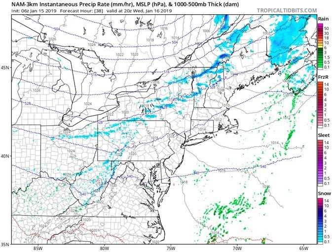
After a break in the action Thursday, another relatively weak system will track through southern New England for Friday, with a light but widespread snowfall for the area. This will luckily be a quick mover, likely starting early Friday morning and ending by the late evening the same day. It will however, be a negative impact on driving as the area looks to receive 2-4” of snow, just enough to be a nuisance for driving, or great for skiing!
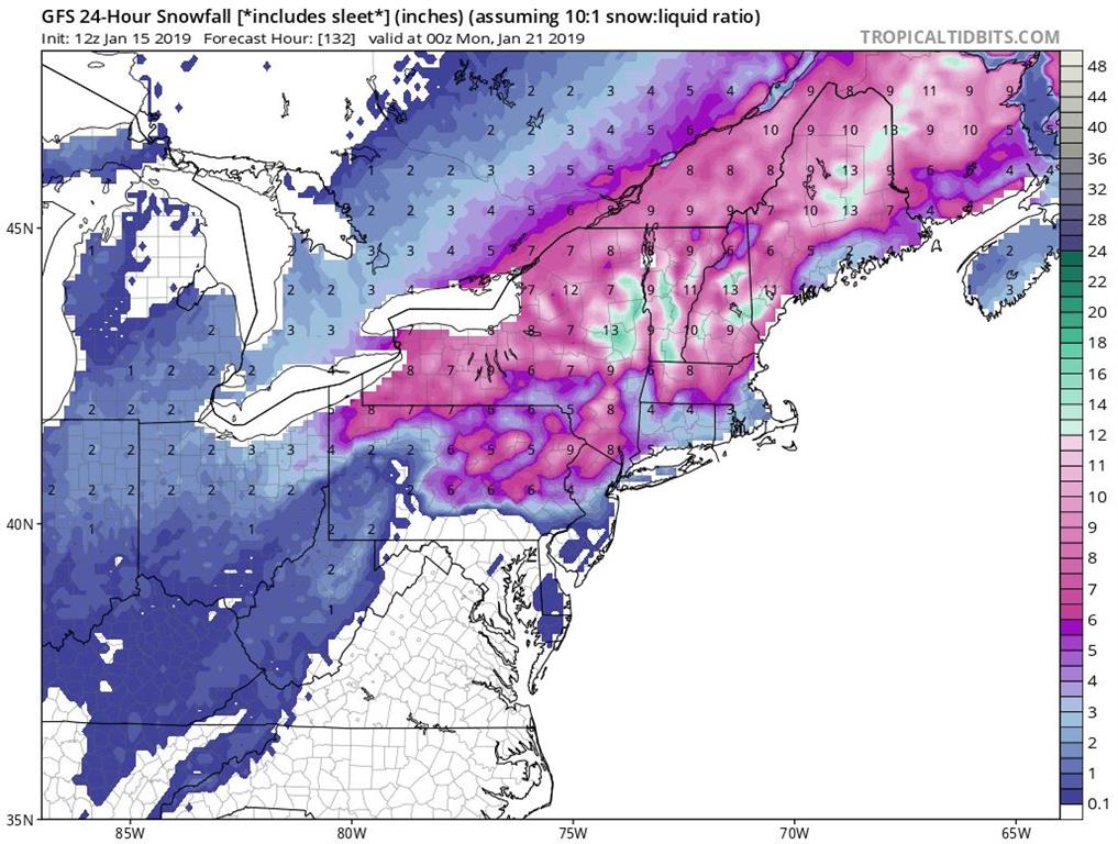
Then attention turns to the much more significant storm. This system is just starting to impact the West Coast tomorrow and Thursday, at which point the models will likely have a much better understanding of how it will evolve over time as it crosses the country. After producing heavy rain and snow in the West, with up to 5 feet of snow in the Sierra Nevada mountains, the storm will redevelop in the lee of the Colorado Rockies Friday. By Saturday the system will be picking up a significant amount of moisture as it tracks across the Mississippi River, quickly pushing snow into the Northeast during the overnight hours.
Temperatures will be cold enough for snow statewide as precipitation begins in earnest by midnight Saturday, with potentially heavy snow during the predawn hours Sunday through the afternoon. What’s still uncertain is how far north warmer air will push in, allowing for a changeover to more of a snow/sleet mixture. Along the coast there could briefly be some freezing rain as well, but eventually warmer air will win out here allowing for a changeover to plain rain. Across the higher elevations of the White Mountains like Mount Washington and for points further north, precipitation should remain all snow.

By the time the storm departs Sunday night we could be looking at a widespread area of near one foot of snow, with localized higher amounts. The summit will almost certainly see 100+ mph winds either during or just after the storm departs, and there’s also the potential for near-record cold on the backside of this system for early next week. It’s going to be a very active and exciting time to observe the weather on Mount Washington, we’ll continue to monitor this storm over the next few days as it develops and hopefully witness some of the extreme winter conditions we’re famous for!
Tom Padham, Weather Observer/Education Specialist

Seek the Peak Spotlight: The Cloud Chasers
Seek the Peak Spotlight: The Cloud Chasers By MWOBS Staff Mike Bergeron and Desiree Bolton have been participating and volunteering for Seek the Peak for three years now. Together, they comprise Team Cloud Chasers

Celebrating 250 Years: The Declaration’s Legacy in the White Mountains
Celebrating 250 Years: The Declaration's Legacy in the White Mountains By Peter Crane We are now approaching July Fourth, Independence Day, the day when we celebrate the adoption of the Declaration of Independence in

Seek the Peak Spotlight: Ryan Shepard
Seek the Peak Spotlight: Ryan Shepard By MWOBS Staff Before Ryan Shepard moved to Conway, he was in Western New York celebrating his 40th birthday party. “I wanted to go big,” he said. “Big”
