
Mount Washington Icing Sensor Project
The purpose of the Mt. Washington Icing Sensor Project, funded by NASA and the FAA with about 15 participating organizations, was intended to evaluate remote sensing technologies for sensing icing conditions ahead of aircraft for avoidance and escape. These instruments, provided by the Army Cold Regions Research and Engineering Laboratory (CRREL) of Hanover, NH, and Stratton Park Engineering Company (SPEC) of Boulder, CO, provided “ground truth” information about cloud liquid water and drop sizes sensed by radars, radiometers and a lidar located at the cog railway base station.
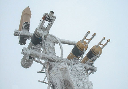
An array of probes mounted on the Observatory tower in April.
SPEC scientists Tara Jensen and Pat Zmarsley monitor their Cloud Particle Imager (CPI), which images and measures ice crystals and water droplets from 5 to 2300 microns in diameter with 2.3 micron resolution, producing near photographic quality records of drops and crystal habit.
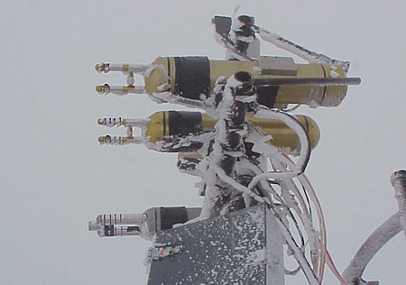
CRREL’s Particle Measuring Systems (PMS) probes on the Observatory tower. The three probes measure cloud drop size (microns) and concentration (#/cubic cm), and compute liquid water content from this information.
NOAA Environmental Technology Laboratory’s (NOAA-ETL) Polarized Scanning Radiometer (PSR) was placed on the northwest corner of the observatory deck to scan from zenith to the western horizon to detect thermal radiative emissions from cloud water and ice crystals.
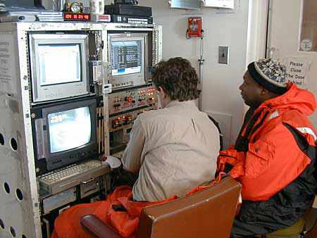
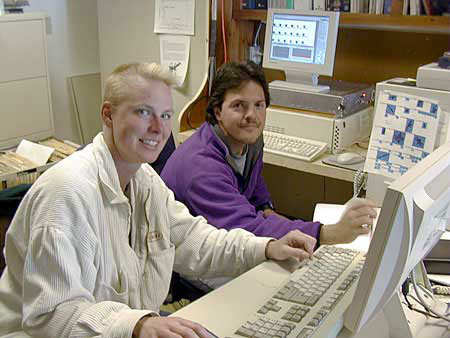
Two NOAA-ETL scientists operating the PSR monitoring and control system in the Observatory weather room.
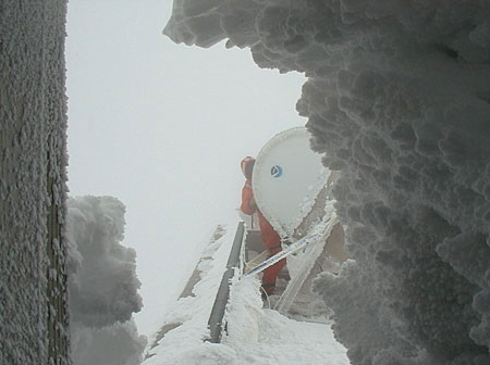
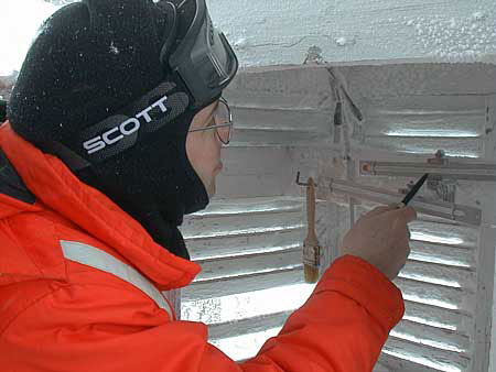
NOAA ETL scientist clearing ice from the PSR.
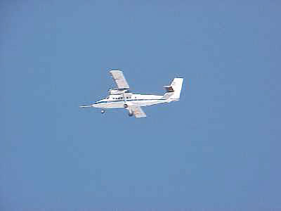
NASA John H. Glenn Research Center (Cleveland, OH) Twin Otter research aircraft flying over the summit to measure cloud properties.
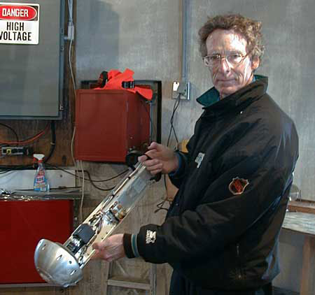
University of Nevada Desert Research Institute (DRI) scientist Rick Purcell adjusting a “cloud scope” in the Observatory tower. The cloud scope images drizzle drops impacting a heated lens, from which drop diameter and mass are computed.
CRREL scientist taking a temperature measurement during a rotating multicylinder run to measure cloud liquid water content and drop size spectrum.
