Signs of Spring
2019-04-19 15:30:09.000 – Thomas Padham, Weather Observer/Education Specialist

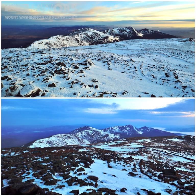
Although snow can fall any month of the year on the mountain (and it has over 1” even in June-August) we typically do not see any snow from very early June through the middle of September. Some years this season can be far longer, and taking a look at the longer range models there isn’t much in the way of snow on the horizon. Things could certainly change in May (I’ve witnessed nearly 3 feet of snow from a storm Mother’s Day 2017) so we’ll absolutely keep our Eastern Mountain Sports winter gear handy!
This weekend’s rain and warmth will likely leave the immediate summit with just patches of snow and ice leftover. Due to our high winds this isn’t too out of the ordinary, most of our snowfall settles lower down on sheltered portions of the mountain. In the Great Gulf and Tuckerman Ravine in particular there is still plenty of snow, and this will remain the case through at least early June unless we see a very rainy and warm May.
In the shorter term, after the weekend rain and warmth another system tracks across the area Tuesday through Thursday, with temperatures likely falling just below freezing and at least some mixed precipitation. Snow totals will be pretty meager due borderline temperatures and also the thermal profile favoring sleet or freezing rain over snow at this time. Sometime the following weekend, April 27th-28th there is also the potential for some snow above roughly 4,000 feet. At this point we’re really getting ahead of ourselves though. The big picture message is there doesn’t appear to be any more major winter-like storms on the horizon through the end of the month, and what snow we do see here on the summit likely won’t substantially add or rebuild our summit snow pack. April looks to be our first real spring-like month for the mountains of New England!
Thomas Padham, Weather Observer/Education Specialist
Bringing Polar Byrd I to Mount Washington
Bringing Polar Byrd I to Mount Washington By Jackie Broccolo In 1968, my grandfather joined the Polar Byrd I “Dustin Transpolar Flight”, which was the first commercial flight to carry civilians across both poles
Seek the Peak 2026: New Adventures, Rooted in Tradition
Seek the Peak 2026: New Adventures, Rooted in Tradition By MWOBS Staff Seek the Peak is Mount Washington Observatory's largest annual fundraiser, and for 26 years it's brought together hikers, adventurers, and people who
What “Prepared” Really Means in the White Mountains
What “Prepared” Really Means in the White Mountains Early Spring in the Whites: The Most Honest Season By Andrew Harris, Burgeon Outdoor If you’ve spent any time in New Hampshire’s White Mountains in March,


