Snow jealousy
2009-10-22 16:58:49.000 – Brian Clark, Observer and Meteorologist
The white is quickly disapearing!
Last week, the first significant snowstorm of the season hit the summit with 8.5 inches measured from late in the day on the 12th through the 14th. Coincidentally, my hometown of State College, PA saw their first snowfall of the year last week as well. From the 15th through the 17th, 4.9 inches of snow was measured at University Park Airport, about 10 miles outside of the city. Almost a foot of snow was reported on the ridge tops around State College which range from about 1500 to 2000 feet in elevation. The vast majority of the 4.9 inches that fell at the airport, 4.7 to be exact, came on the 15th, marking the earliest inch of snow ever measured in State College and also the most snow ever measured in a 24 hour period in the month October. This was truly an historic storm for that area.
State College and central Pennsylvania in general hold a special place in my heart. It’s where I grew up, it’s the home of Penn State University (my alma mater and a great university), it’s a very scenic and beautiful area, and it is also where some of my best friends still live. These are just a few of the things I miss about that area, but until last week, the weather had never been one of those things. In a typical winter, State College measures between 30 and 40 inches of snow which, as a snow lover and skier, is simply not enough for me. Contrast that to an average of over 300 inches a winter here on the mountain and over 80 inches for North Conway, NH (where I call home when I’m not on the mountain). Given those statistics and its significantly more southern location, I couldn’t help but be jealous that State College received their first inch of snow before North Conway!
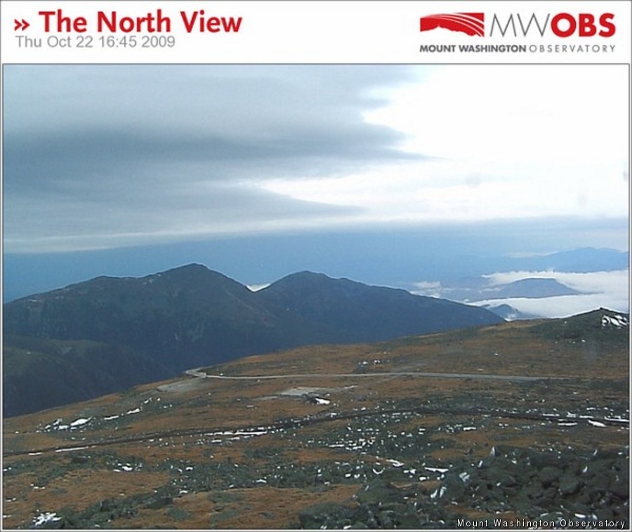
Even more depressing is that winter seems to be taking a hiatus on the summit. Temperatures rose above freezing yesterday and have stayed there through today. That coupled with some plain rain and fog have eaten up the majority of the snow and ice on the ground from last week, although the drifts that formed are still hanging on. Temperatures will fall back below freezing tonight and into tomorrow, but that won’t last long as a couple more (relatively) warm storms loom on the horizon through the rest of this shift. Looks like I will have to wait a little while longer until full winter conditions are here to stay.
P.S. For some photos of the historic central Pennsylvania snowfall and other snow totals from the area, check out Jesse Ferrel’s WeatherMatrix blog on AccuWeather.com, one of our corporate partners. While you’re there, you can check out my blog too!
Brian Clark, Observer and Meteorologist
Three and a Half Months of Snow, Ice and Rime
Three and a Half Months of Snow, Ice and Rime, with Deeper Drifts. By Ryan Steinke Me outside on the summit near the Yankee Building. My internship with the Mount Washington Observatory
Supporter Spotlight: Righteous Vices Coffee Roasters
Supporter Spotlight: Righteous Vices Coffee Roasters By MWOBS Staff Righteous Vices Coffee Roasters, a local coffee roaster and shop located in Center Conway, New Hampshire, has been a partner of the Observatory since 2024.
Winter Storm Tracks Across New Hampshire
Winter Storm Tracks Across New Hampshire By Alex Branton As winter comes to a close, most of us are ready for the warmer temperatures and sunshine that come with Spring and Summer. Although we


