Spring is Coming!
2015-04-10 16:47:09.000 – Michael Dorfman, Weather Observer/IT Specialist
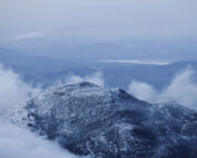
While the valleys have been experiencing on-again, off-again spring weather for the last few weeks, the summit has generally still been in full-on winter mode. We only recently broke our streak of below-freezing temperatures a few days ago on April 3rd! But in the weeks ahead we will be slowly transitioning into summer “warmth” (think 40-60 degrees) and seasonal risk of thunderstorms!
The front that brought severe storms to the Midwest yesterday is passing over us this afternoon and is resulting in some lightning strikes to our north and south. One of the most exciting but dangerous weather phenomena that we experience during the summer are convective storms that often roll over the summits. We get direct lightning strikes to the summit on a regular basis, so we must be extremely careful about our safety. The only times we don’t go outside for our observations are during these lightning events.
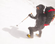
As the summits slowly transition from winter to summer, hikers who wander above tree line may encounter the dangers of cold weather risks (hypothermia, frostbite, etc) as well as potentially deadly warm weather risks such as thunderstorms or sudden downdrafts! Before wandering above tree line, be sure to check out our Higher Summits Weather Outlook. Additionally, while it may seem safe by this late in the season, snow in the mountains continues to remain unstable (for example, there were three human triggered avalanches reported Thursday alone). To better understand what you’re heading into when heading onto steep snow, be sure to visit the Mount Washington Avalanche Center’s page to see their latest forecast.
Michael Dorfman, Weather Observer/IT Specialist
Seek the Peak 2026: New Adventures, Rooted in Tradition
Seek the Peak 2026: New Adventures, Rooted in Tradition By MWOBS Staff Seek the Peak is Mount Washington Observatory's largest annual fundraiser, and for 26 years it's brought together hikers, adventurers, and people who
What “Prepared” Really Means in the White Mountains
What “Prepared” Really Means in the White Mountains Early Spring in the Whites: The Most Honest Season By Andrew Harris, Burgeon Outdoor If you’ve spent any time in New Hampshire’s White Mountains in March,
March on Mount Washington
March on Mount Washington By Ryan Knapp Looking towards Mt. Madison at sunset on March 21, 2026. The calendar has spoken: Friday, 20 March 2026, marked the first day of astronomical spring.


