Spring may be bad.
2011-02-21 23:08:51.000 – Ryan Knapp, Staff Meteorologist
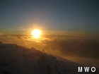
The sun sets on another day.
During most of my off days in the valley, I make looking at the weather models part of my morning routine. I don’t have to do it for work but I do this for various personal reasons. First, I’m a weather geek (read that I said geek and not nerd, there is a difference). Weather has always interested me and it’s why I went to college for a degree in meteorology and why I work as a meteorologist currently. The second reason I look at them is to keep up to date for not only when I return to the summit but in case I’m out doing something and somebody asks me what the weather will be like in the coming days. There’s nothing more embarrassing than for a meteorologist not to have a clue as to what is happening around them. And the last reason is so I can plan my week off activities according to what might be coming up. Should I go skiing/hiking/etc today or opt to stay in and get ready for an incoming weather pattern? Or can I get away with a bit of both.
This past week off, it was the little bit of both option when it came to Thursday. While the summit was focused on the winds that were projected to come in over the weekend, I was more concerned with the temperatures expected to roll in on Thursday and Friday of last week. A warm front was projected to surge into New England well above freezing bringing some of the warmest temperatures we have seen since the start of the New Year. For me, this brought the fear of ice jam issues on my roof and melt out issues under and around my house. So, I decided that in my down time Wednesday and Thursday, I set to work at clearing off the remaining snow from my roof, cleaning out the ice jams in my gutters, and digging trenches in the 5+ feet of snow around my house to prevent flooding and ice for when freezing temperatures returned. By Thursday afternoon, my work was finished and I set out to the west for some fun.
As Friday passed, temperatures around the state and northern New England ranged from 50-60 degrees. On the summit, we even reached the mid 30s when we normally average about 7 degrees that time of year. While some areas did see records set, it wasn’t enough for the summit to break any daily records. Record breaking or not, it was nice to get a break from the relentless cold that has gripped the northeast and get out in short sleeve tee-shirts for a change. But while it was nice to get the warm weather, it also brought about an altered landscape as snow compacted and started melting out turning a white wintry landscape to that ugly cinnamon and brown sugar look that typically comes with spring melt. And with the snow melting out, it also brought about swollen water ways with some ice flow.
While this warm up was brief, it was a glimpse at a potentially bad set up that may greet several parts of not only the Northeast but across the country. This winter has brought a lot of snow to several parts of the country where it has sat pretty much all winter. If the cold spell finally breaks suddenly over these areas or worst, warmer storms move through bringing significant rain, the potential for devastating flooding could lie ahead. While the biggest focus for flooding danger lies in the upper Midwest, conditions are primed here in New Hampshire for flooding that may rival what we saw back in 2006.
But there is some good news is that there is still plenty of time for things to change at least here in NH. It is still February so there are a few months for temperatures to gradually work their magic and slowly decrease the snow pack. And with warmer weather comes occasional rain storms to aid in the melt out. And while it was nice to get brief warm ups or occasional rain storms, we don’t want to see large stretches of them moving in any time soon. So long as our melt out is over a large period of time, all should be ok. And so far, so good. But we’ll keep our fingers crossed and continue to keep an eye on the weather models to let you know if anything pops up.
Ryan Knapp, Staff Meteorologist
Three and a Half Months of Snow, Ice and Rime
Three and a Half Months of Snow, Ice and Rime, with Deeper Drifts. By Ryan Steinke Me outside on the summit near the Yankee Building. My internship with the Mount Washington Observatory
Supporter Spotlight: Righteous Vices Coffee Roasters
Supporter Spotlight: Righteous Vices Coffee Roasters By MWOBS Staff Righteous Vices Coffee Roasters, a local coffee roaster and shop located in Center Conway, New Hampshire, has been a partner of the Observatory since 2024.
Winter Storm Tracks Across New Hampshire
Winter Storm Tracks Across New Hampshire By Alex Branton As winter comes to a close, most of us are ready for the warmer temperatures and sunshine that come with Spring and Summer. Although we


