
Summer Days and Snow-vember Nights
2020-11-23 20:25:41.000 – David DeCou, Weather Observer
Hello and windy greetings from the summit of Mount Washington!
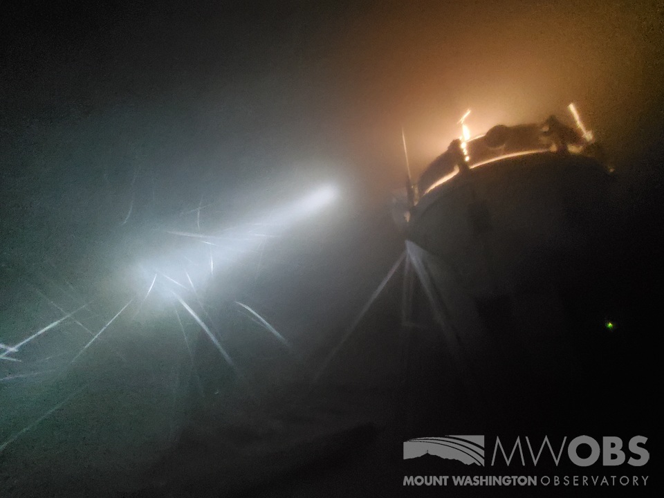
My coworkers and I are currently in the middle of a 10-day long shift up on the Rock Pile, and it is shaping up to an exciting time. As I write this, Jay, Nate and I are finally about to experience our first snow event of the season. The summit has had a few snow events already, but so far, nearly all of the snow accumulation has happened while the three of us were off the summit, followed by a melt-out during our shift up. Finally, it seems to be our turn for snow! Currently, (11/22/20 at 10 PM EST) the summit is in the clouds with temperatures around 21°F, with winds out of the south at 49 mph. A low-pressure system is bringing a warm front through the region tonight along with plenty of moisture out of the south, which is currently responsible for the sparse snow showers passing through. Below is a spectacularly blurry photo of the snow coming in, illuminated by flashlight beam with our instrumentation tower in the background.
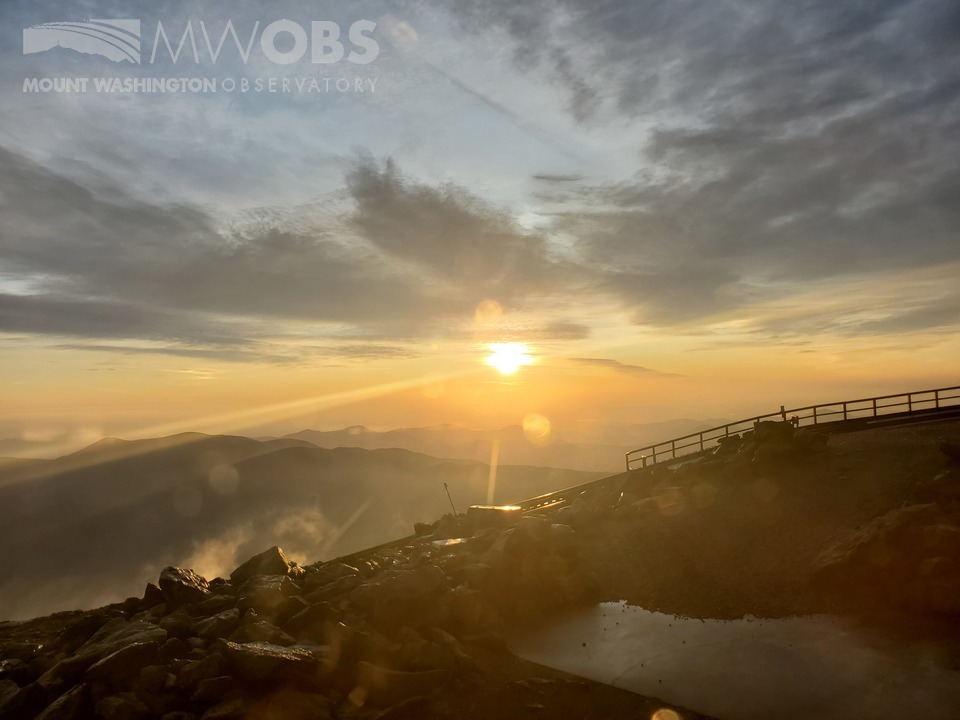
A few questions arose when it came to the forecast for tonight into tomorrow. How much snow will we receive? Will the warm front bring summit temperatures above freezing? Will winds gust over 100 mph tomorrow evening? Snowfall and high winds are always exciting, and these things can be difficult to forecast, especially when winter has not fully arrived yet. Only time will tell. So far this month it feels like we’ve jumped back and forth from one season to the next. The weather conditions this shift have been drastically different from our previous week on the summit. Two weeks ago, on Sunday, November 8, we broke the daily high temperature record, reaching up to 50°F in the afternoon. It was the first of five days in a row where our record daily high temperature was either broken or equaled. 50 degrees may seem chilly, but for us, it was like we time-travelled back to summer! To give you an idea of how warm that is for this time of year, the all-time November temperature record at Mount Washington is 52°F. If it were an average November day, we might have reached somewhere in the lower to mid-20s. It may not have been shorts-and-a-t-shirt kind of weather, but it was as close as we were going to get in early November. We had relatively light winds, sunny skies, and spectacular views from the summit for days in a row. Even on the non-record-breaking days, we enjoyed well-above-average temperatures throughout the entire shift. The snow and ice that had built up during the previous week had all but melted out, with just a few deep patches lingering. I really enjoyed finishing off my night shifts with a sunrise each morning. Below is one such sunrise – the photo was taken from inside the rotunda.
David DeCou, Weather Observer

Seek the Peak 2026: New Adventures, Rooted in Tradition
Seek the Peak 2026: New Adventures, Rooted in Tradition By MWOBS Staff Seek the Peak is Mount Washington Observatory's largest annual fundraiser, and for 26 years it's brought together hikers, adventurers, and people who

What “Prepared” Really Means in the White Mountains
What “Prepared” Really Means in the White Mountains Early Spring in the Whites: The Most Honest Season By Andrew Harris, Burgeon Outdoor If you’ve spent any time in New Hampshire’s White Mountains in March,

March on Mount Washington
March on Mount Washington By Ryan Knapp Looking towards Mt. Madison at sunset on March 21, 2026. The calendar has spoken: Friday, 20 March 2026, marked the first day of astronomical spring.
