
Summit Intern Agenda
2009-03-12 21:02:17.000 – Ali Boris, Summit Intern

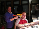
25% of what I do: bug the observers.
When people come to visit the summit, they often ask me what I do while I’m up here. I usually tell them what I do for about 50-60% of my time: shovel, bother the observers, eat, and sleep. But in the past weeks, I’ve increasingly been filling my days with my research project that I get to work on as an intern up here on the summit.
I’m going to be going to grad school this fall to study atmospheric chemistry, so the Obs folks have helped me find a project that’s related. Georgia Murray of the Appalachian Mountain Club has been compiling one of a series of papers on the 2.5 micrometer (and finer) particulate matter (a.k.a. PM2.5) that was measured at several sites in the Mount Washington area. She was nice enough to let me help her run some trajectory models to look at two major questions: where the stuff came from, and whether the mixed-layer depth was affecting it.
I found out just today that I’m going to be a co-author on this first paper (very exciting!) because of my help in running NOAA’s Stability Time Series model (just type or click your location), which approximates the height at the top of the mixed-layer. We were hoping that the mixed-layer depth would explain major differences observed between the amount of PM2.5 collected at a site near the base of the mountain (Camp Dodge) and about 350 m below the summit (Lakes of the Clouds) on certain days. We hypothesized that, if the site at Lakes of the Clouds was within the mixed-layer, the PM2.5 would be similar, whereas if the site were above the mixed-layer, the amounts of particulate would differ. With a little help from a spreadsheet program, we successfully found higher mixed-layer top heights on days when the concentrations at the two sites agreed, and lower heights on days when they disagreed.
It was surprising that we found such a well-defined relationship because the model uses several approximations that shouldn’t theoretically work for the mountain. The biggest of these is that the terrain height is smoothed out between grid points that are 40-80 km wide. That certainly doesn’t allow for a difference in altitude between our sites, or for any of the many complicated wind or heat phenomena that happen around the mountain. Finding out why exactly the model worked so well, and making sure our measurements were accurate are two of my main goals this week.
There are lots of other interesting things that we found as well, but you can read about those in the article! As for the rest of my internship, there are at least a couple more papers that Georgia wants to work on before I head back home. And in between, of course, a little shoveling and bothering the summit crew.
Ali Boris, Summit Intern

From Florida Heat to the Rockpile
From Florida Heat to the Rockpile By Alek Libby Hi everyone! My name is Alek Libby, and I am one of the summit interns here at Mount Washington Observatory this summer! I recently graduated
Summit Summer
Summit Summer By Aspen M. Hello everyone! My name is Aspen, I’m one of the summer weather interns here at the Mount Washington Observatory. I fell in love with weather at a young age
From the Sunshine State to the Home of the World’s Weather
From the Sunshine State to the Home of the World's Weather By Kristen Mihalcik Hello Everyone! My name is Kristen Mihalcik, and I’m one of the Summer interns here at Mount Washington. Enjoying
