The First Snow, And How It Happened
2018-10-15 06:04:08.000 – Christopher Hohman, Observer/Staff Meteorologist

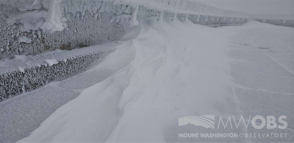
Now it wasn’t exactly a “blockbuster” storm by any means. We picked up a simple 1.1’’ of snow for the day. Of course, we all wish it could have been a lot more, but at this point, we’ll take what we can get! This year has been one of the latest first snows on record. We barely missed our record of October 17th (Shout out to our Intern Zach for digging that statistic out for us).
The actual set up of the storm was rather interesting. We actually had high pressure building into the region during the snow showers. Now to the layman meteorologist one may think, “Well hold on Chris, if you have high pressure moving in, doesn’t that mean you should have nice and sunny weather?” And you’re not entirely off to think like that. On average, high pressure systems bring fair weather to whatever region they move to. However, the atmosphere is much more complex then just thinking “If A then B” will happen. A professor once told me, “It’s not just one thing that causes the weather. It’s multiple processes happening at once. Some processes might be stronger than others one time, then completely non-existent the next.” This is actually the core reason as to why it’s really hard to forecast and make models of the atmosphere, but alas, I digress.
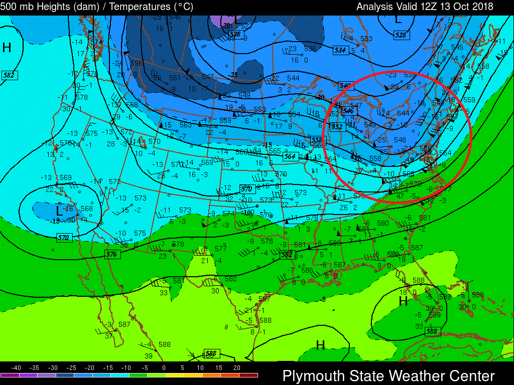
What happened for this snowstorm were really two main factors. I’ll talk about both briefly. What I was trying to get out in the last paragraph was yes, there was high pressure moving in, but something happening in the upper atmosphere was causing the scattered rain showers on the surface. To the maps!

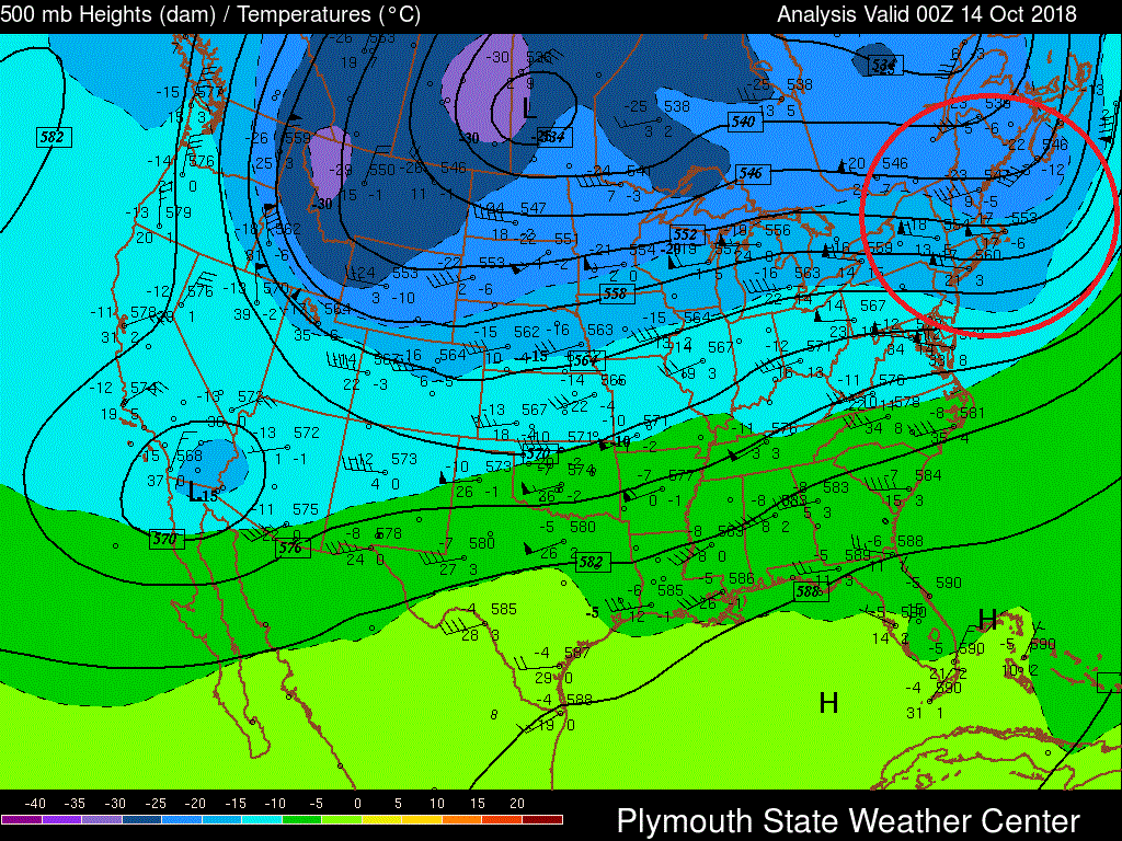
I know this looks big and scary, but I’ll put it in really simple terms. Essentially, what you’re looking at here is a map of the upper atmosphere. The red circle is highlighting what meteorologists refer to as a “Short Wave Trough” or sometimes the National Weather Service calls it “A Disturbance”. I will not go into deep details (Take Dynamics/Synoptic Meteorology 1&2 at your local college for more info!), but essentially these troughs create rising motion in the atmosphere. That’s the single most important factor needed to create precipitation. The picture above was in the morning of the 13th at 8 A.M. (We started recording snow at around 6:30 A.M.). Below is the same trough moving to the east, and over the region:
The second piece to this storm was what we refer to as “Upsloping.” Winds hit the mountains, and are subsequently forced upward. This is another form of that rising motion I talked about earlier, which again causes precipitation! So, it was really these two factors acting together that caused the beautiful snow we saw a few days ago. I’m sure that might all seem a little confusing, but please do not hesitate to contact us if you have any questions about it!
It’s safe to say all the observers up here love all types of weather, but wintry conditions hold a special place in our hearts. Something about a mega-nor’easter slamming New England is just pure joy to all of us. Thank you for coming back winter, please don’t ever leave!
Thank you for reading this blog post. Again, if you have any questions, please do not hesitate to contact us. Hope you learned something, and make sure to check back soon for another blog post!
Christopher Hohman, Observer/Staff Meteorologist
Three and a Half Months of Snow, Ice and Rime
Three and a Half Months of Snow, Ice and Rime, with Deeper Drifts. By Ryan Steinke Me outside on the summit near the Yankee Building. My internship with the Mount Washington Observatory
Supporter Spotlight: Righteous Vices Coffee Roasters
Supporter Spotlight: Righteous Vices Coffee Roasters By MWOBS Staff Righteous Vices Coffee Roasters, a local coffee roaster and shop located in Center Conway, New Hampshire, has been a partner of the Observatory since 2024.
Winter Storm Tracks Across New Hampshire
Winter Storm Tracks Across New Hampshire By Alex Branton As winter comes to a close, most of us are ready for the warmer temperatures and sunshine that come with Spring and Summer. Although we


