
The Fujiwhara Effect
2017-09-19 15:22:06.000 – Taylor Regan, Weather Observer
A few weeks ago, I wrote a post about the formation of hurricanes, to usher in the start of the hurricane season. Since then, we’ve seen multiple tropical cyclones form, even concurrently! Sometimes, these systems appear to revolve around each other as they move across the oceans. This is known as the Fujiwhara effect, after Japanese Meteorologist Sakuhei Fujiwhara, who first observed the phenomenon in a paper in 1921 describing the motion of vortices in water.
As the paths of two tropical cyclones pass within proximity of each other, they begin to interact. Fujiwhara found that as tropical cyclones approach each other, they begin to rotate counter-clockwise about a central point, with the degree of interaction increasing as the distance between the two systems decreases. Further studies have shown that the degree of interaction is dependent not only on the distance between the storm centers but also the strength and size of each storm as well as the overlying environmental setup.
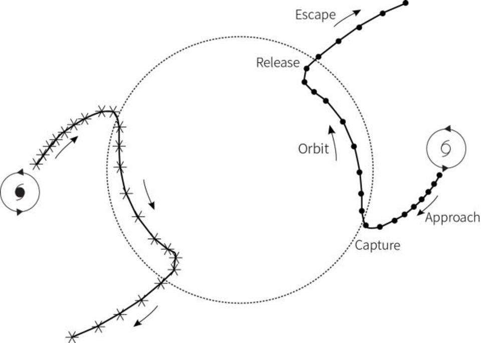 Figure 1. Fujiwhara effect resulting in two orbiting cyclones that break away. Photo from Hong Kong Observatory
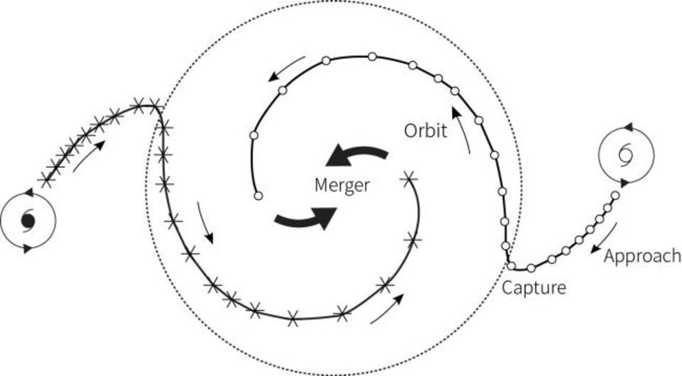 Figure 2. Fujiwhara effect resulting in merger of two tropical cyclones. Photo from Hong Kong Observatory.
 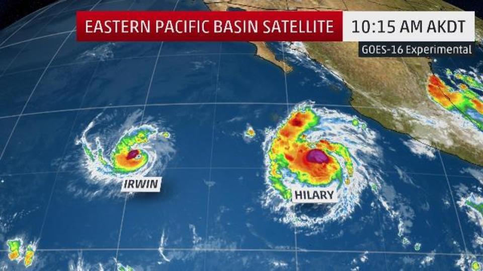 Figure 3. GOES-16 over the Pacific July 25 – August 1 2017. Image from the Weather Channel.
Taylor Regan, Weather Observer

Seek the Peak Spotlight: The Cloud Chasers
Seek the Peak Spotlight: The Cloud Chasers By MWOBS Staff Mike Bergeron and Desiree Bolton have been participating and volunteering for Seek the Peak for three years now. Together, they comprise Team Cloud Chasers

Celebrating 250 Years: The Declaration’s Legacy in the White Mountains
Celebrating 250 Years: The Declaration's Legacy in the White Mountains By Peter Crane We are now approaching July Fourth, Independence Day, the day when we celebrate the adoption of the Declaration of Independence in

Seek the Peak Spotlight: Ryan Shepard
Seek the Peak Spotlight: Ryan Shepard By MWOBS Staff Before Ryan Shepard moved to Conway, he was in Western New York celebrating his 40th birthday party. “I wanted to go big,” he said. “Big”
