
The Rockpile
2015-07-28 08:12:20.000 – Peter Purvis, Summit Museum Attendant
Over 200,000 people visit the summit of Mt. Washington in a typical year. While a number of hikers make the climb, many arrive via one of our supporting partners, the Mt. Washington Auto Road or the Mt. Washington Cog Railway. Even if you “catch a ride” to the top, you may want to do a little hiking. Living on the summit, I get a chance to do some shorter hikes in the evening and I’d like to share a few suggestions to consider for your next visit.
Tuckerman Ravine Trail begins at the edge of the parking area for the Mt. Washington Auto Road. You can test your balancing skills on the rugged rocks and, if you’re up for it, reach the junction with the Lion Head Trail in about 0.4 miles. No matter how far you decide to go, you’ll get some great views down toward the famous ravine and Pinkham Notch.
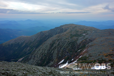
On the other side of the summit, after a short rocky stretch on the Trinity Heights Connector, you’ll find the Gulfside Trail, which is less steep and not as rocky as some of our other trails. Take a right onto Gulfside Trail. The trail crosses over the Cog Railway’s track (look both ways!) and in 0.2 miles you’ll reach the junction with the Great Gulf Trail. You can go straight onto the Great Gulf Trail or take a left to stay on Gulfside Trail. Whatever direction you choose, you’ll get some amazing views down into one of our most famous glacial cirques, The Great Gulf…which, interestingly, was originally known as the Gulf of Mexico. You’ll also see the Northern Presidentials (Mts. Jefferson, Adams, and Madison) rising steeply on the gulf’s northwest side.
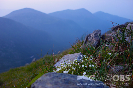
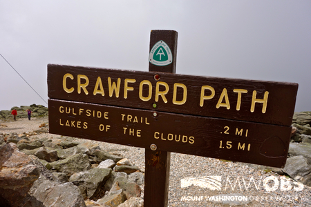
Heading southwest off the summit, according to the AMC’s White Mountain Guide you’ll be on “. . . the oldest continuously maintained footpath in the United States. ” The Crawford Path dates back to the early 1800s. As you head down this rocky slope, you’ll see the Southern Presidentials. Mt. Monroe’s craggy summit is the first and most prominent peak, rising above the AMC’s Lakes of the Clouds Hut.
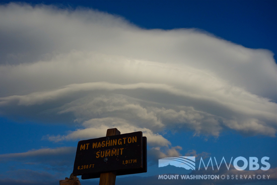
Of course, you don’t have to leave the summit to witness the fascinating weather and scenery that The Rockpile has to offer.
If you do decide to take a short hike during your visit, be sure to dress appropriately, take water, and feel free to ask for information on the weather and trail conditions. It’s always a good idea to have a trail map, even for short hikes. We have a variety of maps available at the Extreme Mt. Washington museum shop. Stop in to visit the museum and say hello! We look forward to seeing you on Mt. Washington . . . “Home of the World’s Worst Weather!”
Peter Purvis, Summit Museum Attendant

Seek the Peak Spotlight: The Cloud Chasers
Seek the Peak Spotlight: The Cloud Chasers By MWOBS Staff Mike Bergeron and Desiree Bolton have been participating and volunteering for Seek the Peak for three years now. Together, they comprise Team Cloud Chasers

Celebrating 250 Years: The Declaration’s Legacy in the White Mountains
Celebrating 250 Years: The Declaration's Legacy in the White Mountains By Peter Crane We are now approaching July Fourth, Independence Day, the day when we celebrate the adoption of the Declaration of Independence in

Seek the Peak Spotlight: Ryan Shepard
Seek the Peak Spotlight: Ryan Shepard By MWOBS Staff Before Ryan Shepard moved to Conway, he was in Western New York celebrating his 40th birthday party. “I wanted to go big,” he said. “Big”
