
The Science Behind Nor’Easters
The Science Behind Nor’Easters
Extra-Tropical Cyclones and the Extreme Weather they Make on Mount Washington

Unique beasts known for punishing weather, nor’easters serve an important purpose for our globe despite their infamous reputation.
A type of extra-tropical cyclone (ETC), nor’easters get their colloquial name from unique localized characteristics, mainly the coastal northeast flow that occurs before the onset of the storm, which often portends snowfall, coastal high surf, and high winds.
The factors influencing the paths of these beautiful and destructive systems are similar. Serving a critical purpose, ETCs and nor’easters redistribute heat energy from the tropics to the poles.
The earth, engineered to seek equilibrium, uses ETCs as a synoptic-scale (massive) temperature and moisture regulating mechanism. Irregular heating and our spinning sphere prevent total equilibrium, yet the earth accomplishes its need to redistribute energy.

Figure 1: General circulation of air from equator to poles and poles to equator. COMET® Program graphic.
As seen in Figure 1, heat rises from the equator and lifts north. The airmass, as it reaches the poles, cools and then sinks to the surface, heading south to start the process over again. As heat rises and lifts from the equator, and the other air masses cool, descend, and travel south, they eventually meet in the mid-latitudes.
At 44.17°N, Mount Washington’s latitude is less than 1° away from the exact middle point between the North Pole and equator. The position of the Presidential Range relative to the Atlantic Ocean, which is a considerable distance, and the elevation of the peaks, put the White Mountain summits in prime position to experience some intense winds and snowfall rates from ETCs.
When combined with the orographic (how mountains alter weather), wedge set-up of the Presidential Range, ETCs and nor’easters have produced some of the most extreme weather events experienced on Mount Washington’s summit.
Extreme wind events in Mount Washington Observatory’s (MWO) history that were caused by the passage of an ETC and the development of a secondary area of low pressure, which is characteristic of a nor’easter, include the fastest wind speed ever directly observed by people on April 12, 1934 at 231 mph.
During a recent wind event on February 25, 2019, observers recorded a gust of 171 mph, caused by a set-up similar to the 1934 World Record Wind. While the secondary low is a characteristic phenomenon of a nor’easter, the secondary development usually merges and overtakes the primary low or forms as a single entity in the Mid-Atlantic and moves northeast along the coast.
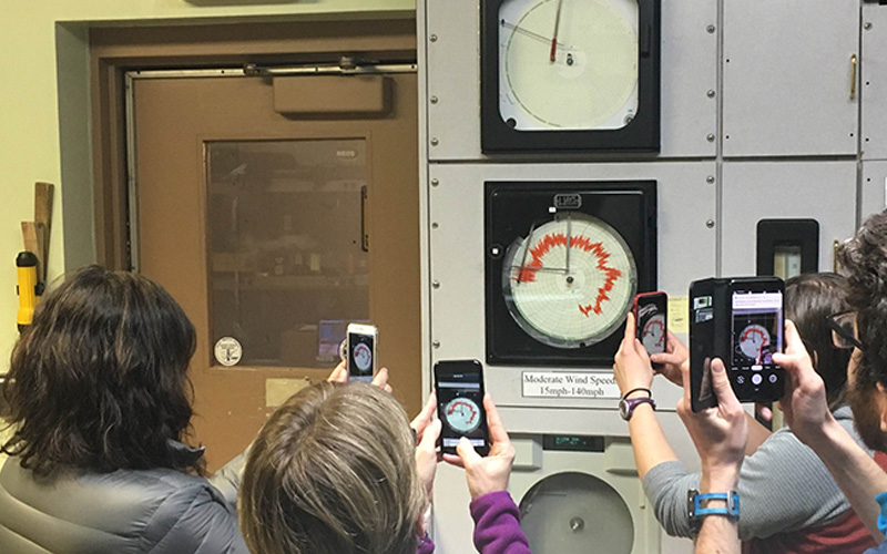
Observers were glued to the Hays Chart on February 25, 2019
It is important to note that the most extreme wind events experienced on Mount Washington were not caused exclusively by nor’easters. They exhibited many nor’easter features, but in these cases, a deep upper-level wave, commonly cut off from the polar vortex, was intense enough to cause an anomalously deep wave in tropopause pressure.
In early March 2021, such a system brought high winds gusting at 147 mph to the summit along with some of the coldest temperatures of winter 2021. The temperature dropped to –28°F. With sustained 130 mph winds, wind chills plunged to 80°F below zero. Meanwhile in the valley, power and heat outages as well as significant damage occurred, including a downed tree in the Observatory’s North Conway office parking lot.
ETCs, also referred to as mid-latitude or wave cyclones, develop as air masses mix in an attempt to dynamically bring about equilibrium of temperature, moisture, and pressure. When the two air masses meet, fluids are deflected to the right (or left in the southern hemisphere) due to the Coriolis effect. This creates counter-clockwise rotation around an area of low pressure.
ETCs are a type of cyclone, which are synoptic-scale low-pressure systems that occur in the mid-latitudes, generally between 30°N and 60°N. They are responsible for a majority of the inclement weather across the globe, especially along the boundary between an eastern continental landmass and a western coast of an ocean.
All nor’easters are ETCs, but not all ETCs are Nor’easters. In the U.S., ETCs tend to affect the northern half of the country as Alberta Clippers and commonly make their way to New England. Nor’easters affect the eastern coastline with particular focus on the Mid-Atlantic and New England. Sometimes, there is a combination of the two, and even cases where systems merge. The previously mentioned record wind gusts measured by MWO all resulted from merging systems. Strong and deep tropospheric waves affected the stratosphere, destabilizing the jet stream and allowing the polar vortex to destabilize and detach.
These systems are not to be confused with tropical cyclones (hurricanes). Extratropical and tropical systems can and sometimes do look strikingly similar on satellite, but differ in some very distinct ways. Arguably the most visible and notable contrast between the two is the comma-shape extension of an ETC that commonly extends to the south along the cold front of the system. ETCs also lack a closed eyewall typically observed in tropical cyclones.
Dynamics wise, the development and evolution of ETCs involve strong temperature and moisture gradients between air masses, known as baroclinic zones, which is why these systems are also called baroclinic cyclones. As a mid-to-upper-level wave approaches such a zone, the two air masses begin to mix and the process of cyclogenesis ensues. This is in contrast to tropical cyclones, which are more vertically surface-based, non-frontal, and develop from convection over warm ocean waters in low horizontal wind shear (gradient) environments.
Every ETC is an individual. Despite each storm’s unique features, they do have many similarities, generally forming along boundaries of differential air masses where temperature and moisture gradients occur with significant vertical wind differences (shear). Cyclogenesis occurs along baroclinic zones near an area in the jet stream where winds are the highest. Known as jet streaks, these areas happen in the atmosphere’s lower and upper levels.
Lower-level jets tend to pass at elevations around the summit of Mount Washington, assigning the Observatory an important responsibility of measuring jet streak velocities.
As the cyclone progresses, the cold front rotates counterclockwise and moves around the back of the cyclone with denser, cooler, and drier air. Meanwhile, the associated warm front progresses more slowly. The warm front’s air mass has to fight gravity as it lifts and mixes into a cooler air mass ahead of the system. As the cold front sweeps around, the denser air undercuts the less dense, warmer, and more humid air, forcing air aloft as well. Later, when the cold front meets and mixes with the warm front, the cyclone begins to occlude.
Occlusion is when the cold air mass overtakes the warm front and becomes cut off from the center of the low by being blocked off by the cold air. Colder air begins to fill the air column, replacing the warm, humid air which causes the system to weaken. Cold air in the column prevents lift and decreases the temperature gradient enough for the cyclone to become barotropically cold. The system becomes stacked and collapses on itself until it dissipates along with the frontal systems associated with the ETC.
Atmospheric pressure can fall very rapidly when there are strong upper-level forces on the system or there is extreme latent heat release as a system moves from a dry continental air mass to a moist oceanic air mass.
When the pressure falls faster than 1 MB (0.030 inHG) per hour, the process is called explosive cyclogenesis or bombogenesis, and these tend to be the nor’easters well known in the Northeast.
Having discussed the life cycle of an ETC, what makes nor’easters different from other ETCs? The difference lies in the track plus the heightened potential of a nor’easters to undergo explosive cyclogenesis due to the geographic set-up of North America. Commonly, areas of low pressure form on the lee side of the Rocky Mountains as an upper-level wave feature crosses over the range, then meets the warm, humid air lifting north from the Gulf of Mexico.
The upper-level troughs in the jet stream tend to dip farther south than the wave features that form Alberta Clippers. The Gulf of Mexico is a very warm body of water that helps feed the Gulf Stream, which moves northeast along the eastern seaboard. Some of these areas of low pressure that come off of the Rockies deepen as convection kicks off, and heat energy is absorbed by what could develop into a nor’easter. As the beginning of the system moves over the Appalachians around the Mid-Atlantic states, it becomes compressed and spreads out to deepen again on the Appalachians’ lee side.
Having said that, an interesting feature also tends to occur on the windward side, and this can be unique to North America, similar to the injection of warm, humid air from the gulf. The cold air descending from the north gets wedged between the Appalachians and the East Coast in a process called cold air damming. Ultimately, the damming can enhance baroclinicity in the lower levels and often form a secondary area of surface low pressure separate from the initial trough and wave feature.
This newly developed center of surface low pressure begins to rotate as warm air is pushed east and absorbs moisture from the warm Atlantic waters. Because of the heightened baroclinicity and the amount of potential energy that warm surface waters of the coastal Atlantic store and can release, explosive or rapid intensification occurs.
With the arrival of another winter in the White Mountains, Mount Washington will undoubtedly be treated with many ETCs and hopefully some more high winds, cold temperatures, and snow from nor’easters.
By Jay Broccolo, Weather Observer & Meteorologist | November 15, 2021

Seek the Peak Spotlight: The Cloud Chasers
Seek the Peak Spotlight: The Cloud Chasers By MWOBS Staff Mike Bergeron and Desiree Bolton have been participating and volunteering for Seek the Peak for three years now. Together, they comprise Team Cloud Chasers

Celebrating 250 Years: The Declaration’s Legacy in the White Mountains
Celebrating 250 Years: The Declaration's Legacy in the White Mountains By Peter Crane We are now approaching July Fourth, Independence Day, the day when we celebrate the adoption of the Declaration of Independence in

Seek the Peak Spotlight: Ryan Shepard
Seek the Peak Spotlight: Ryan Shepard By MWOBS Staff Before Ryan Shepard moved to Conway, he was in Western New York celebrating his 40th birthday party. “I wanted to go big,” he said. “Big”
